Maps of Drentwede

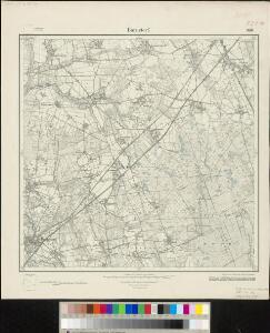
Meßtischblatt 1664 : Barnstorf, 1934
1 : 250000 Barnstorf. - Hrsg. 1899, einz. Nachtr. 1925, gedr. [19]34. - 1:25000. - [Berlin]: Reichsamt für Landesaufnahme, 1934. - 1 Kt.
Meßtischblatt 1664 : Barnstorf, 1899
1 : 250000 Barnstorf. - Aufn. 1897. - 1:25000. - [Berlin]: Reichsamt für Landesaufnahme, 1899. - 1 Kt.
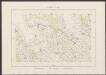
259. Diepholz.
1 : 100000 Reichsamt fur Landesaufnahme
Composite: 234. Wildeshausen.
1 : 100000 Reichsamt fur Landesaufnahme
234. Wildeshausen.
1 : 100000 Reichsamt fur Landesaufnahme
Composite: 259. Diepholz.
1 : 100000 Reichsamt fur Landesaufnahme
72. Nienburg, uit: Topographische Uebersichtskarte des Deutschen Reiches / herausgegeben v. d. Kartogr. Abt. d. Königl. Preuß. Landesaufnahme
1 : 200000 titelvariant: Topogr. Übersichtskarte des Deutschen Reiches; Annotatie: Titel boven bladen ook: Topogr. Übersichtskarte des Deutschen Reiches; Annotatie geografische gegevens: Op elk blad twee maatstokken: 10 Kilometer = 5,5 cm; 1 geogr. Meile = 3,6 cm; Legenda onder op elk blad Königlich Preußische Landesaufnahme. Kartographische Abtheilung [S.l : Königlich Preußische Landesaufnahme, Kartographische Abtheilung]
Bremen 44, uit: Special-Karte von Mittel-Europa / nach amtlichen Quellen bearbeitet von W. Liebenow
1 : 300000 titelvariant: W. Liebenow's Mittel-Europa; Annotatie: Titel boven de bladen: W. Liebenow's Mittel-Europa Johannes Wilhelm Liebenow 1822-1897 Frankfurt a. M. : Ludwig Ravenstein
Bremen 44, uit: [W. Liebenow's Special-Karte von Mittel-Europa]
1 : 300000 titelvariant: W. Liebenow's Mittel-Europa; Annotatie: Titel boven de bladen: W. Liebenow's Mittel-Europa Johannes Wilhelm Liebenow 1822-1897 Hannover : Hermann Oppermann
Le Theatre de Bellone :
Mollova mapová sbírka Schenk, Pieter Braakman, Adriaan
Carte topographique d'Allemagne
1 : 225000 Brémy (Německo) Jaeger, Johann Wilhelm Abraham Berndt, Johann Christoph I.W.A. Iaeger
Oldenburg Comit. [Karte], in: Theatrum orbis terrarum, S. 213.
1 Karte aus Atlas Ortelius, Abraham Vrients, Jan Baptista
L'Eveché de Munster Le Comté de Bentheim Tecklenbourg Stenford Lingen, Diepholtz Delmenhorst, Ritberg &c.
1 : 420000 Mollova mapová sbírka Le Rouge, Georges-Louis Le Rouge, Georges-Louis
Basse Partie de l'Evesché de Munster, et le Comté de Benthem
1 : 300000 Mollova mapová sbírka Sanson, Guillaume Mortier, Pierre

Basse Partie De L'Evesché De Munster, Et Le Comté De Benthem. [Karte], in: Atlas nouveau, contenant toutes les parties du monde [...], Bd. 1, S. 307.
1 Karte aus Atlas Sanson, Nicolas Jaillot, Alexis Hubert und Mortier, Pieter
Grossherzogthum Oldenburg und Gebiet der freien Stadt Bremen
Grosser Hand-Atlas über alle Theile der Erde in 170 Karten Meyer, J. Verlag des Bibliographischen Instituts
Monasteriensis et Osnabvrgensis episcopatvs descriptio
1 Karte : Kupferdruck ; 36 x 25 cm Mascop; Ortelius s.n.
Monasteriensis et Osnabvrgensis episcopatvs descriptio
1 Karte : Kupferdruck ; 25 x 36 cm Mascop; Ortelius s.n.
DUCATUS | BREMÆ & FERDÆ | a Ioanne Gorries Capitaneo Sueco Jußu Com.
Ioan Christoph. a Coningsmarck accuratißime | dimensi & in tabulam redacti. [Amsterdam : Joan Blaeu]
Königreich Hannover u. Herzogthum Oldenburg
1 : 380000 Aurich (Německo) Renner, Art. Frommann, Max.
Nova et accurata descriptio ducatus Bremae et Ferdae cum maxima parte finitimi ducatus Stormariensis et comitatus Oldenburgici, itemque fluminum Albis et Visurgis
1 : 336000 Brémy (Německo) Seutter, Matthäus sumptibus Matthaei Seutteri
Carte Nouvelle de l'Eveché de Munster
1 : 180000 Mollova mapová sbírka Grancourt
Territorium Seculare Episcopatvs Monasterii Mvnster Germanis dicti
1 : 420000 Mollova mapová sbírka Homann, Johann Baptist Homann, Johann Baptista - dědici
Westfalia cum diœcesi Bremensi
1 Karte : Kupferdruck ; 34 x 44 cm Mercator; Hondius sumptibus Henrici Hondij
Westfalia cum diœcesi Bremensi
1 Karte : Kupferdruck ; 34 x 44 cm Mercator; Hondius sumptibus Henrici Hondij
Westfalia cum diœcesi Bremensi
1 Karte : Kupferdruck ; 34 x 44 cm Mercator; Hondius sumptibus Henrici Hondij
Westfalia cum diœcesi Bremensi
1 Karte : Kupferdruck ; 34 x 44 cm Mercator s.n.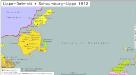
Lippe-Detmold, Schaumburg-Lippe 1812
Lippe-Detmold, Schaumburg-Lippe Hundt, Michael