Mapa catalogado
Meßtischblatt 1669 : Rethem a. d. Aller, 1899


Título completo:Meßtischblatt 1669 : Rethem a. d. Aller, 1899
Año de ilustración:1899
Fecha de publicación:1899
Tamaño físico:20 x 30 cm
Escala del mapa:1:250 000
Meßtischblatt 1669 : Rethem a. d. Aller, 1935
1935
1:250k
Meßtischblatt 1669 : Rethem a. d. Aller, 1899
1899
1:250k
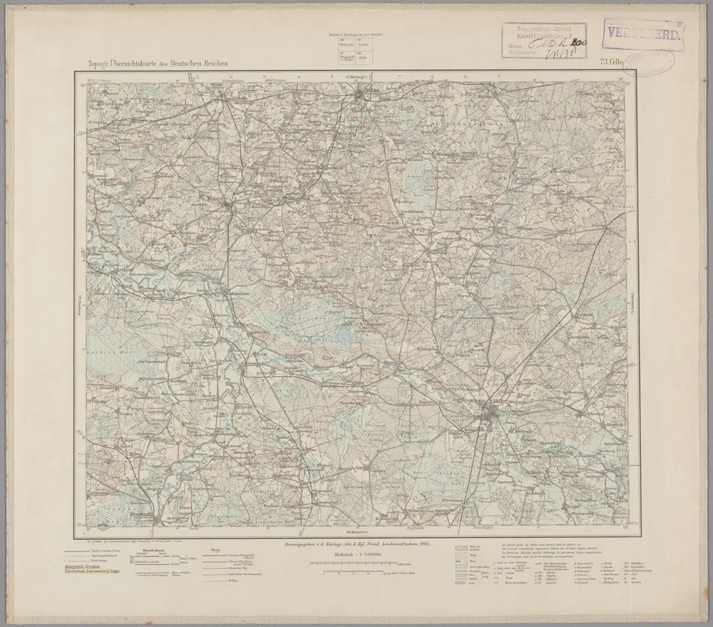
73. Celle, uit: Topographische Uebersichtskarte des Deutschen Reiches / herausgegeben v. d. Kartogr. Abt. d. Königl. Preuß. Landesaufnahme
1899
Königlich Preußische Landesaufnahme. Kartographische Abtheilung
1:200k
n/a
1791
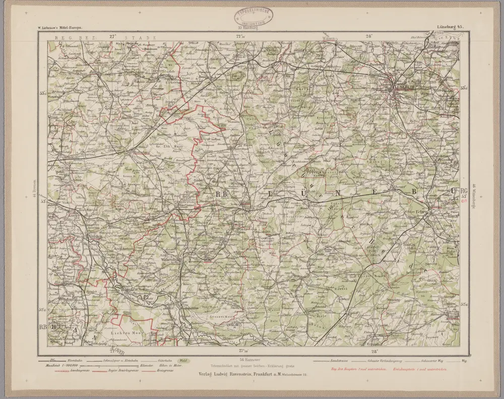
Lüneburg 45, uit: Special-Karte von Mittel-Europa / nach amtlichen Quellen bearbeitet von W. Liebenow
1899
Johannes Wilhelm Liebenow 1822-1897
1:300k
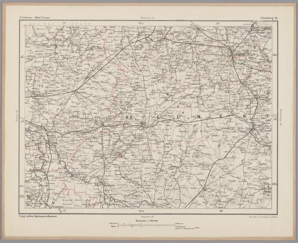
Lüneburg 45, uit: [W. Liebenow's Special-Karte von Mittel-Europa]
1870
Johannes Wilhelm Liebenow 1822-1897
1:300k
n/a
1791

Neuer Atlas Uber die Gantze Welt, mapa ze strany: [175]
1714
Homann Johann Baptist
n/a
1791
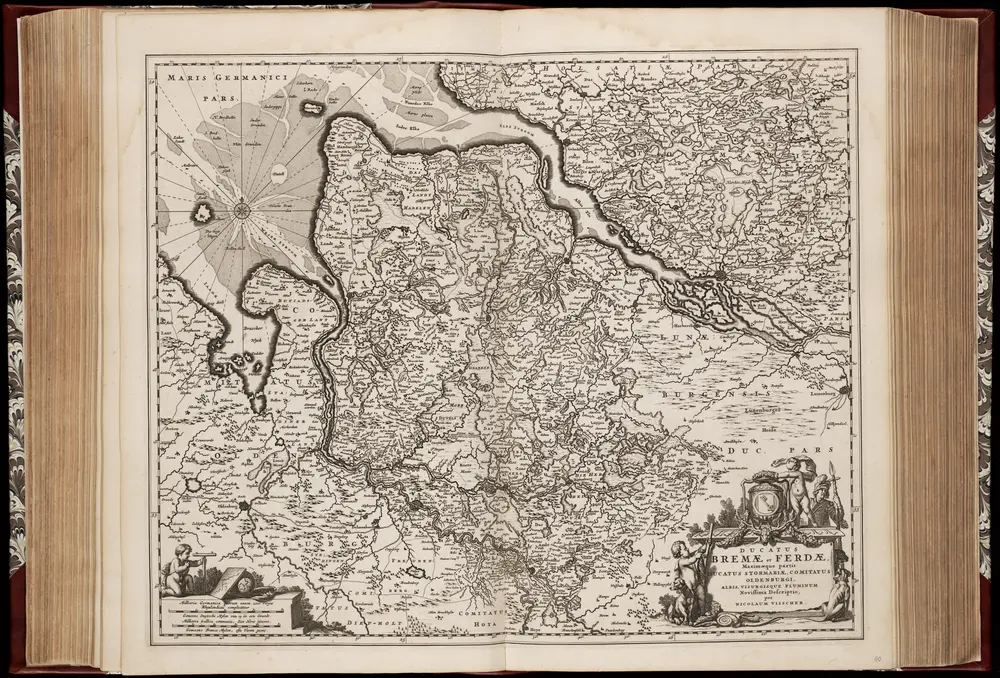
Ducatus Bremae et Ferdae, maximaeque partis ducatus Stormariae, comitatus Oldenburgi, Albis, Visurgisque fluminum novissima descriptio / per Nicolaum Visscher
1670
Nicolaes Jansz Visscher sr 1618-1679
1:350k