Mapa catalogado
Meßtischblatt 3455 : Alt Limmritz, 1936


Título completo:Meßtischblatt 3455 : Alt Limmritz, 1936
Año de ilustración:1936
Fecha de publicación:1936
Tamaño físico:20 x 30 cm
Escala del mapa:1:250 000
Meßtischblatt 1845, neue Nr. 3454 : Sonnenburg, 1938
1938
1:250k
Meßtischblatt 1845 : Sonnenburg, 1892
1892
1:250k
Meßtischblatt 3455 : Alt Limmritz, 1936
1936
1:250k
Meßtischblatt Tamsel
1925
1:250k
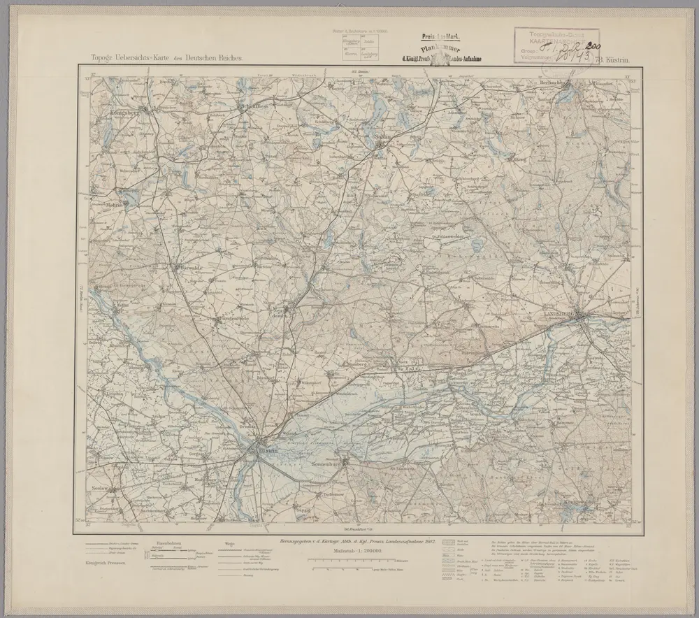
78. Küstrin, uit: Topographische Uebersichtskarte des Deutschen Reiches / herausgegeben v. d. Kartogr. Abt. d. Königl. Preuß. Landesaufnahme
1899
Königlich Preußische Landesaufnahme. Kartographische Abtheilung
1:200k
Meßtischblatt 1774 : Vietz, 1935
1935
1:250k
Meßtischblatt 1774 : Vietz, 1918
1918
1:250k
n/a
1791
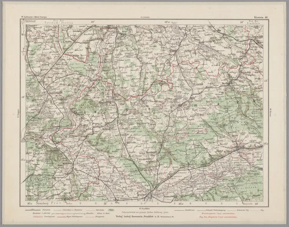
Küstrin 48, uit: Special-Karte von Mittel-Europa / nach amtlichen Quellen bearbeitet von W. Liebenow
1899
Johannes Wilhelm Liebenow 1822-1897
1:300k
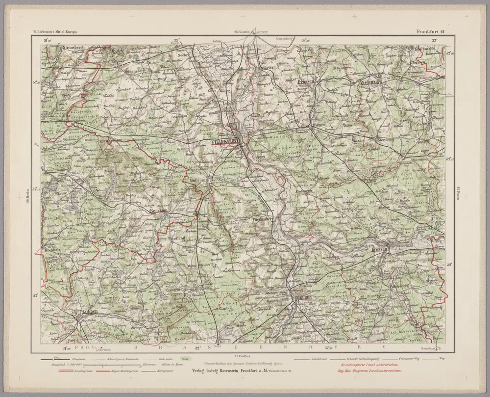
Frankfurt 61, uit: Special-Karte von Mittel-Europa / nach amtlichen Quellen bearbeitet von W. Liebenow
1899
Johannes Wilhelm Liebenow 1822-1897
1:300k