Cataloged map
Meßtischblatt 1977 : Königs- Wusterhausen, 1912


Full title:Meßtischblatt 1977 : Königs- Wusterhausen, 1912
Depicted:1912
Pubdate:1912
Physical Size:20 x 30 cm
Map scale:1:250 000
Meßtischblatt 1977 : Königs- Wusterhausen, 1930
1930
1:250k
Meßtischblatt 1977 : Königs- Wusterhausen, 1912
1912
1:250k
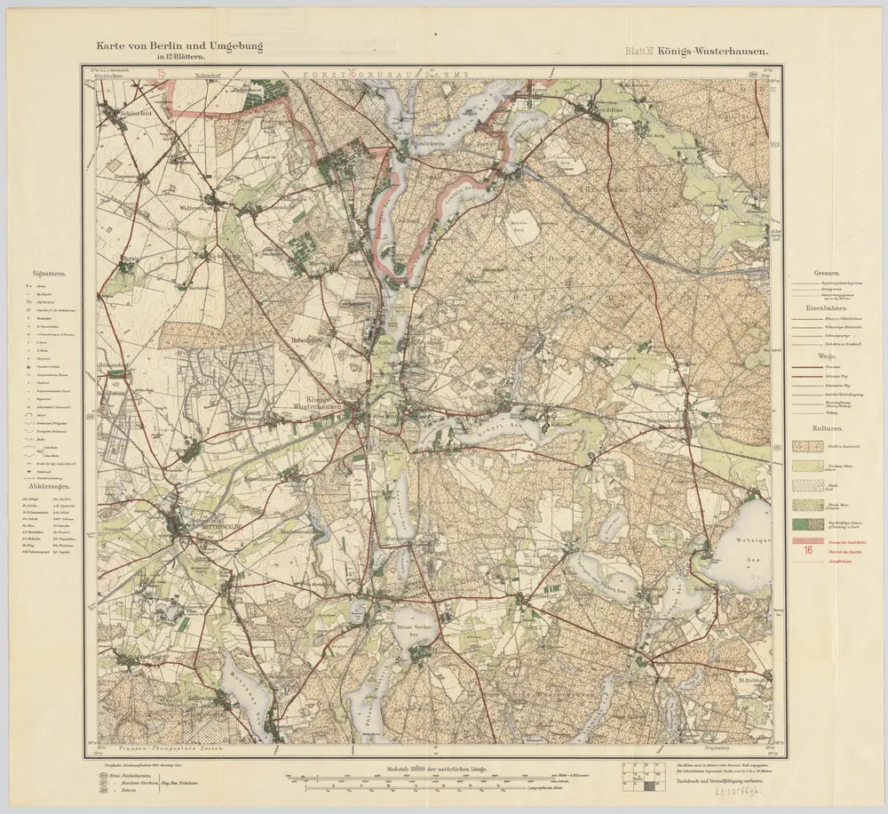
Blatt XI Königs-Wusterhausen, uit: Karte von Berlin und Umgebung in 12 Blättern
1922
Paul Schneider
1:50k
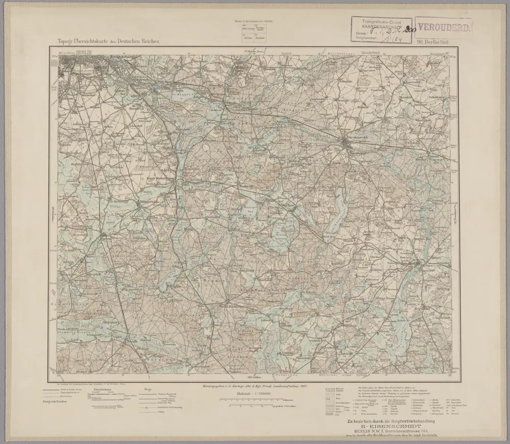
90. Berlin (Süd), uit: Topographische Uebersichtskarte des Deutschen Reiches / herausgegeben v. d. Kartogr. Abt. d. Königl. Preuß. Landesaufnahme
1899
Königlich Preußische Landesaufnahme. Kartographische Abtheilung
1:200k
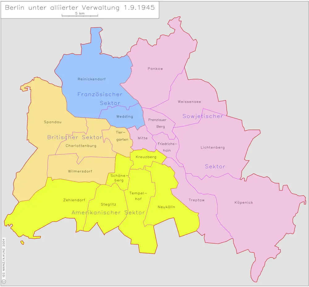
Berlin unter alliierter Verwaltung 1.9.1945
1945
Kunz, Andreas ; Moeschl, Joachim Robert
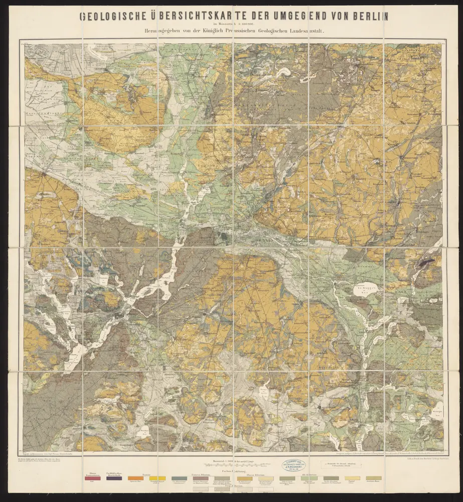
Geologische Übersichtskarte der Umgegend von Berlin
1885
Berendt, G. ; Laufer, E.
1:100k
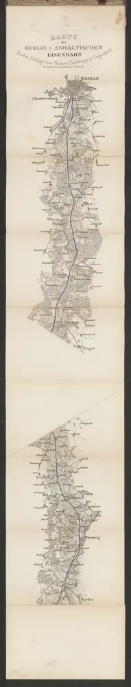
Karte der Berlin-Anhaltischen Eisenbahn
1843
Verlag von Simon Schropp & Cop.
1:200k
n/a
1791
Topographische Carte : Hundert Quadrat-Meilen um Berlin
1811
1:184k
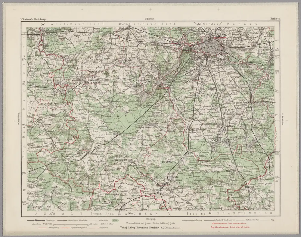
Berlin 60, uit: Special-Karte von Mittel-Europa / nach amtlichen Quellen bearbeitet von W. Liebenow
1899
Johannes Wilhelm Liebenow 1822-1897
1:300k