Mapa catalogado
Meßtischblatt 1978 : Wernsdorf, 1936


Título completo:Meßtischblatt 1978 : Wernsdorf, 1936
Año de ilustración:1936
Fecha de publicación:1936
Tamaño físico:20 x 30 cm
Escala del mapa:1:250 000
Meßtischblatt 3648 : Wernsdorf, 1942
1942
1:250k
Meßtischblatt 3648 : Wernsdorf, 1937
1937
1:250k
Meßtischblatt 1978 : Wernsdorf, 1936
1936
1:250k
Meßtischblatt 1978 : Wernsdorf, 112
1912
1:250k
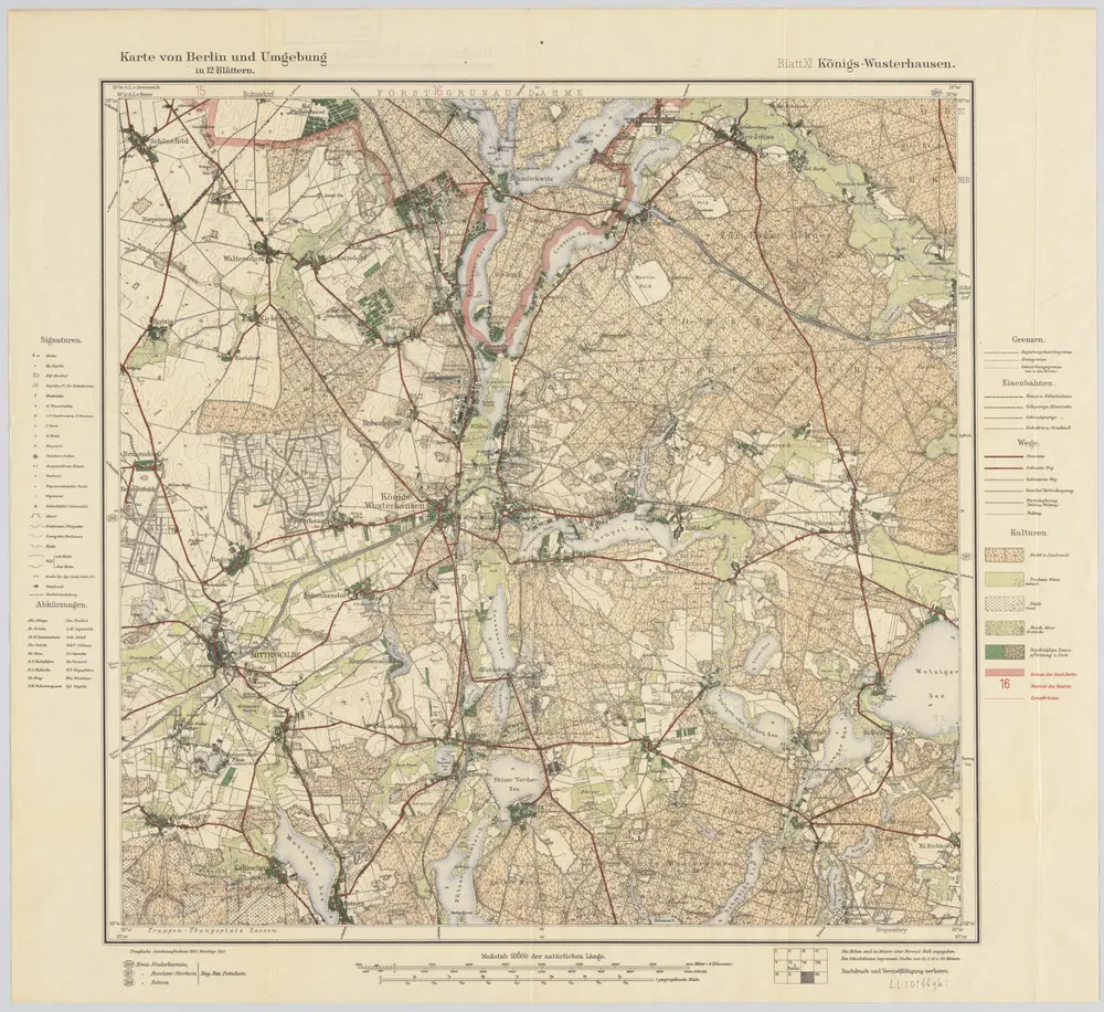
Blatt XI Königs-Wusterhausen, uit: Karte von Berlin und Umgebung in 12 Blättern
1922
Paul Schneider
1:50k
Meßtischblatt 3548 : Rüdersdorf, 1945
1945
1:250k
Meßtischblatt 1910 : Rüdersdorf, 1922
1922
1:250k
Meßtischblatt 1910 : Rüdersdorf, 1916
1916
1:250k
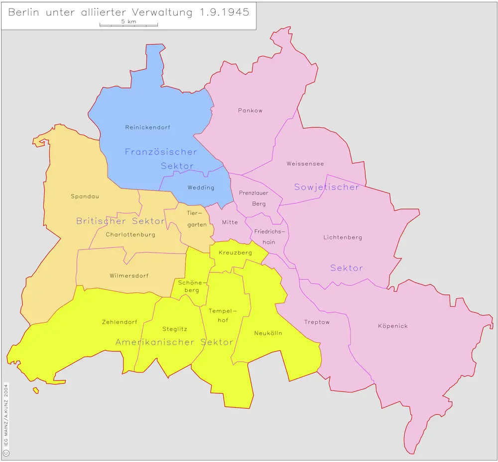
Berlin unter alliierter Verwaltung 1.9.1945
1945
Kunz, Andreas ; Moeschl, Joachim Robert
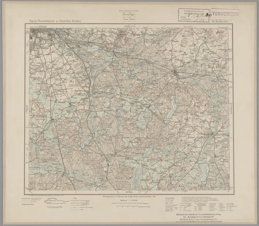
90. Berlin (Süd), uit: Topographische Uebersichtskarte des Deutschen Reiches / herausgegeben v. d. Kartogr. Abt. d. Königl. Preuß. Landesaufnahme
1899
Königlich Preußische Landesaufnahme. Kartographische Abtheilung
1:200k