Mappa catalogata
Meßtischblatt 2228 : Lamspringe, 1878


Titolo completo:Meßtischblatt 2228 : Lamspringe, 1878
Anno di illustrazione:1878
Data di pubblicazione:1878
Dimensione fisica:20 x 30 cm
Scala della mappa:1:250 000
Meßtischblatt 4026 : Lamspringe, 1937
1937
1:250k
Meßtischblatt 2228 : Lamspringe, 1878
1878
1:250k
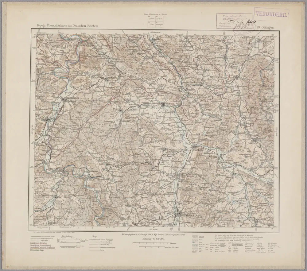
99. Göttingen, uit: Topographische Uebersichtskarte des Deutschen Reiches / herausgegeben v. d. Kartogr. Abt. d. Königl. Preuß. Landesaufnahme
1899
Königlich Preußische Landesaufnahme. Kartographische Abtheilung
1:200k
n/a
1791
n/a
1791
n/a
1791
LandtTafel des Eyszfeldts
1649
Flucken, Johann ; Merian Mattäus
1:180k
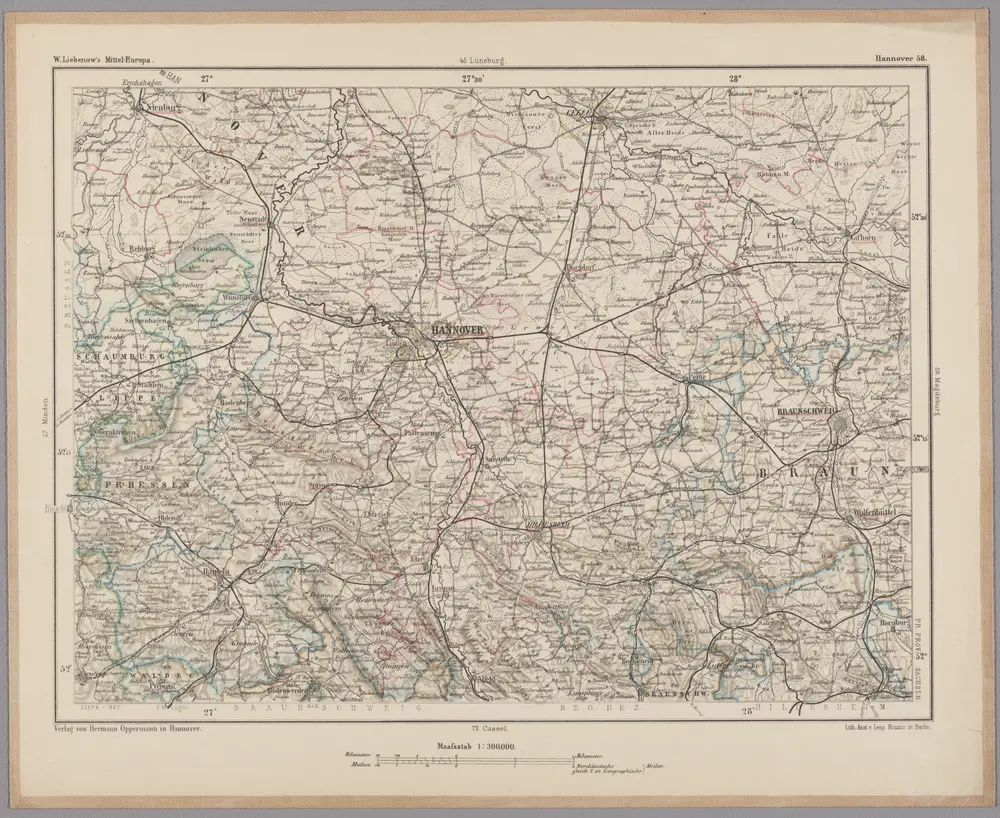
Hannover 58, uit: [W. Liebenow's Special-Karte von Mittel-Europa]
1870
Johannes Wilhelm Liebenow 1822-1897
1:300k
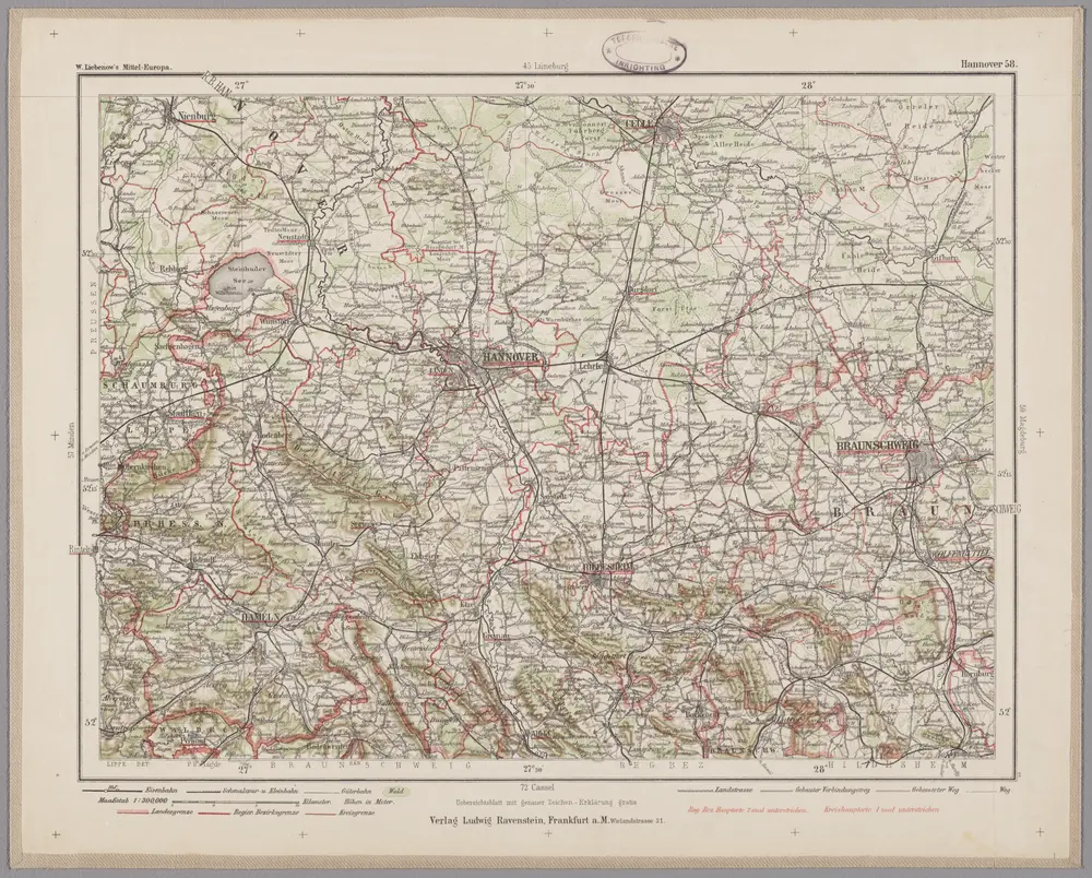
Hannover 58, uit: Special-Karte von Mittel-Europa / nach amtlichen Quellen bearbeitet von W. Liebenow
1899
Johannes Wilhelm Liebenow 1822-1897
1:300k
Meßtischblatt 2158 : Bockenem, 1898
1898
1:250k