Maps of Gernrode/Harz

Maps of Gernrode/Harz

$title$

Meßtischblatt 4232 : Quedlinburg, 1936

1 : 250000 Quedlinburg. - Hrsg. 1905, einz. Nachtr. 1934. - 1:25000. - [Berlin]: Reichsamt für Landesaufnahme, 1936. - 1 Kt.
$title$

Meßtischblatt 2381 : Quedlinburg, 1919

1 : 250000 Quedlinburg. - Aufn. 1903, hrsg. 1905. - 1:25000. - [Berlin]: Reichsamt für Landesaufnahme, 1919. - 1 Kt.
$title$

Meßtischblatt 2381 : Quedlinburg, 1911

1 : 250000 Quedlinburg. - Aufn. 1903, hrsg. 1905, einzelne Nachtr. 1909, gedr. [19]11. - 1:25000. - [Berlin]: Reichsamt für Landesaufnahme, 1911. - 1 Kt.
$title$

Meßtischblatt 4232 : Quedlinburg, 1898?

1 : 250000 Quedlinburg. - 1:25000. - [Berlin]: Reichsamt für Landesaufnahme, [1898?]. - 1 Kt.
$title$

Meßtischblatt 2381 : Quedlinburg, 1876

1 : 250000 Quedlinburg. - Aufn. 1852, hrsg. 1870, bericht. 1876. - 1:25000. - [Berlin]: Reichsamt für Landesaufnahme, 1876. - 1 Kt.
$title$

$title$

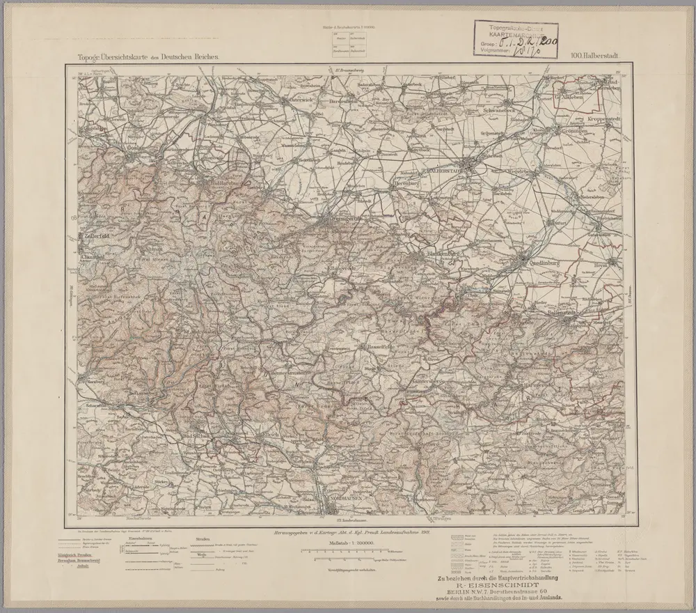
100. Halberstadt, uit: Topographische Uebersichtskarte des Deutschen Reiches / herausgegeben v. d. Kartogr. Abt. d. Königl. Preuß. Landesaufnahme

1 : 200000 titelvariant: Topogr. Übersichtskarte des Deutschen Reiches; Annotatie: Titel boven bladen ook: Topogr. Übersichtskarte des Deutschen Reiches; Annotatie geografische gegevens: Op elk blad twee maatstokken: 10 Kilometer = 5,5 cm; 1 geogr. Meile = 3,6 cm; Legenda onder op elk blad Königlich Preußische Landesaufnahme. Kartographische Abtheilung [S.l : Königlich Preußische Landesaufnahme, Kartographische Abtheilung]
$title$

Mansfeldiae comitatvs descriptio

1 Karte : Kupferdruck ; 36 x 41 cm Stella; Ortelius; Hogenberg s.n.
$title$

Mansfeldiae comitatvs descriptio

1 Karte : Kupferdruck ; 36 x 41 cm Stella; Ortelius; Hogenberg s.n.
$title$

Mansfeldici comitatus typus chorographicus

1 : 180000 Halle an der Saale-oblast (Německo) Stella, Tilemann Mansfeld, Bruno a M. Iohanne Mellingero
$title$

Principatus Halberstadiensis, abbat. Quedlinburgens cum comitatu Wernigerodano, ad hodiernum verum statum ex acta prodiit

1 : 135000 Halberstadt (Německo) Seutter, Matthäus Lotter, Tobias Conrad M. Seutter
$title$

Principatus Halberstadiensis, abbat. Quedlinburgens cum comitatu Wernigerodano, ad hodiernum verum statum ex acta prodiit

1 : 135000 Halberstadt (Německo) Seutter, Matthäus Lotter, Tobias Conrad ex officina Matthaei Seutteri
$title$

$title$

$title$

Comitatvs Mansfeldiae Descriptio

1 : 210000 Mollova mapová sbírka Stella, Tilemann Schenk, Peter I
$title$

Comitatvs Mansfeldiae Descriptio

1 : 210000 Mollova mapová sbírka Stella, Tilemann Janssonius, Johannes I
$title$

Mansfeldiae Comitatvs descriptio auctore Tilemanno Stella Sig.

1 : 180000 Mollova mapová sbírka Stella, Tilemann Hogenberg, Franz Braun, Georg
$title$

Mansfeldia Comitatvs

1 : 170000 Mollova mapová sbírka Stella, Tilemann Blaeu, Joan I.
$title$

Mansfeldia Comitatvs

1 : 240000 Mollova mapová sbírka Merian, Matthaeus Merian, Matthäus
$title$

$title$

Der Harz

Grosser Hand-Atlas über alle Theile der Erde in 170 Karten Meyer, J. Verlag des Bibliographischen Instituts
$title$

Charte vom Harz

1 : 151000 Harz (Německo) Fritsch, I. H. Wilhelm Heinrichshofen
$title$

Der Harz.

1 : 103000 Gotthard, A.
$title$

[Kaart], uit: Geognostische Übersichtskarte des Harzgebirges / zsgest. von K.A. Lossen

1 : 100000 Annotatie geografische gegevens: Samengest. naar opnamen van de Geologische Landesanstalt en oudere geologische kaarten, op basis van de Auhagen'sche topographischen Karte 1:100.000 K.A. Lossen [S.l. : s.n.] / ([Berlin : Berliner Lithogr. Institut])
$title$

MANSFELDIA | COMITATVS

Auctore Tilemanno Stella Sig. Apud Guiljelm. Blaeu.
$title$

Mansfeldiae Comitatus Descriptio. [Karte], in: Theatrum orbis terrarum, S. 130.

1 Karte aus Atlas Ortelius, Abraham
$title$

Charte von dem Harz Gebirge und einem Theile der umliegenden Gegenden

1 : 200000 Harz (Německo) Julius, Friedrich Berghaus, Heinrich Karl Wilhelm C.W. Ramdohr's Hof-Kunsthandlung
$title$

Mansfeldia comitatvs / auctore Tilemanno Stella sig

1 : 170000 Annotatie: Origineel is Blad 99 in atlas factice; Annotatie geografische gegevens: Schaalvermelding op kaart: 2 Milliaria Germanica communia; Kaart toont het graafschap Mansfeld in het gebied tussen Aschersleben, Halle an der Saale, Wiehe Unstruttal en Stolberg Tilemann Stella 1525-1589 [Amsterdami : apud Guiljelm. Blaeu]
$title$

Mansfeldiae Comitatus Descriptio. [Karte], in: Theatrum orbis terrarum, S. 222.

1 Karte aus Atlas Ortelius, Abraham Vrients, Jan Baptista
$title$

Mansfeldia Comitatus [Karte], in: Theatrum orbis terrarum, sive, Atlas novus, Bd. 1, S. 245.

1 Karte aus Atlas Blaeu, Joan Blaeu, Willem Janszoon
© MapTiler © OpenStreetMap contributors
How does it work?
These instructions will show you how to find historical maps online.
Getting started
Type the place name in the search box to find the exact location. You can further adjust the search by zooming in and out.
Zoom
Zoom in and out with the buttons or use your mouse or touchpad natively.
Exact Area tool
Click here and draw a rectangle over the map to precisely define the search area.
Set filters
Narrow your search with advanced settings, such as Years (from/to), Fulltext, Publisher, etc.
Results
See the results of your search on the right side. You can scroll down to find more maps of this location.
?

Download OldMapsOnline Mobile