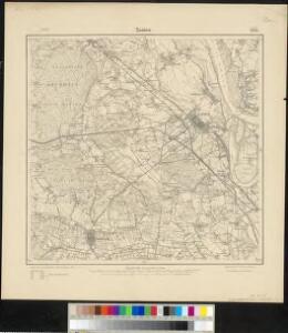
Maps of Xanten

Meßtischblatt 2426 : Xanten, 1906
1 : 250000 Xanten. - Aufn. 1892, hrsg. 1894, bericht. 1906. - 1:25000. - [Berlin]: Reichsamt für Landesaufnahme, 1906. - 1 Kt.
Germany 1:25,000, Xanten
Germany 1:25,000 , Series GSGS 4414. Great Britain. War Office. [London] : War Office
North Rhine-Westphalia 1945
7 Survey Regiment RA - Rhine Crossing : map shewing regimental dispositions and information obtained (other than AA). SA/Misc/4243. Great Britain. Army. Royal Regiment of Artillery. Survey Regiment, 7th. [S.l.] : 7 Survey Regiment RA
Bl. 27 Aalten, 1904, uit: Atlas A.N.W.B.
1 : 200000 titelvariant: Atlas van Nederland van den A.N.W.B. Toeristenbond voor Nederland; Wielrijders-atlas van Nederland; Annotatie: Titel op bladwijzer: Atlas van Nederland van den A.N.W.B. Toeristenbond voor Nederland; Titel op legendablad: Wielrijders-atlas van Nederland; Voor aanwezige bladen zie overzichtsblad; Annotatie geografische gegevens: De serie bestaat uit 36 bladen ANWB ['s-Gravenhage : A.N.W.B.]
Bl. 27 Aalten, 1907, uit: Atlas A.N.W.B.
1 : 200000 titelvariant: Atlas van Nederland van den A.N.W.B. Toeristenbond voor Nederland; Wielrijders-atlas van Nederland; Annotatie: Titel op bladwijzer: Atlas van Nederland van den A.N.W.B. Toeristenbond voor Nederland; Titel op legendablad: Wielrijders-atlas van Nederland; Voor aanwezige bladen zie overzichtsblad; Annotatie geografische gegevens: De serie bestaat uit 36 bladen ANWB ['s-Gravenhage : A.N.W.B.]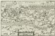
Ducatus Cliviae Pars
1 : 150000 Mollova mapová sbírka Person, Nikolaus Person, Nicolas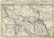
Geldern Eine Statt und Haupt Vestung im Hertzogthum gleiches Nahmens gelegen Mitt der Gegend auff 4 Stunden
1 : 340000 Mollova mapová sbírka Bodenehr, Gabriel Bodenehr, Gabriel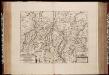
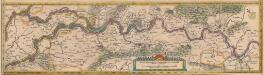
Fossa Eugeniana quae a Rheno ad Mosam duci coepta est, anno MDCXXII ductu comitis Henrici vanden Berge / [Joannes Janssonius]
1 : 80000 Annotatie: Het eerst verschenen in: Novus Atlas, das ist, Weltbeschreibung ... Zweite Theil. - Amsterdami : apud Iohannem Ianssonium, 1645; Origineel is Blad 66 in atlas factice; Annotatie geografische gegevens: Noordwest boven Janssonius, Joannes (jr.) (1588-1664) Amstelodami : sumptibus Ioannis Ianssonii
Fossa Eugeniana quae a Rheno ad Mosam duci coepta est, Anno CICICCXXVII ductu Comitis Henrici vanden Berge. [Karte], in: Novus atlas absolutissimus, Bd. 3, S. 103.
1 Karte aus Atlas Janssonius Offizin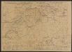
Fossa Eugeniana quae a Rheno ad Mosam duci coepta est, Anno CICICCXXVII ductu Comitis [...] [Karte], in: Gerardi Mercatoris et I. Hondii Newer Atlas, oder, Grosses Weltbuch, Bd. 1, S. 413.
1 Karte aus Atlas Mercator, Gerhard und Hondius, Jodocus Jansson, Jan
Fossa quae a Rheno ad Mosam duci coepta est, anno MDCXXII.
1 : 143000 Amsterdam : excudit Guilj. Janssonius Blaeuw
Fossa Sanctae Mariae, quae et Eugeniana dicitur Vulgo De Nieuwe Grift. [Karte], in: Novus Atlas, das ist, Weltbeschreibung, Bd. 1, S. 385.
1 Karte aus Atlas Blaeu, Joan Blaeu, Willem Janszoon
Fossa Sanctae Mariae, quae et Eugeniana dicitur Vulgo De Nieuwe Grist. [Karte], in: Le théâtre du monde, ou, Nouvel atlas contenant les chartes et descriptions de tous les païs de la terre, Bd. 1, S. 414.
1 Karte aus Atlas Blaeu, Willem Janszoon und Blaeu, Joan Blaeu, Willem Janszoon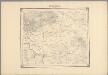
15, uit: Topografische atlas van het Koninkrijk der Nederlanden
Annotatie: Map met 19 losse krt. schaal 1:200.000 en 1 bladwijzer schaal 1:1.000.000 ['s-Gravenhage : Ministerie van Oorlog, Topografisch Bureau]
Fossa Sanctae Mariae, quae et Eugeniana dicitur Vulgo De Nieuwe Grist. [Karte], in: Theatrum orbis terrarum, sive, Atlas novus, Bd. 1, S. 413.
1 Karte aus Atlas Blaeu, Joan Blaeu, Willem Janszoon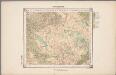
20. Munsterland, uit: Geologische kaart van Nederland / door W.C.H. Staring ; bew. aan de Topographische Inrichting
1 : 200000 Winand Carel Hugo Staring 1808-1877; Topographische Inrichting, 's-Gravenhage 's-Gravenhage : Belinfante
19me Arnhem, uit: Nouvelle carte de la Hollande, d'après Kraijenhoff et les meilleures cartes connues / Établissement Géographique de Bruxelles, fondé par Ph. Vander Maelen
1 : 117000 Annotatie: De bladen zijn genummerd 1-24. De bladen 2 t/m 24 hebben elk een afzonderlijke titel. Blad 5 bevat: Triangulations et positions. Blad 9 bevat: Plan d'Amsterdam; De kaartbladen 1, 5, 9 en 24 zijn niet ingekleurd; Van kaartblad 24 is een extra (ingekleurd) exempl. aanwezig; Annotatie geografische gegevens: 2 schaalstokken: 5 Echelle de 5 lieues de 20 au degré ... (= 23,2 cm) en 7380 Echelle de 5 lieues de 20 au degré ... (= 23,2 cm); Legenda; Met indexkaart: Carte d'assemblage Philippe Marie Guillaume Vander Maelen 1795-1869; Établissement Géographique de Bruxelles Bruxelles : Établissement Géographique
V, uit: Carte chorographique des Pays-Bas Autrichiens / ... par le Comte de Ferraris ; gravée par L.A. Dupuis
1 : 86400 Annotatie: Lit.: Les militaires et la cartographie des Pays-Bas méridionaux et de la Principauté de Liège à la fin du XVIIe et au XVIII siècle / Claire Lemoine-Isabeau. - Bruxelles, 1984, p. 206-212; La cartographie au XVIIIe siècle et l'oeuvre du Comte de Ferraris (1726-1814) : colloque international, Spa, 8-11 sept. 1976. - Bruxelles, 1978; Met opdracht aan keizer Joseph II (bl.XVI); Met plattegrond van Brussel (bl. XXI), overzichtskaart (bl. XXII) en bladwijzer (bl. XXIII); Ontbreekt: bl. I-III en XXI; Voor aanwezige bladen zie overzichtsblad Ferraris, Johann Joseph; Dupuis, L. A. [S.l. : s.n.]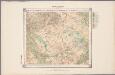
20. Munsterland, uit: Geologische kaart van Nederland / door W.C.H. Staring ; bew. aan de Topographische Inrichting
1 : 200000 Winand Carel Hugo Staring 1808-1877; Topographische Inrichting, 's-Gravenhage 's-Gravenhage : Belinfante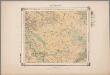
20. Munsterland, uit: Geologische kaart van Nederland : schaal van 1:200.000 / door W.C.H. Staring ; uitgevoerd door het Topographisch Bureau van Oorlog ; uitgegeven op last van Zijne Majesteit Den Koning
Annotatie: Impressum ontleend aan omslag; Kaart "Nederland de dijken weggedacht" [kaart 25] en kaart 13 (bladwijzer) vermelden het jaar 1869; Kaart 'Limburg en de Hesbaije' (bladnr. 26) vermeldt het jaar 1868; Blad 5/9 ontbreekt Topographische Inrichting, 's-Gravenhage; Topographisch Bureau Haarlem : A.C. Kruseman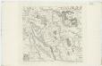
V ; 1.M., uit: Carte chorographique des Pays-Bas Autrichiens / ... par le Comte de Ferraris ; gravée par L.A. Dupuis
1 : 86400 Annotatie: Bladen linksboven genummerd met Romeinse cijfers, rechtsboven met een cijfer en een letter; Met opdracht aan keizer Joseph II (bl.XVI); Met plattegrond van Brussel (bl. XXI), overzichtskaart (bl. XXII) en bladwijzer (bl. XXIII); Annotatie geografische gegevens: Schaalstokken: Echelle de Toises ou de Lieues communes de France; Echelle de Verges ou de Lieues de Brabant; Echelle de Milles d'Allemagne (bl. XVII); Echelle de Mètres; In de hoeken lengte- en breedtematen T.M.e en T.P.e Joseph-Jean François Ferraris Comte de 1726-1814; L.A. Dupuis [S.l. : s.n.]
Tractus Rheni et Mosae, totusque Vahalis à Rhenoberca Gorcomium usque cum terris adjacentibus [...] [Karte, Teil 2], in: Novus Atlas, das ist, Weltbeschreibung, Bd. 1, S. 382.
1 Karte aus Atlas Blaeu, Joan Blaeu, Willem Janszoon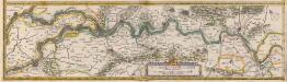
Tractus Rheni et Mosae totusque Vahalis à Rhenoberca Gorcomium usque cum terris adiacentibus [...] [Karte, Teil 2], in: Theatrum orbis terrarum, sive, Atlas novus, Bd. 1, S. 416.
1 Karte aus Atlas Blaeu, Joan Blaeu, Willem Janszoon
Descriptio Fluminum Rheni, Vahalis et Mosae a Rheno Berca ad Goricominum [...] [Karte, Teil 2], in: Gerardi Mercatoris et I. Hondii Newer Atlas, oder, Grosses Weltbuch, Bd. 1, S. 410.
1 Karte aus Atlas Mercator, Gerhard und Hondius, Jodocus Jansson, Jan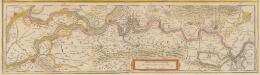
Descriptio Fluminum Rheni, Vahalis et Mosae a Rheno Berca ad Goricominum [...] [Karte, Teil 2], in: Novus atlas absolutissimus, Bd. 3, S. 100.
1 Karte aus Atlas Janssonius Offizin
Tractus Rheni et Mosae, totusque Vahalis à Rhenoberca Gorcomium usque cum terris adiacentibus [...] [Karte, Teil 2], in: Le théâtre du monde, ou, Nouvel atlas contenant les chartes et descriptions de tous les païs de la terre, Bd. 1, S. 411.
1 Karte aus Atlas Blaeu, Willem Janszoon und Blaeu, Joan Blaeu, Willem Janszoon
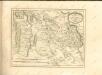
TETRARCHIA | Ducatus Gelriæ | RVRÆMVNDENSIS
[Amsterdam : Joan Blaeu]
19me Arnhem, uit: [Nouvelle carte de la Hollande, d'après Kraijenhoff et les meilleures cartes connus] / [Ph. Vandermaelen]
1 : 130000 Annotatie: Ontbreekt: bl. 1-12 Vandermaelen, Philippe Marie Guillaume Bruxelles : Établissement Géographique