Maps of Nörten-Hardenberg

Meßtischblatt 2447 : Nörten, 1937
1 : 250000 Nörten. - Hrsg. 1910, einz. Nachtr. 1937. - 1:25000. - [Berlin]: Reichsamt für Landesaufnahme, 1937. - 1 Kt.
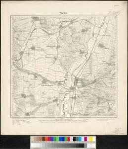
Meßtischblatt 2447 : Nörten, 1925
1 : 250000 Nörten. - Aufn. 1908, einz. Nachtr. 1925. - 1:25000. - [Berlin]: Reichsamt für Landesaufnahme, 1925. - 1 Kt.
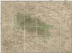
Meßtischblatt 2447 : Nörten, 1910
1 : 250000 Nörten. - Aufn. 1908. - 1:25000. - [Berlin]: Reichsamt für Landesaufnahme, 1910. - 1 Kt.
Meßtischblatt 4325 : Nörten, 1878
1 : 250000 Nörten. - Aufn. 1876. - 1:25000. - [Berlin]: Reichsamt für Landesaufnahme, 1878. - 1 Kt.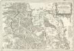
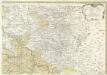
Tableau Topographique Qui comprend la Partie Septentrionale du Landgraviat de Hesse Cassel et de la Principauté de Waldeck, l'Eveché de Paderborn, Partie du Comté de Grubenhague et les Frontieres de ces Etats
1 : 130000 Mollova mapová sbírka Julien, Roch-Joseph Julien, Roch Joseph
Landgraviatus Hassiae Inferioris Comitatvs Waldeciae Eichsfeldiae Tabvla Geographica
1 : 140000 Mollova mapová sbírka Berger, Daniel
99. Göttingen, uit: Topographische Uebersichtskarte des Deutschen Reiches / herausgegeben v. d. Kartogr. Abt. d. Königl. Preuß. Landesaufnahme
1 : 200000 titelvariant: Topogr. Übersichtskarte des Deutschen Reiches; Annotatie: Titel boven bladen ook: Topogr. Übersichtskarte des Deutschen Reiches; Annotatie geografische gegevens: Op elk blad twee maatstokken: 10 Kilometer = 5,5 cm; 1 geogr. Meile = 3,6 cm; Legenda onder op elk blad Königlich Preußische Landesaufnahme. Kartographische Abtheilung [S.l : Königlich Preußische Landesaufnahme, Kartographische Abtheilung]
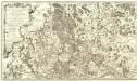
Le Landgraviat de Hesse-Cassel Meridional et Septentr: avec une Partie du Landgraviat de Hesse-Darmstat et de la Vetteravie avec autres dependences
1 : 200000 Mollova mapová sbírka Carlet, Louis-François Lotter, Tobias Conrad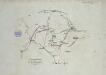
Verproviantirung von Göttingen im Januar 1761
Landgrafiatvs Hasso-Cassellanvs typo geographico quatuor Foliorum expressus Cura Homannianorum Heredum Norimb: 1761
1 : 160000 Mollova mapová sbírka Homann, Johann Baptist Homann, Johann Baptista - dědici
Landt Tafel des Eyßfeldts
1 : 180000 Mollova mapová sbírka Fluck, Johann Merian, Matthäus
Tractvs Eichsfeldiae in suas Praefecturas divisae nec non Territorii Mvlhvsani Chorographia
1 : 160000 Mollova mapová sbírka Homann, Johann Baptist Homann, Johann Baptista - dědici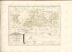
Carte Demi-Topo-Graphique De La Partie Septentrionale du Landgraviat de Hesse-Cassel
1 : 190000 Mollova mapová sbírka Carlet, Louis-François Beaurain, Jean de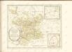

Cassel 72, uit: [W. Liebenow's Special-Karte von Mittel-Europa]
1 : 300000 titelvariant: W. Liebenow's Mittel-Europa; Annotatie: Titel boven de bladen: W. Liebenow's Mittel-Europa Johannes Wilhelm Liebenow 1822-1897 Hannover : Hermann Oppermann
Cassel-Göttingen 72, uit: Special-Karte von Mittel-Europa / nach amtlichen Quellen bearbeitet von W. Liebenow
1 : 300000 titelvariant: W. Liebenow's Mittel-Europa; Annotatie: Titel boven de bladen: W. Liebenow's Mittel-Europa Johannes Wilhelm Liebenow 1822-1897 Frankfurt a. M. : Ludwig Ravenstein
Partie Septentrionale du Landgraviat de Hesse-Cassel avec les Pays Voisins
1 : 130000 Mollova mapová sbírka Carlet, Louis-François Back, Jakob Conrad Broenner, Heinrich Ludwig II.
Episcopatvs Hildesiensis descriptio novissima
1 : 317000 Hildesheim (Německo) Gigas, Johann Michael Ioanne Gigante
EPISCOPATVS | HILDESIENSIS | DESCRIPTIO NOVISSIMA
Authore Ioanne Gigante D. Med. et Math. [Amsterdam : Joan Blaeu]
Übersicht der Operationen der Allirten u. Französischen Armee im November 1761, vom Uebergange des Herzogs über die Weser bis zu Ende des Feldzuges
1 : 200000
Eveché de Paderborn
1 : 230000 Mollova mapová sbírka Le Rouge, Georges-Louis Baisiez Le Rouge, Georges-Louis
Recens et Accurata Designatio Episcopatus Paderbornensis in suas Dioecenses et Praefect. Exacte Distincti
1 : 230000 Mollova mapová sbírka Seutter, Matthäus Seutter, Matthäus
Episcopatus Hildesiensis Descriptio Novissima [Karte], in: Gerardi Mercatoris et I. Hondii Newer Atlas, oder, Grosses Weltbuch, Bd. 1, S. 286.
1 Karte aus Atlas Mercator, Gerhard und Hondius, Jodocus Jansson, Jan
Episcopatvs Hildesiensis descriptio novissima / authore Ioanne Gigante
1 : 310000 Annotatie: Origineel is Blad 86 in atlas factice; Annotatie geografische gegevens: Met drie schaalstokken: 3 Milliaria Saxonica magna quorum decem constituunt gradum coelestem, en: 3 Milliaria Saxonica mediocria, en: 6 Horae itineris pedestris; Rechtsboven: XVII Johannes Janssonius van Waesberge -1681?; Moses Pitt ca. 1654-1696; Stephanus Swart [Amstelodami : apud Janssonio-Waesbergios, Mosem Pitt et Stephanu Swart]
Episcopatus Hildesiensis Descriptio Novissima [Karte], in: Novus atlas absolutissimus, Bd. 2, S. 84.
1 Karte aus Atlas Janssonius Offizin

Episcopatus Hildesiensis Descriptio Novissima [Karte], in: Novus Atlas, das ist, Weltbeschreibung, Bd. 1, S. 108.
1 Karte aus Atlas Blaeu, Joan Blaeu, Willem Janszoon