Cataloged map
Meßtischblatt 2560 : Gimmel, 1892 Gimmel


Full title:Meßtischblatt 2560 : Gimmel, 1892 Gimmel
Depicted:1892
Pubdate:1892
Physical Size:20 x 30 cm
Map scale:1:250 000
Meßtischblatt 2560 : Gimmel, 1933 Gimmel
1933
1:250k
Meßtischblatt 2560 : Gimmel, 1892 Gimmel
1892
1:250k
n/a
1737
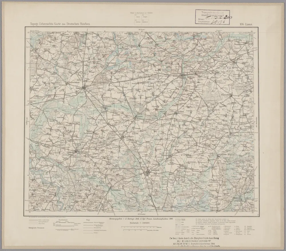
106. Lissa, uit: Topographische Uebersichtskarte des Deutschen Reiches / herausgegeben v. d. Kartogr. Abt. d. Königl. Preuß. Landesaufnahme
1899
Königlich Preußische Landesaufnahme. Kartographische Abtheilung
1:200k
n/a
1737
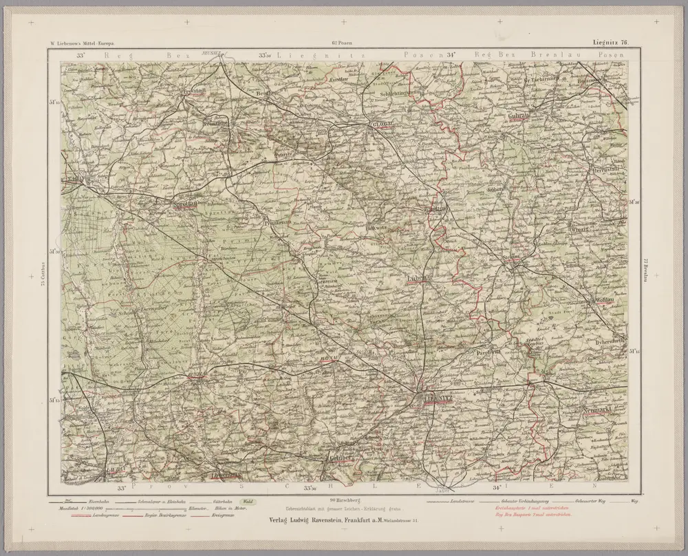
Liegnitz 76, uit: Special-Karte von Mittel-Europa / nach amtlichen Quellen bearbeitet von W. Liebenow
1899
Johannes Wilhelm Liebenow 1822-1897
1:300k
n/a
1737
n/a
1737
Meßtischblatt 2487 : Guhrau, 1937
1937
1:250k
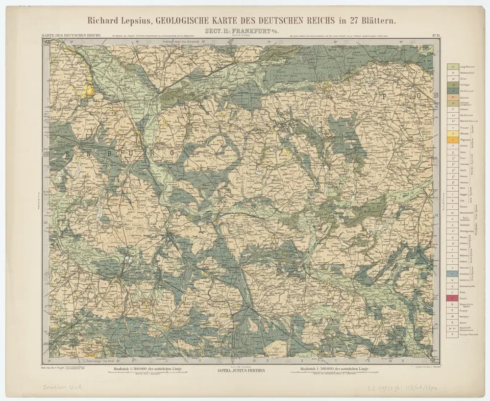
Sect. 15: Frankfurt a/O, uit: Geologische Karte des Deutschen Reichs in 27 Blaettern / [von] Richard Lepsius ; Red. von C. Vogel
1894
Carl Vogel 1828-1897
1:500k