Gecatalogiseerde kaart
Messtischblatt 2571 : Straelen, 1893


Volledige titel:Messtischblatt 2571 : Straelen, 1893
Jaar illustratie:1907
Pubdatum:1907
Fysieke grootte:20 x 30 cm
Schaal kaart:1:250 000
Messtischblatt 2571 : Straelen, 1893
1907
1:250k
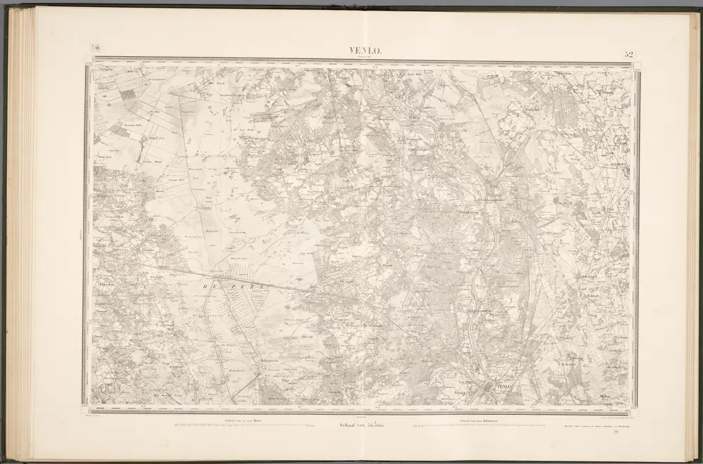
52 Venlo, uit: Topographische en militaire kaart van het Koningrijk der Nederlanden / vervaardigd door de officieren van den Generale Staf ; en gegraveerd op het Topographisch Bureau, van het Ministerie van Oorlog
1888
Generale Staf, Nederland; Ministerie van Oorlog. Topographisch Bureau
1:50k
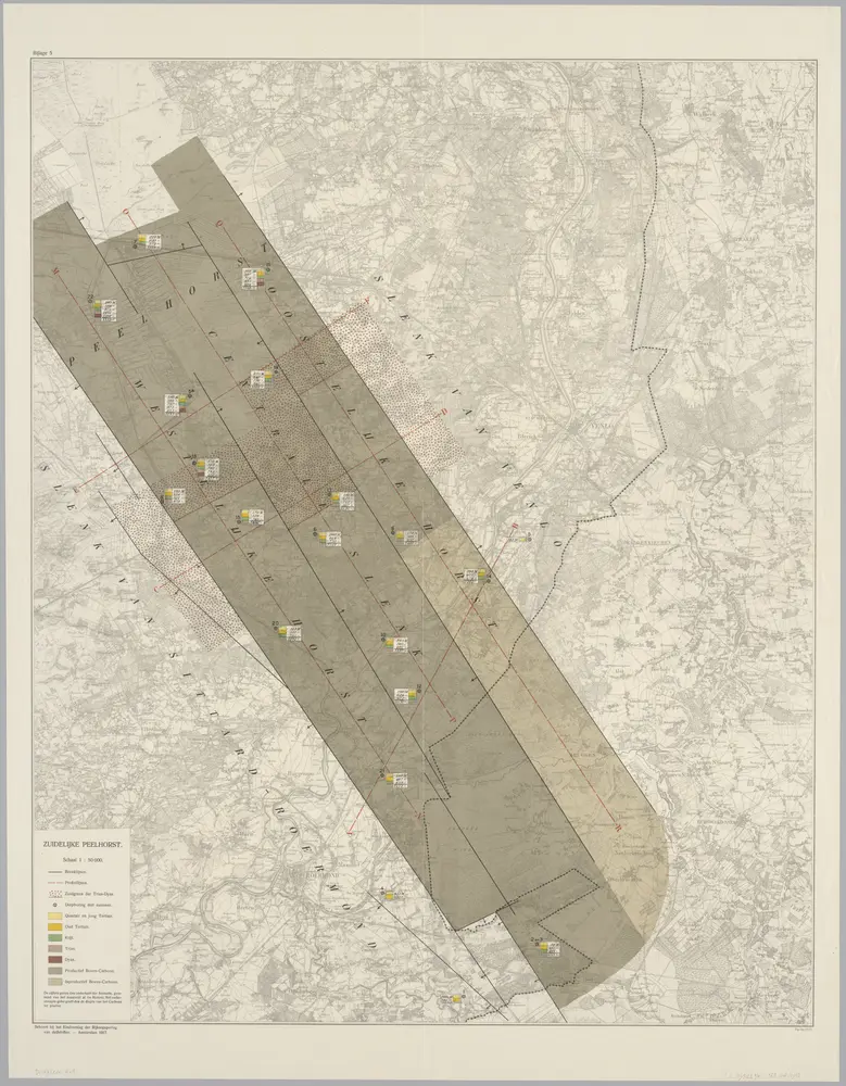
Bijlage 5, uit: Eindverslag over de onderzoekingen en uitkomsten van den Dienst der Rijksopsporing van Delfstoffen in Nederland, 1903-1916
1918
Departement van Landbouw, Nijverheid en Handel. Dienst der Rijksopsporing van Delfstoffen
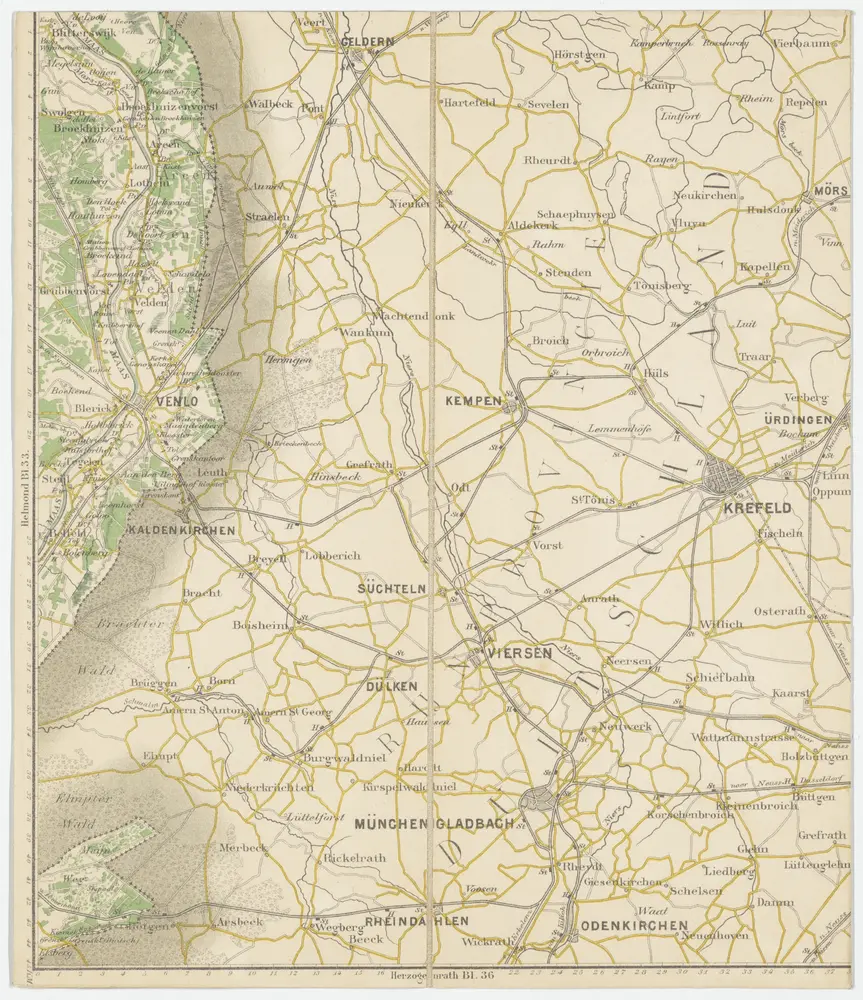
Bl. 34 Venlo, 1904, uit: Atlas A.N.W.B.
1904
ANWB
1:200k
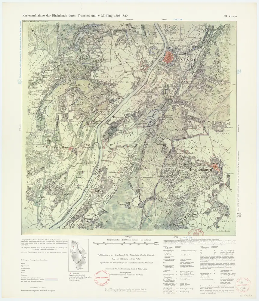
33 Venlo, uit: De Tranchotkaart van het gebied tussen Maas en Rijn : Nederlands gedeelte
1971
Jean Joseph Tranchot 1752-1815
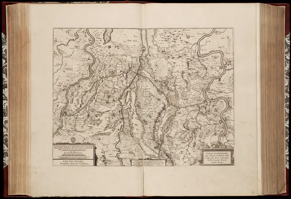
Fossa Eugeniana quae a Rheno ad Mosam duci coepta est, anno MDCXXII ductu comitis Henrici vanden Berge / [Joannes Janssonius]
1645
Janssonius, Joannes (jr.) (1588-1664)
1:80k
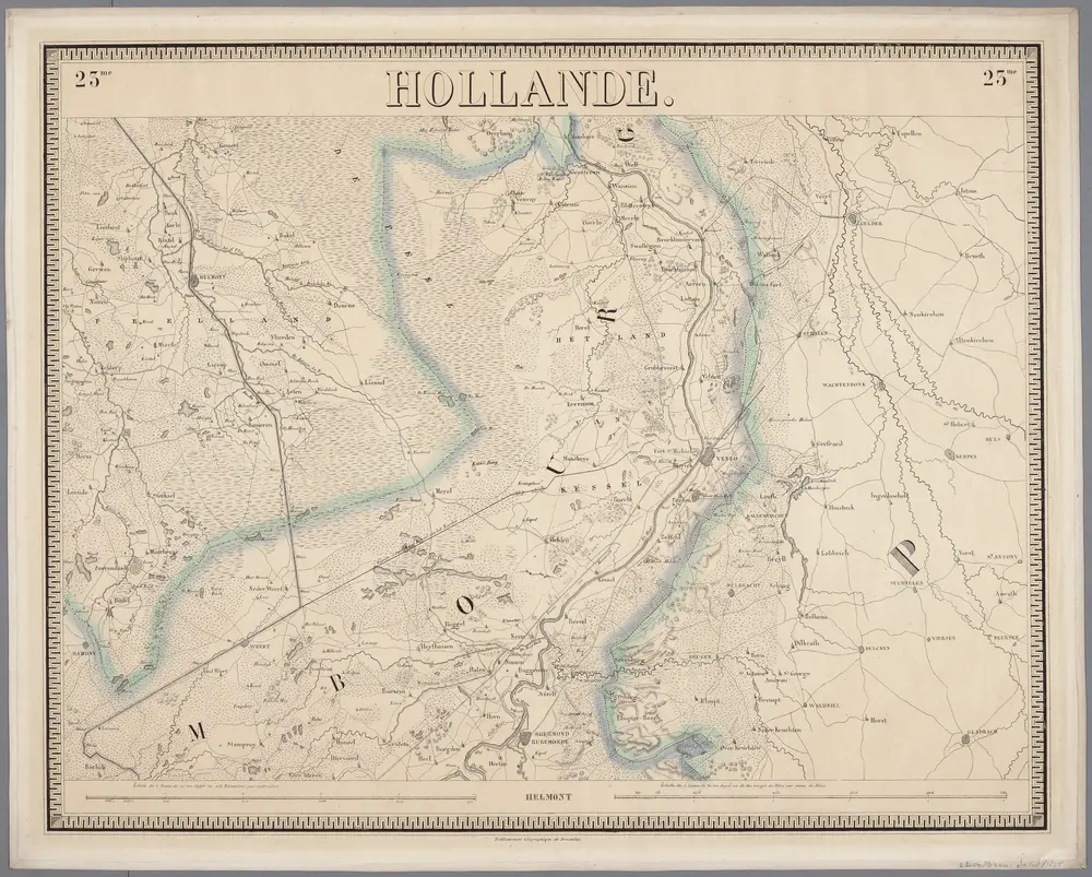
23me Helmont, uit: Nouvelle carte de la Hollande, d'après Kraijenhoff et les meilleures cartes connues / Établissement Géographique de Bruxelles, fondé par Ph. Vander Maelen
1830
Philippe Marie Guillaume Vander Maelen 1795-1869; Établissement Géographique de Bruxelles
1:117k
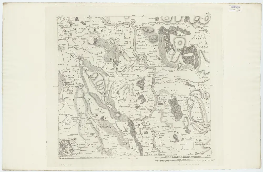
V ; 1.M., uit: Carte chorographique des Pays-Bas Autrichiens / ... par le Comte de Ferraris ; gravée par L.A. Dupuis
1807
Joseph-Jean François Ferraris Comte de 1726-1814; L.A. Dupuis
1:86k
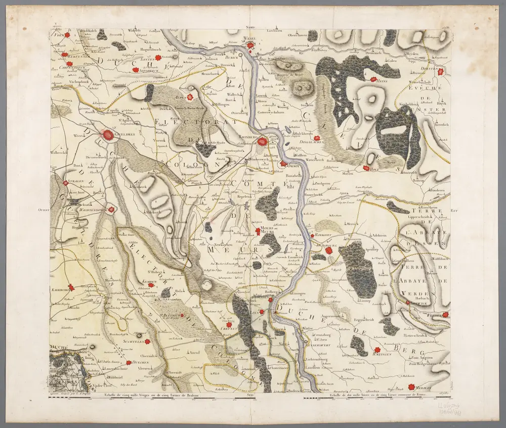
V, uit: Carte chorographique des Pays-Bas Autrichiens / ... par le Comte de Ferraris ; gravée par L.A. Dupuis
1777
Ferraris, Johann Joseph; Dupuis, L. A.
1:86k
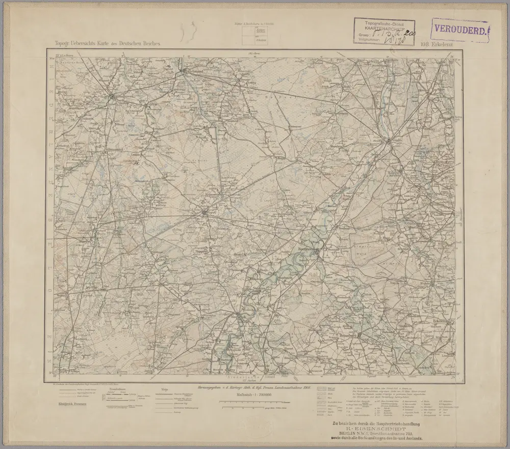
108. Erkelenz, uit: Topographische Uebersichtskarte des Deutschen Reiches / herausgegeben v. d. Kartogr. Abt. d. Königl. Preuß. Landesaufnahme
1899
Königlich Preußische Landesaufnahme. Kartographische Abtheilung
1:200k