Cataloged map
Meßtischblatt 3172 : Fulda, 1907


Full title:Meßtischblatt 3172 : Fulda, 1907
Depicted:1907
Pubdate:1907
Physical Size:20 x 30 cm
Map scale:1:250 000
Meßtischblatt 3172 : Fulda, 1907
1907
1:250k
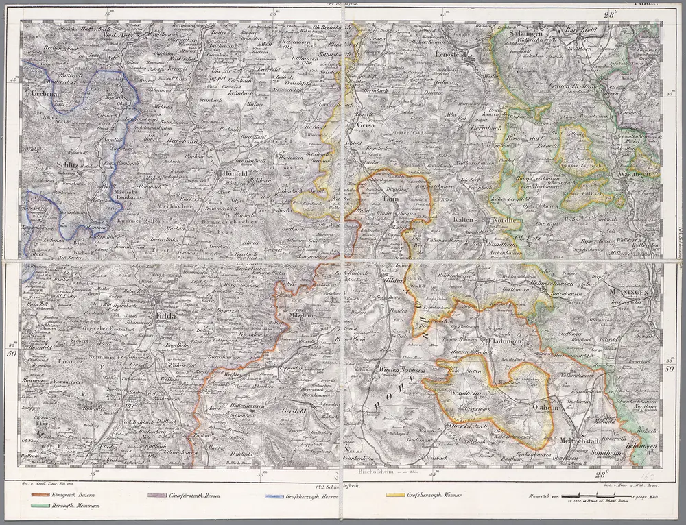
163 Fulda, uit: Topographische Special-Karte von Deutschland (von Central-Europa) / begründet von D.G. Reymann ; [entworfen und gezeichn. von Heinrich Berghaus... [et al.]]
1816
Reymann, Daniel Gottlob; Berghaus, Heinrich
1:200k
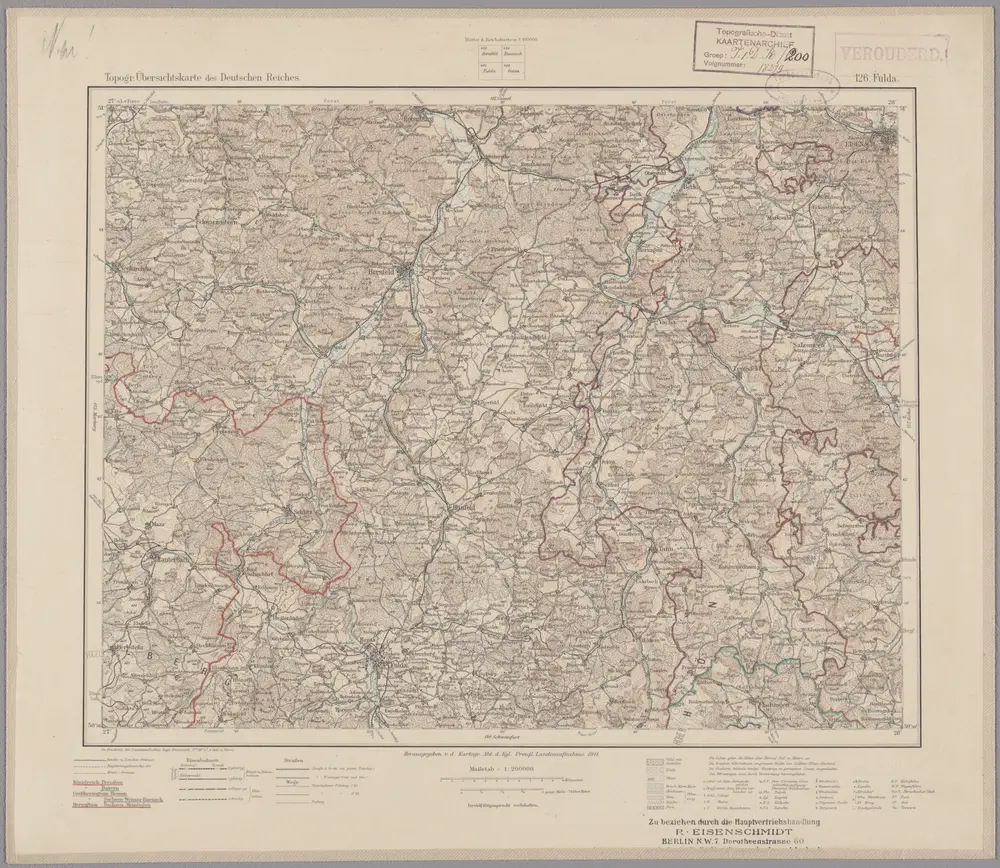
126. Fulda, uit: Topographische Uebersichtskarte des Deutschen Reiches / herausgegeben v. d. Kartogr. Abt. d. Königl. Preuß. Landesaufnahme
1899
Königlich Preußische Landesaufnahme. Kartographische Abtheilung
1:200k
Bvchaviae, siue Fvldensis ditionis typvs
1574
Regerwyl; Ortelius

Neuer Atlas Uber die Gantze Welt, mapa ze strany: [182]
1714
Homann Johann Baptist
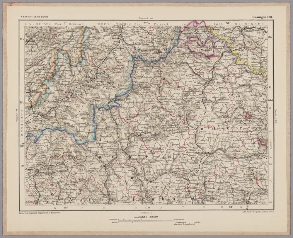
Kissingen 100, uit: [W. Liebenow's Special-Karte von Mittel-Europa]
1870
Johannes Wilhelm Liebenow 1822-1897
1:300k
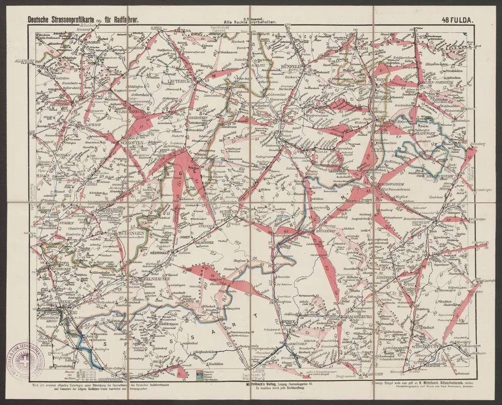
Fulda
1890
R. Mittelbach
1:300k
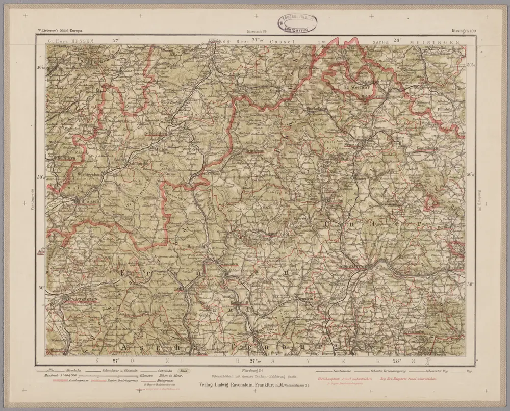
Kissingen 100, uit: Special-Karte von Mittel-Europa / nach amtlichen Quellen bearbeitet von W. Liebenow
1899
Johannes Wilhelm Liebenow 1822-1897
1:300k
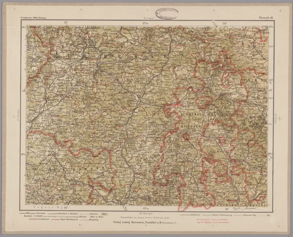
Eisenach 86, uit: Special-Karte von Mittel-Europa / nach amtlichen Quellen bearbeitet von W. Liebenow
1899
Johannes Wilhelm Liebenow 1822-1897
1:300k

Neuer Atlas Uber die Gantze Welt, mapa ze strany: [156]
1714
Homann Johann Baptist