Maps of Poręba

Meßtischblatt 3340 : Habelschwerdt, 1919
1 : 250000 Habelschwerdt. - Aufn. 1882, hrsg. 1884, bericht. 1919. - 1:25000. - [Berlin]: Preuss. Landesaufnahme, 1919. - 1 Kt.
Bärnwald (Baernwald) - c5052-1-001 - Kaiserpflichtexemplar der Landkarten des stabilen Katasters
1 : 2880
Bärnwald (Baernwald) - c5052-1-004 - Kaiserpflichtexemplar der Landkarten des stabilen Katasters
1 : 2880
Bärnwald (Baernwald) - c5052-1-002 - Kaiserpflichtexemplar der Landkarten des stabilen Katasters
1 : 2880
Bärnwald (Baernwald) - c5052-1-003 - Kaiserpflichtexemplar der Landkarten des stabilen Katasters
1 : 2880
Schönwald - c5898-2-001 - Kaiserpflichtexemplar der Landkarten des stabilen Katasters
1 : 2880
Schönwald - c5898-2-002 - Kaiserpflichtexemplar der Landkarten des stabilen Katasters
1 : 2880
Neudorf (Nowawes) - c5235-1-001 - Kaiserpflichtexemplar der Landkarten des stabilen Katasters
1 : 2880
Neudorf (Nowawes) - c5235-1-002 - Kaiserpflichtexemplar der Landkarten des stabilen Katasters
1 : 2880
Neudorf (Nowawes) - c5235-1-003 - Kaiserpflichtexemplar der Landkarten des stabilen Katasters
1 : 2880
Neudorf (Nowawes) - c5235-1-004 - Kaiserpflichtexemplar der Landkarten des stabilen Katasters
1 : 2880
Halbseiten - c4378-1-001 - Kaiserpflichtexemplar der Landkarten des stabilen Katasters
1 : 2880
Schwarzwasser (Černávoda) - c0875-1-001 - Kaiserpflichtexemplar der Landkarten des stabilen Katasters
1 : 2880
Schwarzwasser (Černávoda) - c0875-1-002 - Kaiserpflichtexemplar der Landkarten des stabilen Katasters
1 : 2880
Schwarzwasser (Černávoda) - c0875-1-003 - Kaiserpflichtexemplar der Landkarten des stabilen Katasters
1 : 2880
Schwarzwasser (Černávoda) - c0875-1-005 - Kaiserpflichtexemplar der Landkarten des stabilen Katasters
1 : 2880
Schwarzwasser (Černávoda) - c0875-1-004 - Kaiserpflichtexemplar der Landkarten des stabilen Katasters
1 : 2880
Gradabtheilung 50/51 der Breite 34/35 der Länge
Kořistka, Karel František Edvard
Orlické hory s podhůřím

Orlické hory s podhůřím
1 : 75000 Orlické hory (Česko a Polsko : oblast) Mach, Adolf A. Mach
Orlické hory s podhůřím

Karte des Schulbezirkes Senftenberg
1 : 150000 Žamberk-oblast (Česko) Weiner, J.
Das Adlergebirge
Orlické hory (Česko a Polsko) Deutscher Gebirgsverein für das Adlergebirge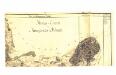


Kunštát a Glatz
1 : 75000 Kladsko (Polsko : oblast) Vojenský zeměpisný ústav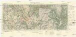
Mittelwalde-Kamnitz
1 : 100000 Międzylesie (Polsko : oblast) Reichsamt für Landesaufnahme-Reichskartenstelle
Žamberk
1 : 75000 Žamberk (Česko : oblast) Vojenský zeměpisný ústav
Žamberk
1 : 75000 Žamberk (Česko : oblast) Vojenský zeměpisný ústav


