Maps of Kravaře

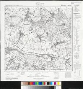
Meßtischblatt 6074 : Dtsch. Krawarn, 1939
1 : 250000 Dtsch. Krawarn. - Aufn. 1882, hrsg. 1883, bericht. 1939. - 1:25000. - [Berlin]: Reichsamt für Landesaufnahme, 1939. - 1 Kt.
Stettin (Stetina) - m3060-1-004 - Kaiserpflichtexemplar der Landkarten des stabilen Katasters
1 : 2880
Stettin (Stetina) - m3060-1-003 - Kaiserpflichtexemplar der Landkarten des stabilen Katasters
1 : 2880
Stettin (Stetina) - m3060-1-001 - Kaiserpflichtexemplar der Landkarten des stabilen Katasters
1 : 2880
Stettin (Stetina) - m3060-1-002 - Kaiserpflichtexemplar der Landkarten des stabilen Katasters
1 : 2880
Ellgoth (Lhota) - m1516-1-001 - Kaiserpflichtexemplar der Landkarten des stabilen Katasters
1 : 2880
Ellgoth (Lhota) - m1516-1-002 - Kaiserpflichtexemplar der Landkarten des stabilen Katasters
1 : 2880
[Kartenblatt]
1 : 25000 Chuchelná (Česko) Reichsamt für Landesaufnahme
III. vojenské mapování 4060/1
1 : 25000
Smolkau (Smoůkowo) - m2796-1-002 - Kaiserpflichtexemplar der Landkarten des stabilen Katasters
1 : 2880
Smolkau (Smoůkowo) - m2796-1-001 - Kaiserpflichtexemplar der Landkarten des stabilen Katasters
1 : 2880
Smolkau (Smoůkowo) - m2796-1-003 - Kaiserpflichtexemplar der Landkarten des stabilen Katasters
1 : 2880
Alt Mokrolasetz (Stare Mokre Lasice) - m1845-1-006 - Kaiserpflichtexemplar der Landkarten des stabilen Katasters
1 : 2880
Alt Mokrolasetz (Stare Mokre Lasice) - m1845-1-001 - Kaiserpflichtexemplar der Landkarten des stabilen Katasters
1 : 2880
Alt Mokrolasetz (Stare Mokre Lasice) - m1845-1-004 - Kaiserpflichtexemplar der Landkarten des stabilen Katasters
1 : 2880
Alt Mokrolasetz (Stare Mokre Lasice) - m1845-1-002 - Kaiserpflichtexemplar der Landkarten des stabilen Katasters
1 : 2880
Alt Mokrolasetz (Stare Mokre Lasice) - m1845-1-003 - Kaiserpflichtexemplar der Landkarten des stabilen Katasters
1 : 2880
Alt Mokrolasetz (Stare Mokre Lasice) - m1845-1-005 - Kaiserpflichtexemplar der Landkarten des stabilen Katasters
1 : 2880
Chabitschau (Chabičowo) - m0951-1-002 - Kaiserpflichtexemplar der Landkarten des stabilen Katasters
1 : 2880
Chabitschau (Chabičowo) - m0951-1-001 - Kaiserpflichtexemplar der Landkarten des stabilen Katasters
1 : 2880
Chabitschau (Chabičowo) - m0951-1-003 - Kaiserpflichtexemplar der Landkarten des stabilen Katasters
1 : 2880
Jlleschowitz (Jllessowick) - m1104-1-002 - Kaiserpflichtexemplar der Landkarten des stabilen Katasters
1 : 2880
Jlleschowitz (Jllessowick) - m1104-1-001 - Kaiserpflichtexemplar der Landkarten des stabilen Katasters
1 : 2880
III. vojenské mapování 4060
1 : 75000
Opava
1 : 75000 Bílovec (Česko : oblast) Vojenský zeměpisný ústav
Opava
1 : 75000 Bílovec (Česko : oblast) Kartografické odd. při Min. nár. obrany
Troppau
1 : 75000 Morava (Česko) Schuberth K. u. k. Militärgeographisches Institut
III. vojenské mapování 4060
1 : 75000
Carte ethnographique de la partie de la Haute-Silésie cedée a l'etat Tchécoslovaque par le traité de Versailles
1 : 125000 Horní Slezsko Kapras, Jan Hocke, Jan Unie