Maps of Weidenthal

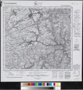
Meßtischblatt 6513 : Hochspeyer, 1942
1 : 250000 Hochspeyer. - Aufn. 1910, hrsg. 1914, bericht. 1938, letzte Na. - 1:25000. - [Wiesbaden]: Hauptvermessungsabteilung XI, 1942. - 1 Kt.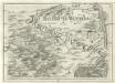
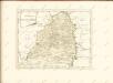
Geographica Provinciarum Sveviae Descriptio =
Mollova mapová sbírka Hurter, Johann Christoph Bodenehr, Johann Georg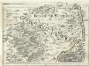
Geographica Provinciarum Sveviae Descriptio =
Mollova mapová sbírka Hurter, Johann Christoph Bodenehr, Gabriel
Atlas zu der geognostischen Beschreibung des Landes, zwischen der untern Saar und dem Rheine
1 : 100000 Südost-Blatt Steininger, Johann Verlag der Lintz'schen Buchhandlung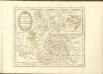

160. Landau, uit: Topographische Uebersichtskarte des Deutschen Reiches / herausgegeben v. d. Kartogr. Abt. d. Königl. Preuß. Landesaufnahme
1 : 200000 titelvariant: Topogr. Übersichtskarte des Deutschen Reiches; Annotatie: Titel boven bladen ook: Topogr. Übersichtskarte des Deutschen Reiches; Annotatie geografische gegevens: Op elk blad twee maatstokken: 10 Kilometer = 5,5 cm; 1 geogr. Meile = 3,6 cm; Legenda onder op elk blad Königlich Preußische Landesaufnahme. Kartographische Abtheilung [S.l : Königlich Preußische Landesaufnahme, Kartographische Abtheilung]
Section Worms, uit: Charte von dem Grossherzogtum Hessen und dem Herzogtum Nassau / trigonometrisch aufgenommen und hrsg. von C.L.P. Eckhardt
1 : 200000 titelvariant: Karte von Hessen und Nassau Eckhardt, C. L. P Darmstadt : Joh. Wilh. Heyer
Partie du Cours du Palatinat du Rhin Levesché de Spire et de Worms les Comté de Spanheim et de Linange levée Sur les lieu
1 : 160000 Mollova mapová sbírka Baillieul, Gaspard Bailleul, Gaspard
Le Cours du Rhein, depuis Spire jusqu'a Mayence
1 : 180000 Mollova mapová sbírka Fer, Nicolas de Fer, Nicolas de
Special Carte des Rheinlaufes von Speier bis Bingen nebst den angraentzenden Gegenden von beiden Ufern bis an die Gebirge
1 : 250000 Bingen (Německo) Dewarat, Peter Verhelst, Aegid Schwan und Götz
Carte Particuliere des Pays qui sont situéz entre le Rhein, la Saare, la Moselle, et la Basse Alsace
1 : 150000 Mollova mapová sbírka Mortier, Pieter Mortier, Pierre
Territorium Seculare Episcopatvs Spirensis una cum terris adiacentibus
1 : 140000 Mollova mapová sbírka Blödtner, Cyriak Homann, Johann Baptista - dědici
Mannheim 113, uit: [W. Liebenow's Special-Karte von Mittel-Europa]
1 : 300000 titelvariant: W. Liebenow's Mittel-Europa; Annotatie: Titel boven de bladen: W. Liebenow's Mittel-Europa Johannes Wilhelm Liebenow 1822-1897 Hannover : Hermann Oppermann

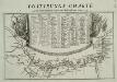
Suevia universa IX. tabulis delineata, 1
1 Blatt : s.n.
Mannheim 113, uit: Special-Karte von Mittel-Europa / nach amtlichen Quellen bearbeitet von W. Liebenow
1 : 300000 titelvariant: W. Liebenow's Mittel-Europa; Annotatie: Titel boven de bladen: W. Liebenow's Mittel-Europa Johannes Wilhelm Liebenow 1822-1897 Frankfurt a. M. : Ludwig Ravenstein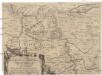
Eigentliche Entwerffung deßn Marquis Spinolae Lägern bey Maintz und Oppenheim
Mohuč (Německo)
Carte Particuliere Des Pays Qui Sont Situéz Entre Le Rhein, La Saare, la Moselle, Et La Basse Alsace [...] [Karte], in: Atlas nouveau, contenant toutes les parties du monde [...], Bd. 1, S. 244.
1 Karte aus Atlas Sanson, Nicolas Jaillot, Alexis Hubert und Mortier, Pieter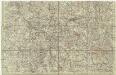
[Lotrinsko a Sársko]
Lotrinsko (Francie) Buna, Wilhelm C.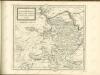

Provinz Starkenburg und Rheinhessen
1 : 250000 Hügel, Adolf Diehl
Die Grafschaft Hanau-Lichtenberg mit dem Departement Nieder-Elsas
1 : 180000 Müller, Johann Jakob
Provinz Starkenburg und Rheinhessen
1 : 250000 Hügel, Adolf Diehl
Die Pfalz oder Rhein - Bayern

Partie Orientale du Palatinat et Eslectorat du Rhein. Les Eveschés de Spire, de Wormes et le Comté de Linange
1 : 260000 Mollova mapová sbírka Sanson, Guillaume Jaillot, Alexis Hubert
Le Duché de Luxembourg divisé en Quartier Walon et Allemand
1 : 140000 Mollova mapová sbírka Jaillot, Alexis-Hubert Jaillot, Alexis Hubert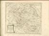

Partie Orientale Du Palatinat et Eslectoriat Du Rhein. Les Eveschés De Spire, De Wormes et Le Comté De Linange. [Karte], in: Atlas nouveau, contenant toutes les parties du monde [...], Bd. 1, S. 184.
1 Karte aus Atlas Sanson, Nicolas Jaillot, Alexis Hubert und Mortier, Pieter