Mapa catalogado
Meßtischblatt 25 : Pfedelbach, 1932


Título completo:Meßtischblatt 25 : Pfedelbach, 1932
Año de ilustración:1932
Fecha de publicación:1932
Tamaño físico:20 x 30 cm
Escala del mapa:1:250 000
Meßtischblatt 25 : Pfedelbach, 1932
1932
1:250k
Meßtischblatt 24 : Willsbach, 1932
1932
1:250k
Tabula geographica sistens territorivm liberæ sacri romani imperii civitatis Svevo=Hallensis
1762
Cnopf
Die Freye Reichsstadt Schwaebisch Hall mit ihrem Gebiethe : Nro. 190
1791
Reilly, Franz Johann Joseph von
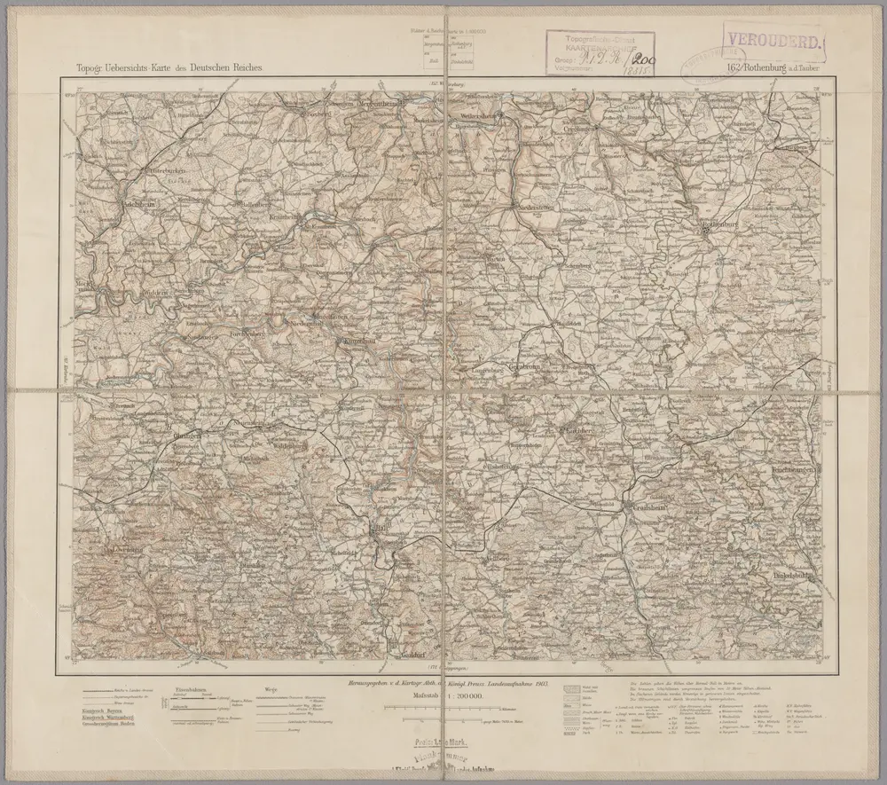
162. Rothenburg a.d. Thauber, uit: Topographische Uebersichtskarte des Deutschen Reiches / herausgegeben v. d. Kartogr. Abt. d. Königl. Preuß. Landesaufnahme
1899
Königlich Preußische Landesaufnahme. Kartographische Abtheilung
1:200k
Die freye Reichsstadt Schwæbisch Hall mit ihrem Gebiethe
1806
Reilly
Suevia universa IX. tabulis delineata, 2
1740
s.n.
Des Herzogthums Würtemberg nordöstliche Aemter mit den freyen Reichsstädten Heilbronn, Wimpfen und Eslingen
1806
Reilly
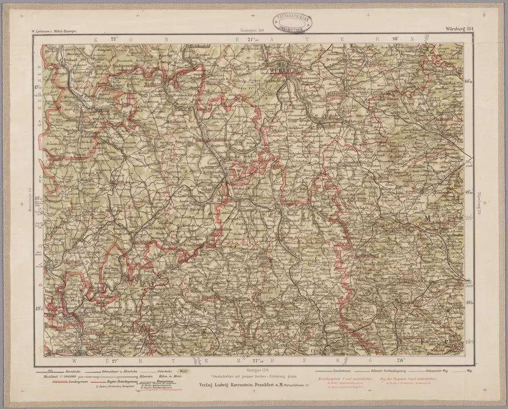
Würzburg 114, uit: Special-Karte von Mittel-Europa / nach amtlichen Quellen bearbeitet von W. Liebenow
1899
Johannes Wilhelm Liebenow 1822-1897
1:300k
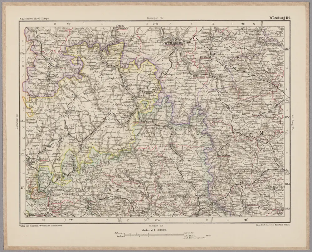
Würzburg 114, uit: [W. Liebenow's Special-Karte von Mittel-Europa]
1870
Johannes Wilhelm Liebenow 1822-1897
1:300k