Cataloged map
Meßtischblatt 3570 : Bitsch, 1883


Full title:Meßtischblatt 3570 : Bitsch, 1883
Depicted:1883
Pubdate:1883
Physical Size:20 x 30 cm
Map scale:1:250 000
Meßtischblatt 3570 : Bitsch, 1883
1883
1:250k
Meßtischblatt 3571 : Stürzelbronn, 1883
1883
1:250k
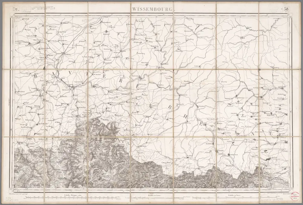
Wissembourg / réd. et gravée au Dépôt général de la Guerre sous la dir. de Pelet
1866
Pelet, Jean Jacques Germaine; Dépôt de la Guerre
1:80k
n/a
1791
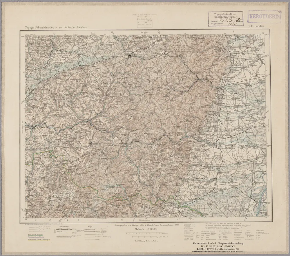
160. Landau, uit: Topographische Uebersichtskarte des Deutschen Reiches / herausgegeben v. d. Kartogr. Abt. d. Königl. Preuß. Landesaufnahme
1899
Königlich Preußische Landesaufnahme. Kartographische Abtheilung
1:200k
[Landau - Wissembourg]
1772
Brunet
Alasatia superior et inferior III. tabulis delineata, 3
1730
s.n.
Alsatia inferior
1595
Lambert Andreae
Alsatia inferior
1600
Specklin; Quad
Le pays Messin, partie du temporel de l'evesché de Metz et partie du balliage allemand, dans le duché de Lorraine
1781
Jaillot