Carte cataloguée
Meßtischblatt [7219] : Weil der Stadt, 1930


Titre complet:Meßtischblatt [7219] : Weil der Stadt, 1930
Année de l'image:1930
Date de publication:1930
Taille physique:20 x 30 cm
Échelle de la carte:1:250 000
Meßtischblatt [7219] : Weil der Stadt, 1930
1930
1:250k
Meßtischblatt 55 = [7119] : Weissach, 1936
1936
1:250k
Meßtischblatt 55 = [7119] : Weissach, 1900
1900
1:250k
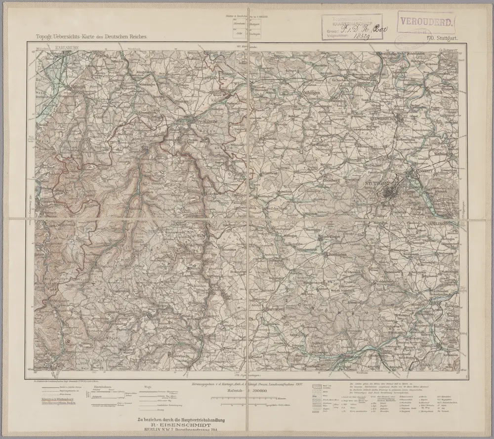
170. Stuttgart, uit: Topographische Uebersichtskarte des Deutschen Reiches / herausgegeben v. d. Kartogr. Abt. d. Königl. Preuß. Landesaufnahme
1899
Königlich Preußische Landesaufnahme. Kartographische Abtheilung
1:200k
Des Herzogthums Würtemberg nordwestliche Aemter mit der freyen Reichsstadt Weil : Nro. 187
1791
Reilly, Franz Johann Joseph von
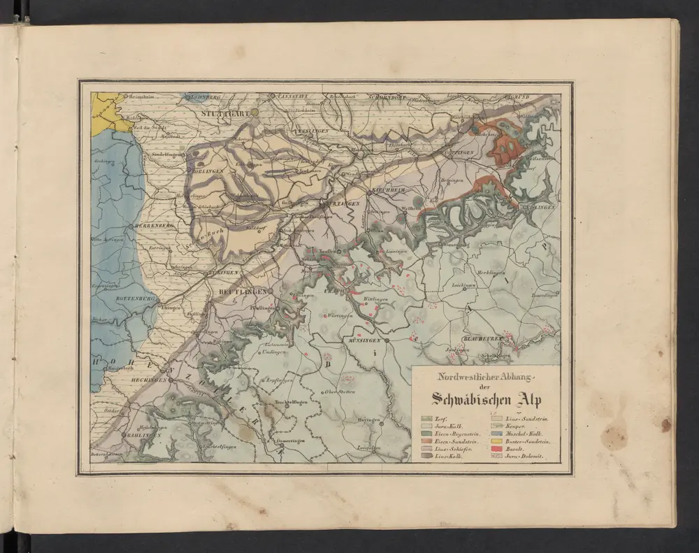
Nordwestlicher Abhang der Schwäbischen Alp
1841
Leonhard, Carl Cäsar von
Die untere Markgrafschaft Baaden oder die Grafschaft Eberstein mit den Durlachischen Landen
1806
Reilly
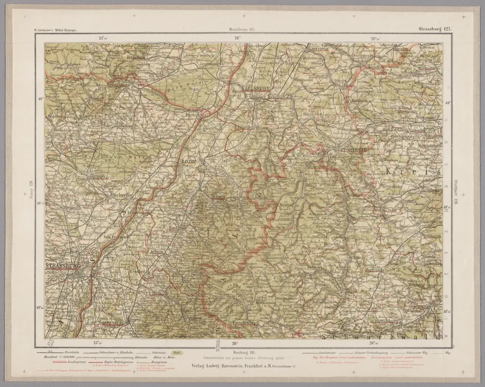
Strassburg 127, uit: Special-Karte von Mittel-Europa / nach amtlichen Quellen bearbeitet von W. Liebenow
1899
Johannes Wilhelm Liebenow 1822-1897
1:300k
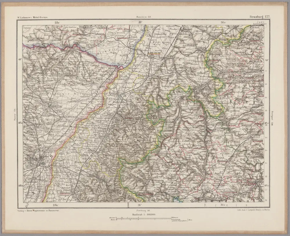
Strasburg 127, uit: [W. Liebenow's Special-Karte von Mittel-Europa]
1870
Johannes Wilhelm Liebenow 1822-1897
1:300k
Des Herzogthums Würtemberg nordwestliche Aemter mit der freyen Reichsstadt Weil
1806
Reilly