Maps of Ortenaukreis

Meßtischblatt [7614] : Zell A/H, 1935
1 : 250000 Zell A/H. - 1876, bericht. 1890, wichtigere Nachtr. 1933, Zwischenaufl .[ca. 1935]. - 1:25000. - Leipzig: Giesecke & Devrient, 1932. - 1 Kt.
Le Flambeau de la Guerre Allumee au Rhin
Mollova mapová sbírka Delisle, Guillaume Schenk, Peter II
Übersichtskarte über die Erzgänge des Kinzigthales
1 : 50000 Chr. Fr. Müller'sche Hofbuchhandlung
Geologische Karte der Umgebungen der Renchbäder
1 : 50000 Sandberger, Fr. Chr. Fr. Müller'sche Hofbuchhandlung
Übersichtskarte über die Erzgänge des Kinzigthales
1 : 8000 Specialkarte 2 Chr. Fr. Müller'sche Hofbuchhandlung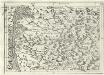
Geographica Provinciarum Sveviae Descriptio =
Mollova mapová sbírka Hurter, Johann Christoph Bodenehr, Johann Georg
Le Theatre de la Guerre Sur le Haut Rhein
1 : 142000 Mollova mapová sbírka Sanson, Guillaume
177. Offenburg, uit: Topographische Uebersichtskarte des Deutschen Reiches / herausgegeben v. d. Kartogr. Abt. d. Königl. Preuß. Landesaufnahme
1 : 200000 titelvariant: Topogr. Übersichtskarte des Deutschen Reiches; Annotatie: Titel boven bladen ook: Topogr. Übersichtskarte des Deutschen Reiches; Annotatie geografische gegevens: Op elk blad twee maatstokken: 10 Kilometer = 5,5 cm; 1 geogr. Meile = 3,6 cm; Legenda onder op elk blad Königlich Preußische Landesaufnahme. Kartographische Abtheilung [S.l : Königlich Preußische Landesaufnahme, Kartographische Abtheilung]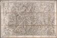
Rottweil
1 : 100000 Annotatie: Linksonder: T-28 [Paris : Depôt de la Guerre]
Argentoratensis Agri Descriptio. [Karte], in: Theatrum orbis terrarum, S. 175.
1 Karte aus Atlas Ortelius, Abraham
Argentoratensis Agri Descriptio. [Karte], in: Theatrum orbis terrarum, S. 267.
1 Karte aus Atlas Ortelius, Abraham Vrients, Jan Baptista
Territorium Argentoratense
1 Karte : Kupferdruck ; 36 x 48 cm Janssonius van Waesbergen; Pitt; Swart apud Janssonio-Waesbergios Mosem Pitt et Stephanum Swart
Territorium Argentoratense
1 Karte : Kupferdruck ; 36 x 48 cm Janssonius; Keere Ioannes Ianssonius excudit
Territorium Argentoriatense. [Karte], in: Novus atlas absolutissimus, Bd. 2, S. 208.
1 Karte aus Atlas Janssonius Offizin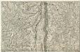
Le Cours du Rhein, depuis Spire jusqu'a Mayence
1 : 180000 Mollova mapová sbírka Fer, Nicolas de Fer, Nicolas de
Geographica Provinciarum Sveviae Descriptio =
Mollova mapová sbírka Hurter, Johann Christoph Bodenehr, Gabriel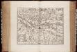
Territorium Argentoratense / apud Janssonio-Waesbergios, Mosem Pitt et Stephanum Swart
1 : 103000 Annotatie: Origineel is Blad 114 in atlas factice; Kaart toont het gebied rondom Straatsburg, deels gelegen in de Elzas en deels in Baden-Württemberg; In rechter bovenhoek: XLIV; Met wapens; Annotatie geografische gegevens: Schaalstok op de kaart: Milliaria Germanica communia; Oost boven Johannes Janssonius van Waesberge -1681?; Moses Pitt ca. 1654-1696; Stephanus Swart [Oxford : printed at the Theatre at Oxford]
[Carte eines Theils des Schwartzwaldes]

Suevia Universa :
1 : 170000 Mollova mapová sbírka Michal, Jacques de Seutter, Matthäus Seutter, Matthäus
Alasatia superior et inferior III. tabulis delineata, 2
1 Blatt : 62 x 59 cm s.n.
Freiburg 141, uit: [W. Liebenow's Special-Karte von Mittel-Europa]
1 : 300000 titelvariant: W. Liebenow's Mittel-Europa; Annotatie: Titel boven de bladen: W. Liebenow's Mittel-Europa Johannes Wilhelm Liebenow 1822-1897 Hannover : Hermann Oppermann
Freiburg 141, uit: Special-Karte von Mittel-Europa / nach amtlichen Quellen bearbeitet von W. Liebenow
1 : 300000 titelvariant: W. Liebenow's Mittel-Europa; Annotatie: Titel boven de bladen: W. Liebenow's Mittel-Europa Johannes Wilhelm Liebenow 1822-1897 Frankfurt a. M. : Ludwig Ravenstein
March. Badensis pars, duc. septentrio Wurtenbergici pars
Bádensko (Německo)
Kriegs-Theatrum.
Mollova mapová sbírka Lidl, Johann Jakob Lidl, Johann Jacob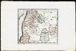
Die obere Markgrafschaft Baden oder die Markgrafschaft Hochberg, Landgrafschaft Sausenberg, und die Herrschaften Röteln und Baadenweiler mit den Herrschaften Hausen und Hohengeroldseck,...
Reilly, Franz Johann Joseph von
Tribocci
1 Karte : Kupferdruck ; 39 x 49 cm Sanson; Robert de Vaugondy; Somer chés le Sr. Robert geog. du roi quai de l'horloge
Accurata delineatio Brisgoviæ
1 Karte : Kupferdruck ; 56 x 48 cm Seutter; Drentwett Matthäus Seutter
Alsatia inferior
1 Karte : Kupferdruck ; 35 x 42 cm Hondius; Mercator Jodocus Hondius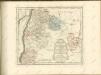

![Meßtischblatt [7614] : Zell A/H, 1935](https://images-2.georeferencer.com/images/iiif/065682651206/full/,300/0/native.jpg)

