Maps of Schelklingen

Meßtischblatt [7624] : Schelklingen, 1912
1 : 250000 Schelklingen. - 1:25000. - Stuttgart, 1912. - 1 Kt.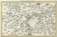
Ulm mit der Gegend auf 1 1/4 Stund
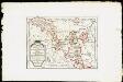
Mollova mapová sbírka Bodenehr, Gabriel Bodenehr, Gabriel
Ehingen, Weissenhorn a okolí]
Mollova mapová sbírka Bodenehr, Gabriel Bodenehr, Gabriel
Geographica Provinciarum Sveviae Descriptio =
Mollova mapová sbírka Hurter, Johann Christoph Bodenehr, Gabriel
Geographica Provinciarum Sveviae Descriptio =
Mollova mapová sbírka Hurter, Johann Christoph Bodenehr, Johann Georg
Nova et accurata Territorii Vlmensis cum Dominio Wainensi Descriptio
1 : 100000 Mollova mapová sbírka Lauterbach, Johann Christoph Homann, Johann Baptista

Nova et accurata territorii Vlmensis cum dominio Wainensi descriptio
1 : 100000 Bádensko-Württembersko (Německo) Lauterbach, Johann Christoph Homann, Johann Baptist Ioh. Baptista Homann
Nova et accurata territorii Vlmensis cum dominio Wainensi descriptio
1 Karte : Kupferdruck ; 47 x 56 cm Lauterbach; Homann Johann Baptist Homann
Nova et accurata territorii Vlmensis cum dominio Wainensi descriptio
1 Karte : Kupferdruck ; 47 x 56 cm Lauterbach; Homann Johann Baptist Homann
179. Ulm, uit: Topographische Uebersichtskarte des Deutschen Reiches / herausgegeben v. d. Kartogr. Abt. d. Königl. Preuß. Landesaufnahme
1 : 200000 titelvariant: Topogr. Übersichtskarte des Deutschen Reiches; Annotatie: Titel boven bladen ook: Topogr. Übersichtskarte des Deutschen Reiches; Annotatie geografische gegevens: Op elk blad twee maatstokken: 10 Kilometer = 5,5 cm; 1 geogr. Meile = 3,6 cm; Legenda onder op elk blad Königlich Preußische Landesaufnahme. Kartographische Abtheilung [S.l : Königlich Preußische Landesaufnahme, Kartographische Abtheilung]
Des Herzogthums Würtemberg ostsüdliche Aemter mit der freyen Reichsstadt Giengen
1 Karte : Kupferdruck ; 23 x 26 cm Reilly F. J. J. von Reilly
Des Herzogthums Würtemberg ostsüdliche Aemter mit der freyen Reichsstadt Giengen : Nro. 189
Reilly, Franz Johann Joseph von
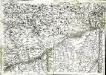
Nordwestlicher Abhang der Schwäbischen Alp
Geologischer Atlas zur Naturgeschichte der Erde Leonhard, Carl Cäsar von E. Schweizerbart'sche Verlagsbuchhandlung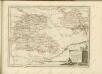
Das Fürstenthum Hohenzollern und die Grafschaft Sigmaringen mit der gefürsteten Abtey Buchau, der Deutschen Ordens Komthurey Alschhausen, der Herrschaft Justingen, den Abteÿen um den Federsee ...
Reilly, Franz Johann Joseph von
Umgegend von Ulm
1 : 200000 Kartographischen Abtheilung konigl Preuss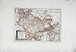
Die freye Reichsstadt Ulm mit ihrem Gebiete
1 Karte : Kupferdruck ; 19 x 27 cm Reilly F. J. J. von Reilly
Suevia Universa :
1 : 170000 Mollova mapová sbírka Michal, Jacques de Seutter, Matthäus Seutter, Matthäus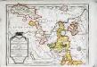
Das Fürstenthum Hohenzollern und die Grafschaft Sigmaringen
1 Karte : Kupferdruck ; 19 x 27 cm Reilly F. J. J. von Reilly
Ulm 142, uit: [W. Liebenow's Special-Karte von Mittel-Europa]
1 : 300000 titelvariant: W. Liebenow's Mittel-Europa; Annotatie: Titel boven de bladen: W. Liebenow's Mittel-Europa Johannes Wilhelm Liebenow 1822-1897 Hannover : Hermann Oppermann
Ulm 142, uit: Special-Karte von Mittel-Europa / nach amtlichen Quellen bearbeitet von W. Liebenow
1 : 300000 titelvariant: W. Liebenow's Mittel-Europa; Annotatie: Titel boven de bladen: W. Liebenow's Mittel-Europa Johannes Wilhelm Liebenow 1822-1897 Frankfurt a. M. : Ludwig Ravenstein
Suevia universa IX. tabulis delineata, 5
1 Blatt : s.n.
Le Theatre de Bellone :
Mollova mapová sbírka Schenk, Pieter Braakman, Adriaan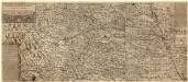
Ilerae Amnis ac Vtrinqve adiacentis Alemanniae Geographica descriptio
1 : 120000 Mollova mapová sbírka Hurter, Johann Christoph Custos, Raphael Hurter, Christoph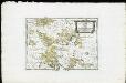
Die Landgrafschaft Nellenburg die Landvogtey Altorf die Grafschaft Hohenberg und die kleinern durch das östreichische Schwaben zerstreuten Besitzungen mit der Stadt Kostanz und den vier Donaustaedten : Nro. 153
Reilly, Franz Johann Joseph von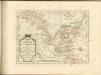
Geographica provinciarum Sueviae descriptio, 4
4 Blätter : Johann Georg Bodenehr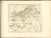

![Meßtischblatt [7624] : Schelklingen, 1912](https://images-2.georeferencer.com/images/iiif/366531837840/full/,300/0/native.jpg)

