Maps of Zähringen

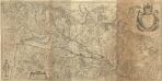
Meßtischblatt [7913] : Waldkirch, 1878
1 : 250000 Waldkirch. - 1:25000. - Leipzig: Giesecke & Devrient, 1878. - 1 Kt.
Geologische Karte der Umgebungen der Bäder Glotterthal und Suggenthal
1 : 50000 Schill, Julius Chr. Fr. Müller'sche Hofbuchhandlung
Friburg, in Brisgouw, aan den Treisamtusschen Brisack en het Swarte Wald
Fribourg (Švýcarsko) Schenk, Pieter P. Schenk
Nieuwe en naukeurige aftekening van Freiburg met alle zyne sterktens en omleggende landen etc
1 Karte : Kupferdruck ; 43 x 55 cm Ottens; Ottens chez R. et I. Ottens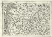
Geographica Provinciarum Sveviae Descriptio =
Mollova mapová sbírka Hurter, Johann Christoph Bodenehr, Johann Georg
177. Offenburg, uit: Topographische Uebersichtskarte des Deutschen Reiches / herausgegeben v. d. Kartogr. Abt. d. Königl. Preuß. Landesaufnahme
1 : 200000 titelvariant: Topogr. Übersichtskarte des Deutschen Reiches; Annotatie: Titel boven bladen ook: Topogr. Übersichtskarte des Deutschen Reiches; Annotatie geografische gegevens: Op elk blad twee maatstokken: 10 Kilometer = 5,5 cm; 1 geogr. Meile = 3,6 cm; Legenda onder op elk blad Königlich Preußische Landesaufnahme. Kartographische Abtheilung [S.l : Königlich Preußische Landesaufnahme, Kartographische Abtheilung]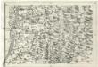
Geographica Provinciarum Sveviae Descriptio =
Mollova mapová sbírka Hurter, Johann Christoph Bodenehr, Johann Georg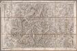
Rottweil
1 : 100000 Annotatie: Linksonder: T-28 [Paris : Depôt de la Guerre]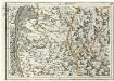
Geographica Provinciarum Sveviae Descriptio =
Mollova mapová sbírka Hurter, Johann Christoph Bodenehr, Gabriel
Alasatia superior et inferior III. tabulis delineata, 2
1 Blatt : 62 x 59 cm s.n.
Fernere Erweiterung unserer weiteren Kriegs Progressen von den 11ten Aug: biß 12ten Octob:
Mollova mapová sbírka Lidl, Johann Jakob Lidl, Johann Jacob
Freiburg
1 : 200000 Herder, Bartholomew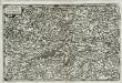
Alsatia svperior
1 Karte : Kupferdruck ; 14 x 22 cm Lambert Andreae
Freiburg 141, uit: [W. Liebenow's Special-Karte von Mittel-Europa]
1 : 300000 titelvariant: W. Liebenow's Mittel-Europa; Annotatie: Titel boven de bladen: W. Liebenow's Mittel-Europa Johannes Wilhelm Liebenow 1822-1897 Hannover : Hermann Oppermann
Freiburg 141, uit: Special-Karte von Mittel-Europa / nach amtlichen Quellen bearbeitet von W. Liebenow
1 : 300000 titelvariant: W. Liebenow's Mittel-Europa; Annotatie: Titel boven de bladen: W. Liebenow's Mittel-Europa Johannes Wilhelm Liebenow 1822-1897 Frankfurt a. M. : Ludwig Ravenstein
Sequani Latobrigi
1 Karte : Kupferdruck ; 40 x 43 cm Sanson; Robert de Vaugondy; Laleman chés le Sr. Robert geog. du roi quai de l'horloge du Palais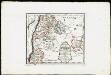
Die obere Markgrafschaft Baden oder die Markgrafschaft Hochberg, Landgrafschaft Sausenberg, und die Herrschaften Röteln und Baadenweiler mit den Herrschaften Hausen und Hohengeroldseck,...
Reilly, Franz Johann Joseph von
Sequani Latobrigi
1 Karte : Kupferdruck ; 40 x 43 cm Sanson; Robert de Vaugondy; Laleman chés le Sr. Robert geog. du roi quai de l'horloge du Palais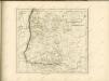

Alsatia superior cu[m] Suntgoa et Brisgoia
1 Karte : Kupferdruck ; 17 x 24 cm Mercator Cloppenburgh
Provincia Brisgoia avst. ant
1 Karte : Kupferdruck ; 57 x 47 cm Homann Johann Baptist Homann
Accurata delineatio Brisgoviæ
1 Karte : Kupferdruck ; 56 x 48 cm Seutter; Drentwett Matthäus Seutter
Part Septentr. de l'Evesché de Basle et Partie de l'Eveché de Constance. Haute Alsace, Sungow, Brisgow &c.
1 : 240000 Mollova mapová sbírka Sanson, Nicolas Lalleman, N. Sanson, Nicolas
Alsatia superior cu[m] Suntgoia [et] Brisgoia
1 Karte : Kupferdruck ; 34 x 46 cm Mercator s.n.
La Haute Alsace, le Suntgow et le Brisgow
1 Blatt : 52 x 38 cm de Fer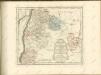
Alsatia Landgraviatus, cum Svntgoia et Brisgoia
1 : 250000 Mollova mapová sbírka Mercator, Gerhard Blaeu, Joan I.
Ganz neue Vorstellung des Rhein_Stroms von Basel bis Coblenz...

Die obere Markgrafschaft Baaden oder die Markgrafschaft Hochberg
1 Karte : Kupferdruck ; 21 x 24 cm Reilly F. J. J. von Reilly
![Meßtischblatt [7913] : Waldkirch, 1878](https://images-2.georeferencer.com/images/iiif/349437840596/full/,300/0/native.jpg)

