Maps of Bnei Shimon Regional Council

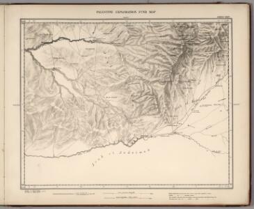
Sheet XXIV. Palestine Exploration Map.
1 : 63360 Kitchener, H.R. (Horatio Herbert)
(Sheet 3). Western Palestine Natural Drainage and the Mountain Ranges.
1 : 168960 Kitchener, H.R. (Horatio Herbert)
Palestine campaign (1921)
Palestine campaign: Situation at 1800 on 1st Nov. 1917 (24 hours after the capture of Beersheba), GSGS 2965. Great Britain. General Staff. Geographical Section. [London] : [GSGS, War Office]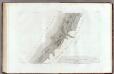
43 Gaza.
1 : 100000 Jacotin, Pierre, 1765-1827
Palestýna
1 : 566000 Palestina
Terra Sancta, sive promissionis, olim Palestina
1 : 960000 Izrael Wit, Frederick de per Fredericum de Wit
Cesta Israelitů z Egypta a cesty sv. Pavla

Palaestina
1 : 170000 Palestina
Palestine or Canaan
1 : 1
Carte géologique du Liban
1 : 200000 Libanon Zumoffen, G. Barrere, Henry l'Institut Cartographique
Palestine with the Hauran
Jeruzalém Hughes, W. Edward Stanford
Kaart van het Heilige Land ten tijde van Josua en de Regteren
1 : 1100000 S.I. Mulder del. steend. v. C. W. Mieling [Leyden] : D. du Mortier & Fil. excud.

Palestina seu Terra Sancta. (1826)
1 : 1090000 Tanner, Henry S.
Ancient Palestine.
1 : 990000 Teesdale, Henry
Palestina čili Kanaan
Palestina Fried, Franz Luther, Th. nákladem Spolku Komenského
Regio Canaan seu Terra Promissionis, postea Iudaea vel Palaestina nominata, hodie Terra Sancta vocata
1 : 3000000 Kanaán Seutter, Matthäus Rogg, Gottfried per Matth. Seutter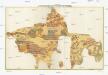
The Madaba Map
Jeruzalém Survey of Israel
Karte vom Heil. Lande
1 : 1400000 Izrael
Palestine.
1 : 1000000 Colton, G.W.
Palestine.
1 : 1130000 Tanner, Henry S.
Wegekarte von Palästina
1 : 800000 Palestina Preußische Landesaufnahme
Palestine.
1 : 1000000 Finley, Anthony
[Karte von Palästina]
1 : 500000 Palestina Leway, G.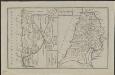
Schul-Atlas für die alte Erdbeschreibung : zur allgemeinen Schul-encyclopädie gehörig
J. H. Campe Zusammensetzung und Zeichnung von [...] Dufour, unter Leitung von Heusinger ; gestochen von Frentzel. Braunschweig : Schulbuchhandlung
Modern Palestine.
1 : 1077120 Tallis, J. & F.
Ancient Palestine.
1 : 1077120 Tallis, J. & F.
Palestine, Jerusalem.
1 : 970000 Mitchell, Samuel Augustus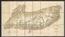
Terra Sancta quae in Sacris Terra Promissionis ol. Palestina [Karte], in: Gerardi Mercatoris Atlas, sive, Cosmographicae meditationes de fabrica mundi et fabricati figura, S. 517.
1 Karte aus Atlas Mercator, Gerhard Montanus, Petrus