Maps of Stanislaus County

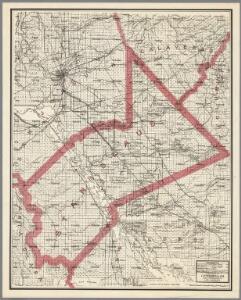
Weber's Map of Stanislaus County, California
1 : 190080 Punnett Brothers
San Jose
1 : 250000
San Jose
1 : 250000
San Jose
1 : 250000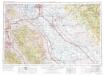
San Jose
1 : 250000
San Jose
1 : 250000
San Jose
1 : 250000
San Jose
1 : 250000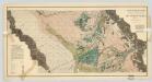
Sheet No. 3, South-central Portion, Irrigation Map of The San Joaquin Valley, California.
1 : 190000 California State Engineering Department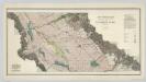
Sheet No. 2, North-central Portion, Irrigation Map of the San Joaquin Valley, California.
1 : 190000 California State Engineering Department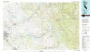
Oakdale
1 : 100000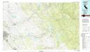
Oakdale
1 : 100000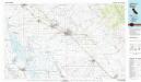
Merced
1 : 100000
Turlock
1 : 62500
Atwater
1 : 62500
Orestimba
1 : 62500
Orestimba
1 : 62500
Orestimba
1 : 62500
Modesto West
1 : 62500
Modesto East
1 : 62500
Carbona
1 : 62500
Stockton
1 : 62500
Manteca
1 : 62500
Manteca
1 : 62500
Farmington
1 : 62500
Copperopolis
1 : 62500
Copperopolis
1 : 62500
Copperopolis
1 : 62500
Howard Ranch
1 : 24000
Mississippi Creek
1 : 24000
Sandy Mush
1 : 24000
Turner Ranch
1 : 24000
Turner Ranch
1 : 24000
San Luis Ranch
1 : 24000
Turner Ranch
1 : 24000
San Luis Ranch
1 : 24000
Ingomar
1 : 24000
Ingomar
1 : 24000
El Nido
1 : 24000
El Nido
1 : 24000
Mississippi Creek
1 : 24000
Mississippi Creek
1 : 24000
Mississippi Creek
1 : 24000
Mississippi Creek
1 : 24000
Mustang Peak
1 : 24000
Mustang Peak
1 : 24000
Mustang Peak
1 : 24000
Mustang Peak
1 : 24000
Mustang Peak
1 : 24000
Crevison Peak
1 : 24000
Crevison Peak
1 : 24000
Crevison Peak
1 : 24000
Crevison Peak
1 : 24000
Crevison Peak
1 : 24000
Crevison Peak
1 : 24000
Howard Ranch
1 : 24000
Howard Ranch
1 : 24000
Howard Ranch
1 : 24000
Howard Ranch
1 : 24000
Turner Ranch
1 : 24000
Sandy Mush
1 : 24000
Lingard
1 : 24000
Ingomar
1 : 24000
San Luis Ranch
1 : 24000
Sandy Mush
1 : 24000
Howard Ranch
1 : 31680
Howard Ranch
1 : 31680
Ingomar
1 : 31680
Ingomar
1 : 31680
San Luis Ranch
1 : 31680
San Luis Ranch
1 : 31680
Turner Ranch
1 : 31680
Turner Ranch
1 : 31680
Sandy Mush
1 : 31680