Project
Community
News
My maps
Cataloged map
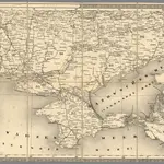
14. Cherson
Full title:
14. Cherson
Publisher:
Generalquartiermeisterstab
Physical Size:
20 x 30 cm
Map scale:
1:1 400 000
History