Maps of United States

Composite: United States of Nth. America.
1 : 1584000 Tardieu, P.F.
Amplissimae regionis Mississipi seu provinciae Ludovicianae â R.P. Ludovico Hennepin Francisc. Miss. in America septentrionali anno 1687
1 : 6500000
Amplissimae regionis Mississipi seu Provinciae Ludovicianae â R.P. Ludovico Hennepin Francisc Miss in America Septentrionali anno 1687
1 : 1
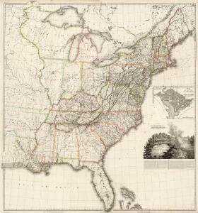
A map of the United States, from the latest surveys.
1 : 4822000 Tuttle, Joseph Willard, 1813-1888
United States.
1 : 1900800 Lay, Amos
Map of the United States / Euphemia Fenno.
from Whole Euphemia Fenno,
Amplissimae regionis Mississipi seu Provinciae Ludovicianae â R. P. Ludovico Hennepin francisc miss. in America septentrionali anno 1687 detectae, nunc Gallorum coloniis et actionum negotiis toto orbe celeberrimae, nova tabula
1 : 6350000 Mississippi, řeka-oblast Homann, Johann Baptist a Io. Bapt. Homanno
Watson's New County and Railroad Map of the United States.
1 : 2154240 Watson, Gaylord
Etats-Unis d'Amerique.
1 : 8000000 Buchon, J. A. C.; Carey, H. C.; Lea, I.
United States of America.
1 : 7900000 Lavoisne, M.
United States of America.
1 : 7900000 Lavoisne, M.
United States of America / compiled from the latest & best authorities by John Melish; engraved by Saml. Harrison.
from Charts and maps John Melish; Saml. Harrison,
Railroad Map Of The United States And Of The Dominion Of Canada.
1 : 2280960 Watson, Gaylord
Map of the United States of America.
from Whole s.n.: [Philadelphia?],
United States.
1 : 8700000 Lizars, Daniel
United States of North America.
1 : 7603200 Maclure, William
United States.
1 : 5400000 W. & A.K. Johnston Limited
Map of the United States, constructed from the latest authorities
1 : 7000000
Mitchell's map of the United States : showing the principal travelling turnpike and common roads, on which are given the distances in miles from one place to another, also the courses of the canals & rail roads throughout the country, carefully compi
from Whole
The eagle map of the United States
1 : 7500000
United States.
1 : 5400000 W. & A.K. Johnston Limited
United States.
1 : 8000000 Teesdale, Henry
Map Of The United States Of North America.
1 : 2154240 Vance, David H.
New Map of the United States. (Proposal to publish.)
Vance, David H.
United States / by David H. Burr; engraved by S. Stiles & Co., N. York.
from Whole David H. Burr; S. Stiles & Co.,
Map of the United States and Canada : shewing Captn. Hall's route through those countries in 1827 & 1828 / engraved on steel by W.H. Lizars.
from Parts
United States.
1 : 5400000 W. & A.K. Johnston Limited
A new and correct map of the United States ... Upper & Lower Canada ... &c
1 : 4100000 Lewis, Samuel
The United States of America, showing the boundaries fixed in 1782, five years before the ratification of the Constitution : from a contemporary copy of Benjamin Franklin's red-line map identified in Spain by the Library of Congress at Washington.
1 : 6860480 Facsimile of map published in Paris by Le Rouge and dated 1777. Relief shown pictorially. Inset letters of Aranda and Franklin printed in facsimile reflect the official use of the map in establishing United States boundaries. "Reprinted 1838 by U.S. Geological Survey." Includes text and inset: Nouvelle carte de la Baye dHudson et de Labrador selon las dernieres cartes levées sur les lieux. "This map is one of a series of similar colored maps, depicting the 13 original states from New Hampshire to Georgia at the time of the formation of the Constitution." John, Mitchel, 1711-1768 Washington, D.C. : United States Constitution Sesquicentennial Commission, [Washington, D.C.] : U.S. Geological Survey