Maps of Charlevoix County

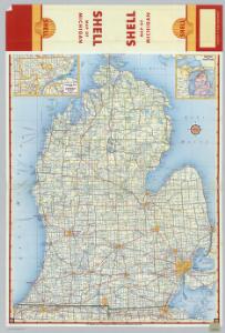
Shell Highway Map of Michigan (southern portion).
1 : 887040 Shell Oil Company
AutoTrails Map, Southern Peninsula of Michigan, Northern Indiana, Northwestern Ohio.
1 : 791000 Rand McNally and Company
Michigan Southern Peninsula.
1 : 760000 Rand McNally and Company
Michigan.
1 : 1500000 Colton, G.W.
Michigan.
1 : 1500000 Colton, G.W.
Michigan.
1 : 1400000 Colton, G.W.
Iowa.
1 : 1267200 Gray, Ormando Willis
Michigan.
1 : 1305000 Gray, Ormando Willis
Michigan.
1 : 1330000 Colton, G.W.
Michigan.
1 : 950000 Colton, G.W.
Michigan.
1 : 1330560 Colton, G.W.
Michigan.
1 : 1500000 Rand McNally and Company
Michigan, Southern Peninsula.
1 : 760000 Rand McNally and Company
Michigan (Southern Part).
1 : 1314000 Hammond, C.S.
Michigan (southern).
1 : 1500000 Colton, G.W.
Michigan showing contour lines.
1 : 1300000 Winchell, Alexander, 1824-1891
Michigan.
Rand McNally and Company
Michigan.
1 : 2100000 Rand McNally and Company
Michigan.
1 : 2000000 Tanner, Henry S.
Southern Michigan.
1 : 780000 Rand McNally and Company
Michigan.
1 : 2154240 Burr, David H., 1803-1875
Michigan.
1 : 2050000 Greenleaf, Jeremiah
Michigan.
1 : 2027520 Greenleaf, Jeremiah
Map of the state of Michigan and the surrounding country : exhibiting the sections and the latest surveys
1 : 780000 This map shows townships, villages, Indian villages, railroads, roads, mills, prairies, swamps, and canals. An inset map shows a plat of the copper district on Lake Superior. The map reads: "Note: Michigan is bounded west by Lake Michigan, Menomonie River of Green Bay, and Montreal River of Lake Superior." Farmer, John Farmer, John
Schonberg's Map of Michigan.
1 : 1900000 Schonberg & Co.
A map of the surveyed part of Michigan / by John Farmer ; engraved by S. Stiles & Co.
1 : 450000 John Farmer 1795-1859; S. Stiles & Co., New York, N.Y. New York, N.Y. : J.H. Colton
Grand Rapids
1 : 250000
Grand Rapids
1 : 250000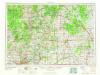
Midland
1 : 250000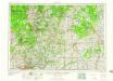
Midland
1 : 250000
Midland
1 : 250000
Midland
1 : 250000