Maps of Massachusetts
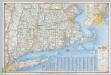
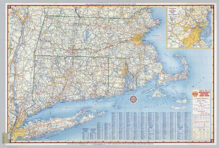
Shell Highway Map of Massachusetts, Connecticut, Rhode Island.
1 : 570240 Shell Oil Company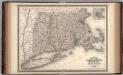
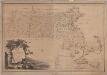
Massachusetts, Connecticut, and Rhode Island.
1 : 660000 Johnson, A.J.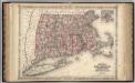
Massachusetts, Connecticut, And Rhode Island.
1 : 570240 Johnson, A.J.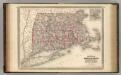
Massachusetts, Connecticut, and Rhode Island.
1 : 660000 Johnson, A.J.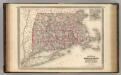
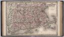
Massachusetts, Connecticut, and Rhode Island.
1 : 660000 Johnson, A.J.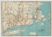
Map of the railroads of Connecticut : to accompany the report of the railroad commissioners
1 : 383000 Dodd Lithographic Co.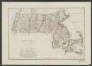
Massachusetts
1 : 490000 Sotzmann, D. F Bey Carl Ernst Bohn
Massachusetts, Connecticut, Rhode Island.
1 : 688000 Finley, Anthony
County map of Massachusetts, Connecticut, and Rhode Island.
from New general atlas.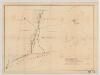
[Map of railroad lines from New York to Springfield, Mass.]
J.H. Bufford & Co Bufford & Co. Lith.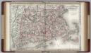
Massachusetts, Connecticut and Rhode Island.
1 : 550000 Colton, G.W.
New England and New York in 1697

To the honourable Walter Younge, barronet, one of the commissioners for his majestie's collonis : this description of New England in America is most humbly dedicated & presented by your hombl., faithfull & obedient servt
1 : 2200000 Hacke, William
A map of the most inhabited part of New England containing the provinces of Massachusets Bay and New Hampshire with the colonies of Connecticut and Rhode Island divided into counties and townships the w[h]ole composed from actual surveys ...

A map of the most inhabited part of New England, containing the provinces of Massachusets Bay and New Hampshire, with the colonies of Connecticut and Rhode Island, divided into counties and townships, the whole composed from actual surveys ...

Massachusetts, Rhode Island, and Connecticut.
1 : 1006000 Schonberg & Co.
Railroad Map Featuring Many Northeastern States Rhode Island Connecticut Massachusetts
1 : 2000
An accurate map of the Commonwealth of Massachusetts exclusive of the District of Maine : compiled pursuant to an act of the General Court from actual surveys of the several towns &c. taken by their order, exhibiting the boundary lines of the Commonwealth, the counties and towns, the principal roads, rivers, mountains, mines, islands, rocks, shoals, channels, lakes, ponds, falls, mills, manufactures & public buildings, with the true latitudes & longitudes, &c : Eastern sheet
1 : 281560 Carleton, Osgood, 1742-1816 Published and sold by O. Carleton and I. Norman
An accurate map of the Commonwealth of Massachusetts exclusive of the District of Maine : compiled pursuant to an act of the General Court from actual surveys of the several towns &c. taken by their order, exhibiting the boundary lines of the Commonwealth, the counties and towns, the principal roads, rivers, mountains, mines, islands, rocks, shoals, channels, lakes, ponds, falls, mills, manufactures & public buildings, with the true latitudes & longitudes, &c : Western sheet
1 : 281560 Carleton, Osgood, 1742-1816 Published and sold by O. Carleton and I. Norman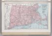
Massachusetts, Connecticut, and Rhode Island.
1 : 759000 Hammond, C.S.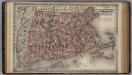
Massachusetts, Connecticut and Rhode Island.
1 : 550000 Colton, G.W.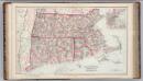
Massachusetts, Rhode Island, and Connecticut.
1 : 570000 Gray, Frank A.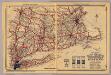
Mass., Conn., R.I.
1 : 910000 Rand McNally and Company
Map of Massachusetts, Rhode-Island & Connecticut : compiled from the latest authorities
1 : 442000 Wilcox, A. F A.F. Wilcox & Co. ; Light & Stearns ; C. Shepard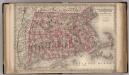
Massachusetts, Connecticut, and Rhode Island.
1 : 850000 Colton, G.W.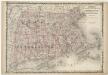
Johnson's Massachusetts Connecticut and Rhode Island
Massachusetts, Connecticut and Rhode Island.
1 : 550000 Colton, G.W.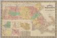
New map of Massachusetts : compiled from the latest and best authorities and corrected by permission from the survey ordered by the legislation in 1830, carefully revised and additions made in 1841
1 : 422400 Nathl. Dearborn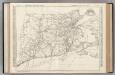
Connecticut, Massachusetts, and Rhode Island.
Rand McNally and Company