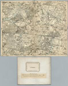
Maps of Nennhausen

267. Rathenow.
1 : 100000 Reichsamt fur Landesaufnahme
Composite: 267. Rathenow.
1 : 100000 Reichsamt fur Landesaufnahme
Meßtischblatt 3441 : Garlitz, 1942
1 : 250000 Garlitz. - Aufn. 1880, hrsg. 1882, bericht. 1940. - 1:25000. - [Berlin]: Reichsamt für Landesaufnahme, 1942. - 1 Kt.
Meßtischblatt 3341 : Haage, 1942
1 : 250000 Haage. - Aufn. 1880, hrsg. 1882, bericht. 1940. - 1:25000. - [Berlin]: Reichsamt für Landesaufnahme, 1942. - 1 Kt.
Meßtischblatt 1831, neue Nr. 3440 : Bamme, 1934
1 : 250000 Bamme. - Hrsg. 1882, einz. Nachtr. 1922, gedr. [19]34. - 1:25000. - [Berlin]: Reichsamt für Landesaufnahme, 1934. - 1 Kt.
Meßtischblatt 1759 : Rathenow, 1928
1 : 250000 Rathenow. - Aufn. 1880, einz. Nachtr. 1928. - 1:25000. - [Berlin]: Reichsamt für Landesaufnahme, 1928. - 1 Kt.
Meßtischblatt 1759 : Rathenow, 1882
1 : 250000 Rathenow. - Aufn. 1880. - 1:25000. - [Berlin]: Kgl. Preuss. Landesaufnahme, 1882. - 1 Kt.
Meßtischblatt 3442 : Tremmen, 1882
1 : 250000 Tremmen. - Aufn. 1880. - 1:25000. - [Berlin]: Reichsamt für Landesaufnahme, 1882. - 1 Kt.
Meßtischblatt 3342 : Ribbeck, 1943
1 : 250000 Ribbeck. - Hrsg. 1882, bericht. 1940, Ausg. 1943. - 1:25000. - [Berlin]: Reichsamt für Landesaufnahme, 1943. - 1 Kt.
Meßtischblatt 3241 : Friesack, 1942
1 : 250000 Friesack. - Hrsg. 1882, ber. 1940, Ausg. 1942. - 1:25000. - [Berlin]: Reichsamt für Landesaufnahme, 1942. - 1 Kt.
Meßtischblatt 1688 : Friesack, 1882
1 : 250000 Friesack. - Aufn. 1880. - 1:25000. - [Berlin]: Reichsamt für Landesaufnahme, 1882. - 1 Kt.
Meßtischblatt 1687 : Rhinow, 1932
1 : 250000 Rhinow. - Hrsg. 1882. - 1:25000. - [Berlin]: Reichsamt für Landesaufnahme, 1932. - 1 Kt.
76. Charlottenburg, uit: Topographische Uebersichtskarte des Deutschen Reiches / herausgegeben v. d. Kartogr. Abt. d. Königl. Preuß. Landesaufnahme
1 : 200000 titelvariant: Topogr. Übersichtskarte des Deutschen Reiches; Annotatie: Titel boven bladen ook: Topogr. Übersichtskarte des Deutschen Reiches; Annotatie geografische gegevens: Op elk blad twee maatstokken: 10 Kilometer = 5,5 cm; 1 geogr. Meile = 3,6 cm; Legenda onder op elk blad Königlich Preußische Landesaufnahme. Kartographische Abtheilung [S.l : Königlich Preußische Landesaufnahme, Kartographische Abtheilung]

Composite: 292. Brandenburg a. d. Havel
1 : 100000 Reichsamt fur Landesaufnahme
Meßtischblatt 1689 : Brunne, 1882
1 : 250000 Brunne. - Aufn. 1880. - 1:25000. - [Berlin]: Reichsamt für Landesaufnahme, 1882. - 1 Kt.
Meßtischblatt 1903 : Brandenburg an der Havel, 1932
1 : 250000 Brandenburg an der Havel. - Hrsg. 1882, einz. Nachtr. 1932. - 1:25000. - [Berlin]: Reichsamt für Landesaufnahme, 1932. - 1 Kt.
Meßtischblatt 1903 : Brandenburg an der Havel, 1922
1 : 250000 Brandenburg an der Havel. - Aufn. 1880, Nachtr. 1922. - 1:25000. - [Berlin]: Reichsamt für Landesaufnahme, 1922. - 1 Kt.
Meßtischblatt 3540 : Plaue, 1942
1 : 250000 Plaue. - Aufn. 1880, hrsg. 1882 [letzte Nachtr. 1925], bericht. 1940. - 1:25000. - [Berlin]: Reichsamt für Landesaufnahme, 1942. - 1 Kt.
Meßtischblatt 3542 : Gr. Kreutz, 1943
1 : 250000 Gr. Kreutz. - Aufn. 1880, hrsg. 1882, bericht. 1941. - 1:25000. - [Berlin]: Reichsamt für Landesaufnahme, 1943. - 1 Kt.
MAGDEBVRGENSIS | ARCHIEPISCOPATVS.
Amstelædami | J. Blaeu excudebat.
MARCH. BRANDENBURGICI | PARS, quæ | MARCHIA MEDIA | Vulgo MITTELMARCK audit.
Amstelædami, | Excud. Joannes Blaeu.
Geographische Charte des Hertzogthums und Halle Nebst etlichen angräntzende Orthen und Fürstenthume Gestochen
1 : 310000 Mollova mapová sbírka Schenk, Pieter Schenk, Peter II
Ducatus Magdeburgensis et Halensis cum finitimis Delineatio geographica curante
1 : 320000 Mollova mapová sbírka Seutter, Matthäus Lotter, Tobias Conrad Seutter, Matthäus
Das Hertzogthum Magdeburg mit seinen abgetheilten Provintzien
1 : 930000 Mollova mapová sbírka Weigel, Johann Christoph Weigel, Johann Christoph
[Berlin und Umgebung; Die Donau von Paussau bis Wien mit Umgebung]
Stieler's Hand-Atlas Stieler, Adolf bei Justus Perthes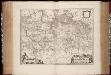
March. Brandenburgici pars, quae Marchia Media vulgo Mittelmarck audit
1 : 400000 Annotatie: Origineel is Blad 91 in atlas factice; Annotatie geografische gegevens: Met schaalstok: Milliaria Germanica Joan Blaeu 1597/98-1673 Amstelaedami : excud. Joannes Blaeu
Berlin - Leipzig - Wittenberge