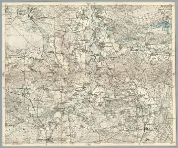
Maps of Samtgemeinde Schwarmstedt

Composite: 261. Neustadt a. Rubenberge.
1 : 100000 Reichsamt fur Landesaufnahme
261. Neustadt a. Rubenberge.
1 : 100000 Reichsamt fur Landesaufnahme
Meßtischblatt 1742 : Schwarmstedt, 1898
1 : 250000 Schwarmstedt. - Aufn. 1897, hrsg. 1898. - 1:25000. - [Berlin]: Kgl. Preuss. Landesaufnahme, 1898. - 1 Kt.
Meßtischblatt 1743 : Thören, 1899
1 : 250000 Thören. - Aufn. 1897. - 1:25000. - [Berlin]: Reichsamt für Landesaufnahme, 1899. - 1 Kt.
Meßtischblatt 1670 : Ahlden, 1899
1 : 250000 Ahlden. - Aufn. 1897, hrsg. 1899. - 1:25000. - [Berlin]: Reichsamt für Landesaufnahme, 1899. - 1 Kt.
Meßtischblatt 3224 : Ostenholz, 1942
1 : 250000 Ostenholz. - bericht. 1937, letzte Nachtr. 1940, Ausg. 1942. - 1:25000. - [Berlin]: Reichsamt für Landesaufnahme, 1942. - 1 Kt.
Meßtischblatt 1671 : Ostenholz, 1931
1 : 250000 Ostenholz. - Hrsg. 1899, einz. Nachtr. 1931. - 1:25000. - [Berlin]: Reichsamt für Landesaufnahme, 1931. - 1 Kt.
73. Celle, uit: Topographische Uebersichtskarte des Deutschen Reiches / herausgegeben v. d. Kartogr. Abt. d. Königl. Preuß. Landesaufnahme
1 : 200000 titelvariant: Topogr. Übersichtskarte des Deutschen Reiches; Annotatie: Titel boven bladen ook: Topogr. Übersichtskarte des Deutschen Reiches; Annotatie geografische gegevens: Op elk blad twee maatstokken: 10 Kilometer = 5,5 cm; 1 geogr. Meile = 3,6 cm; Legenda onder op elk blad Königlich Preußische Landesaufnahme. Kartographische Abtheilung [S.l : Königlich Preußische Landesaufnahme, Kartographische Abtheilung]
236. Walsrode.
1 : 100000 Reichsamt fur Landesaufnahme
Composite: 236. Walsrode.
1 : 100000 Reichsamt fur Landesaufnahme
Meßtischblatt 1814 : Otternhagen, 1899
1 : 250000 Otternhagen. - Aufn. 1897. - 1:25000. - [Berlin]: Reichsamt für Landesaufnahme, 1899. - 1 Kt.
Meßtischblatt 1815 : Mellendorf, 1899
1 : 250000 Mellendorf. - Aufn. 1897. - 1:25000. - [Berlin]: Reichsamt für Landesaufnahme, 1899. - 1 Kt.
Meßtischblatt 1741 : Rodewald, 1899
1 : 250000 Rodewald. - Aufn. 1897. - 1:25000. - [Berlin]: Reichsamt für Landesaufnahme, 1899. - 1 Kt.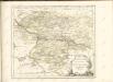

Le Theatre de Bellone :
Mollova mapová sbírka Schenk, Pieter Braakman, Adriaan
Carte topographique d'Allemagne
1 : 225000 Brémy (Německo) Jaeger, Johann Wilhelm Abraham Berndt, Johann Christoph I.W.A. Iaeger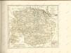


Ducatus Luneburgici et comitatus Dannenbergensis
1 : 363000 Lüneburg (Německo) Visscher, Nicolaus Schenk, Pieter Pet. Schenk Iun.
Ducatus Luneburgici et comitaus Dannebergensis accurata descriptio
1 : 380000 Dolní Sasko (Německo) Homann, Johann Baptist J. B. Homann
Geographische Lage der südlichen Braunschweigischen Reichsgebiete darinnen
1 : 280000 Mollova mapová sbírka Homann, Johann Baptist Homann, Johann Baptista - dědici
Ducatus Lunenburgensis in omnes ejusdem subjacentes praefecturas Nova descriptio
1 : 870000 Mollova mapová sbírka Danckerts, Justus Danckerts, Justus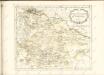

Das Hertzogthum Braunschweig mit seinen abgetheilten Furstenthümern dem Stiffte Hildesheim und andern angräntzenden Provintzien
1 : 1200000 Mollova mapová sbírka Weigel, Johann Christoph Weigel, Christoph I.
Ducatus Brunsuicensis
1 : 394000 Braunschweig (Německo) Homann, Johann Baptist cura Ioh. Bapt. Homanni
Dvcatvs Brvnsvicensis fereq. Lvnaeburgensis
1 : 540000 Mollova mapová sbírka Merian, Matthaeus Merian, Matthäus - dědici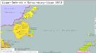
Lippe-Detmold, Schaumburg-Lippe 1812
Lippe-Detmold, Schaumburg-Lippe Hundt, Michael
Ducatus Luneburgici in suas Praefecturas et Vogteyas ad Statum recentissimum divisi Tabula Geographica
1 : 380000 Mollova mapová sbírka Böhme, August Gottlob Homann, Johann Baptista - dědici
Ducatvs Brunswicensis, Maximaeq; Partis Luneburgensis, et Episcopatvs Hildesiensis nova & exacta Tabvla
1 : 360000 Mollova mapová sbírka Funck, David Funk, David