Maps of gmina Wielka Nieszawka

254. Argenau.
1 : 100000 Reichsamt fur Landesaufnahme
Composite: 254. Argenau.
1 : 100000 Reichsamt fur Landesaufnahme
Meßtischblatt 3177 : Neugrabia, 1936
1 : 250000 Neugrabia. - Aufn. 1891/1908,hrsg. 1909, letzte Nachtr. 1938. - 1:25000. - [Berlin]: Reichsamt für Landesaufnahme, 1936. - 1 Kt.
Meßtischblatt 3178 : Aleksandrów, 1936
1 : 250000 Aleksandrów. - Aufn. 1928, letzte Nachtr. 1930. - 1:25000. - [Berlin]: Reichsamt für Landesaufnahme, 1936. - 1 Kt.
Meßtischblatt 3077 : Podgorz (neu: Amberg), 1942
1 : 250000 Podgorz (neu: Amberg). - Ausg. m. dt. Namen, Ausg. 1940, [gedr. 19]42. - 1:25000. - [Berlin]: Reichsamt für Landesaufnahme, 1942. - 1 Kt.
Meßtischblatt 3078 : Schillno (neu: Drewenzwinkel), 1942
1 : 250000 Schillno (neu: Drewenzwinkel). - Ausg. m. dt. Namen, Ausg. 1940, [gedr. 19]42, vo. - 1:25000. - [Berlin]: Reichsamt für Landesaufnahme, 1942. - 1 Kt.
Meßtischblatt 3176 : Argenau, 1940
1 : 250000 Argenau. - Aufn. 1908, hrsg. 1910, letzte Nachtr. 1934. - 1:25000. - [Berlin]: Reichsamt für Landesaufnahme, 1940. - 1 Kt.
Meßtischblatt 3076 : Schirpitz, 1942
1 : 250000 Schirpitz. - Ausg. m. dt. Namen, Ausg. 1940, [gedr. 19]42. - 1:25000. - [Berlin]: Reichsamt für Landesaufnahme, 1942. - 1 Kt.
Meßtischblatt 3277 : Luisenfelde, 1936
1 : 250000 Luisenfelde. - Aufn. 1908, letzte Nachtr. 1929/34. - 1:25000. - [Berlin]: Reichsamt für Landesaufnahme, 1936. - 1 Kt.
Meßtischblatt 3276 : Freitagsheim, 1936
1 : 250000 Freitagsheim. - Aufn. 1908, letzte Nachtr. 1929/34. - 1:25000. - [Berlin]: Reichsamt für Landesaufnahme, 1936. - 1 Kt.
Meßtischblatt 2977 : Thorn, 1942
1 : 250000 Thorn. - Ausg. m. dt. Namen, Ausg. 1940, [gedr. 19]42. - 1:25000. - [Berlin]: Reichsamt für Landesaufnahme, 1942. - 1 Kt. Mit vorläuf. Namensänd. (rot eingedr.)
Meßtischblatt 1510 : Thorn, 1911
1 : 250000 Thorn. - Aufn. 1908, hrsg. 1909, [gedr. 19]11. - 1:25000. - [Berlin]: Reichsamt für Landesaufnahme, 1911. - 1 Kt.
Meßtischblatt 2978 : Gramtschen, 1940
1 : 250000 Gramtschen. - Aufn. 1901/08, hrsg. 1910, letzte Nachtr. 1938. - 1:25000. - [Berlin]: Reichsamt für Landesaufnahme, 1940. - 1 Kt.
Meßtischblatt 2976 : Pensau, 1940
1 : 250000 Pensau. - Aufn. 1908, hrsg. 1909, letzte Nachtr. 1924, Ausg. 1940. - 1:25000. - [Berlin]: Reichsamt für Landesaufnahme, 1940. - 1 Kt.
Plock 51, uit: Special-Karte von Mittel-Europa / nach amtlichen Quellen bearbeitet von W. Liebenow
1 : 300000 titelvariant: W. Liebenow's Mittel-Europa; Annotatie: Titel boven de bladen: W. Liebenow's Mittel-Europa Johannes Wilhelm Liebenow 1822-1897 Frankfurt a. M. : Ludwig Ravenstein
226. Thorn.
1 : 100000 Reichsamt fur Landesaufnahme
Composite: 226. Thorn.
1 : 100000 Reichsamt fur Landesaufnahme
253. Inowrazlaw.
1 : 100000 Reichsamt fur Landesaufnahme
Meßtischblatt 2979 : Preußisch Lanke, 1940
1 : 250000 Preußisch Lanke. - Aufn. 1909. - 1:25000. - [Berlin]: Reichsamt für Landesaufnahme, 1940. - 1 Kt.
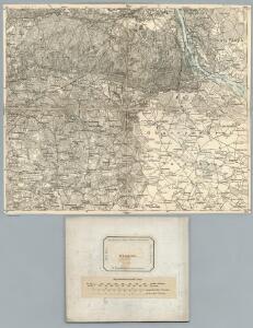
Sect. 10: Bromberg, uit: Geologische Karte des Deutschen Reichs in 27 Blaettern / [von] Richard Lepsius ; Red. von C. Vogel
1 : 500000 Annotatie: Blad 18 ontbreekt; Een aantal bladen op linnen; Een aantal bladen gereviseerd 1913-1914; Annotatie geografische gegevens: Met schaalstokken o.a. in kilometers; Legenda Carl Vogel 1828-1897 Gotha : Justus Perthes
Danzig, Colberg, Thorn
1 : 750000 Gdaňsk (Polsko : oblast) Konrad, A. K. u. k. Militärgeographisches Institut
Danzig, Colberg, Thorn
1 : 750000 Gdaňsk (Polsko : oblast) K. k. militär-geographisches Institut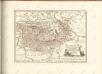

Kolonie założone za panowania Fryderyka Wielkiego w Prusach Królewskich i w obwodzie nadnoteckim
Polen Ostpreußen Netzedistrikt Stadtgründung Friedrich II.
Schema Teatra kampanīi 1806-7 gg.
Polen Napoleonische Kriege

West Preussen.
1 : 940000 Flemming, Carl
Die Preussische Provinz Posen, bestehend aus den Regierungs-Bezirken: Posen & Bromberg
1 : 1850000 Provinz Posen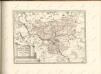

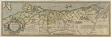
Pomeraniae dvcatvs tabvla
1 : 950000 Mollova mapová sbírka Lubin, Eilhard Rogiers, Salomon Blaeu, Willem Jansz.