Maps of Samtgemeinde Grafschaft Hoya

235. Verden.
1 : 100000 Reichsamt fur Landesaufnahme
Messtischblatt 1598 : Dörverden, 1925 Dörverden
1 : 250000 Dörverden. - Aufn. 1897, einz. Nachtr. 1925. - 1:25000. - [Berlin]: Reichsamt für Landesaufnahme, 1925. - 1 Kt.
Messtischblatt 1598 : Dörverden, 1899 Dörverden
1 : 250000 Dörverden. - Aufn. 1897, hrsg. 1899. - 1:25000. - [Berlin]: Reichsamt für Landesaufnahme, 1899. - 1 Kt.
Messtischblatt 1597 : Hoya, 1936 Hoya
1 : 250000 Hoya. - Hrsg. 1899, einz. Nachtr. 1936. - 1:25000. - [Berlin]: Reichsamt für Landesaufnahme, 1936. - 1 Kt.
Messtischblatt 1596 : Vilsen, 1934 Vilsen
1 : 250000 Vilsen. - Hrsg. 1899, einz. Nachtr. 1925, gedr. [19]34. - 1:25000. - [Berlin]: Reichsamt für Landesaufnahme, 1934. - 1 Kt.
Meßtischblatt 1526 : Thedinghausen, 1936
1 : 250000 Thedinghausen. - Hrsg. 1899, einz. Nachtr. 1936. - 1:25000. - [Berlin]: Reichsamt für Landesaufnahme, 1936. - 1 Kt.
Meßtischblatt 1525 : Riede, 1936
1 : 250000 Riede. - Hrsg. 1899, einz. Nachtr. 1936. - 1:25000. - [Berlin]: Reichsamt für Landesaufnahme, 1936. - 1 Kt.
Composite: 235. Verden.
1 : 100000 Reichsamt fur Landesaufnahme
Germany 1:25,000, Eystrup
Germany 1:25,000 , Series GSGS 4414. Great Britain. War Office. [London] : War Office
Meßtischblatt 1668 : Eystrup, 1936
1 : 250000 Eystrup. - Hrsg. 1899, einz. Nachtr. 1936. - 1:25000. - [Berlin]: Reichsamt für Landesaufnahme, 1936. - 1 Kt.
Meßtischblatt 1668 : Eystrup, 1899
1 : 250000 Eystrup. - Aufn. 1897. - 1:25000. - [Berlin]: Reichsamt für Landesaufnahme, 1899. - 1 Kt.
Meßtischblatt 1667 : Bücken. Flecken, 1934
1 : 250000 Bücken Flecken. - Hrsg.1899, einz. Nachtr. 1924, [gedr. 19]34. - 1:25000. - [Berlin]: Reichsamt für Landesaufnahme, 1934. - 1 Kt.
Meßtischblatt 1666 : Schwaförden, 1935
1 : 250000 Schwaförden. - Hrsg. 1899, einz. Nachtr. 1925, gedr. [19]35. - 1:25000. - [Berlin]: Reichsamt für Landesaufnahme, 1935. - 1 Kt.
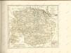
72. Nienburg, uit: Topographische Uebersichtskarte des Deutschen Reiches / herausgegeben v. d. Kartogr. Abt. d. Königl. Preuß. Landesaufnahme
1 : 200000 titelvariant: Topogr. Übersichtskarte des Deutschen Reiches; Annotatie: Titel boven bladen ook: Topogr. Übersichtskarte des Deutschen Reiches; Annotatie geografische gegevens: Op elk blad twee maatstokken: 10 Kilometer = 5,5 cm; 1 geogr. Meile = 3,6 cm; Legenda onder op elk blad Königlich Preußische Landesaufnahme. Kartographische Abtheilung [S.l : Königlich Preußische Landesaufnahme, Kartographische Abtheilung]
Central Europe 1:1,000,000, Bremen
Sheet M3 of the 287 sheet series: Central Europe. 1 : 100,000. G.S.G.S. No. 4416. AMS. M641, M651, M671. [London?] ; Washington, D.C. : War Office : Army Map Service, U.S. Army.
Carte topographique d'Allemagne
1 : 225000 Brémy (Německo) Jaeger, Johann Wilhelm Abraham Berndt, Johann Christoph I.W.A. Iaeger
Composite: 206. Bremen. (Germany)
1 : 100000 Reichsamt fur Landesaufnahme
Karte des Gebiethes der Reichs und Hanse Stadt Bremen
1 : 39400 Brémy (Německo) Heineken, Christian Abraham Tischbein, Georg Heinrich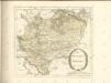
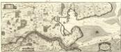
Nobilis Saxoniae Fl. Visvrgis cum Terris adjacentib. Ab Inclyta Brema ad Ostium Maris
1 : 130000 Mollova mapová sbírka Merian, Matthaeus Merian, Matthäus - dědici
207. Ottersberg. (Germany)
1 : 100000 Reichsamt fur Landesaufnahme
Composite: 234. Wildeshausen.
1 : 100000 Reichsamt fur Landesaufnahme
Composite: 236. Walsrode.
1 : 100000 Reichsamt fur Landesaufnahme
236. Walsrode.
1 : 100000 Reichsamt fur Landesaufnahme
Composite: 260. Nienburg.
1 : 100000 Reichsamt fur Landesaufnahme
260. Nienburg.
1 : 100000 Reichsamt fur Landesaufnahme
Messtischblatt 1599 : Kirchboitzen, 1899 Kirchboitzen
1 : 250000 Kirchboitzen. - Aufn. 1897. - 1:25000. - [Berlin]: Reichsamt für Landesaufnahme, 1899. - 1 Kt.
Meßtischblatt 1528 : Bendingbostel, 1899
1 : 250000 Bendingbostel. - Aufn. 1897. - 1:25000. - [Berlin]: Reichsamt für Landesaufnahme, 1899. - 1 Kt.