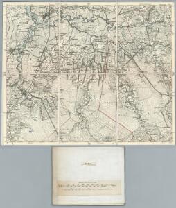
Maps of Samtgemeinde Nordhümmling

204. Leer. (Germany)
1 : 100000 Reichsamt fur Landesaufnahme
Composite: 204. Leer. (Germany)
1 : 100000 Reichsamt fur Landesaufnahme
Messtischblatt 1446 : Friesoythe, 1925 Friesoythe
1 : 250000 Friesoythe. - Aufn. 1898, einz. Nachtr. 1925. - 1:25000. - [Berlin]: Reichsamt für Landesaufnahme, 1925. - 1 Kt.
Messtischblatt 1446 : Friesoythe, 1900 Friesoythe
1 : 250000 Friesoythe. - Aufn. 1898. - 1:25000. - [Berlin]: Reichsamt für Landesaufnahme, 1900. - 1 Kt.
Messtischblatt 1445 : Scharrel, 1908 Scharrel
1 : 250000 Scharrel. - Aufn. 1898, hrsg. 1900, einz. Nachtr. 1908. - 1:25000. - [Berlin]: Reichsamt für Landesaufnahme, 1908. - 1 Kt.
Meßtischblatt 1444/1445 (Doppelblatt) : Burlage/Scharrel, 1908
1 : 250000 Burlage/Scharrel . - Aufn. 1898, hrsg. 1900, einzelne Nachtr. 1908. - 1:25000. - [Berlin]: Reichsamt für Landesaufnahme, 1908. - 1 Kt.
Meßtischblatt 1443 : Papenburg, 1908
1 : 250000 Papenburg. - Aufn. 1898, hrsg. 1899, einzelne Nachtr. 1908. - 1:25000. - [Berlin]: Reichsamt für Landesaufnahme, 1908. - 1 Kt.
Meßtischblatt 1366 : Edewecht, 1900
1 : 250000 Edewecht. - Aufn. 1898, hrsg. 1900. - 1:25000. - [Berlin]: Reichsamt für Landesaufnahme, 1900. - 1 Kt.
Meßtischblatt 1365 : Barssel, 1900
1 : 250000 Barssel. - Aufn. 1898. - 1:25000. - [Berlin]: Reichsamt für Landesaufnahme, 1900. - 1 Kt.
Meßtischblatt 1364 : West- Rhauderfehn, 1900
1 : 250000 West- Rhauderfehn. - Aufn. 1898. - 1:25000. - [Berlin]: Reichsamt für Landesaufnahme, 1900. - 1 Kt.
Meßtischblatt 1363 : Weener, 1925
1 : 250000 Weener. - Aufn. 1898, Nachtr. 1925. - 1:25000. - [Berlin]: Reichsamt für Landesaufnahme, 1925. - 1 Kt.
Meßtischblatt 1285 : Westerstede, 1900
1 : 250000 Westerstede. - Aufn. 1898. - 1:25000. - [Berlin]: Reichsamt für Landesaufnahme, 1900. - 1 Kt.
Meßtischblatt 1284 : Apen, 1900
1 : 250000 Apen. - Aufn. 1898, hrsg. 1900. - 1:25000. - [Berlin]: Reichsamt für Landesaufnahme, 1900. - 1 Kt.
Meßtischblatt 1283 : Nortmoor, 1898
1 : 250000 Nortmoor. - Aufn. 1897, hrsg. 1898. - 1:25000. - [Berlin]: Reichsamt für Landesaufnahme, 1898. - 1 Kt.
Meßtischblatt 1282 : Leer, 1898
1 : 250000 Leer. - Aufn. 1897. - 1:25000. - [Berlin]: Reichsamt für Landesaufnahme, 1898. - 1 Kt.
Plan der Vehncolonie Papenburg
1 : 82000
LIEROORT : [fortification plan].
[Amsterdam : Joan Blaeu]
Meßtischblatt 1519 : Markhausen, 1900
1 : 250000 Markhausen. - Aufn. 1898. - 1:25000. - [Berlin]: Reichsamt für Landesaufnahme, 1900. - 1 Kt.
Meßtischblatt 1518 : Neu-Arenberg, 1900
1 : 250000 Neu- Arenberg. - Aufn. 1898. - 1:25000. - [Berlin]: Reichsamt für Landesaufnahme, 1900. - 1 Kt.
Meßtischblatt 1517 : Börger, 1900
1 : 250000 Börger. - Aufn. 1898. - 1:25000. - [Berlin]: Reichsamt für Landesaufnahme, 1900. - 1 Kt.
Meßtischblatt 1516 : Wippingen, 1899
1 : 250000 Wippingen. - Aufn. 1898. - 1:25000. - [Berlin]: Reichsamt für Landesaufnahme, 1899. - 1 Kt.
55. Oldenburg, uit: Topographische Uebersichtskarte des Deutschen Reiches / herausgegeben v. d. Kartogr. Abt. d. Königl. Preuß. Landesaufnahme
1 : 200000 titelvariant: Topogr. Übersichtskarte des Deutschen Reiches; Annotatie: Titel boven bladen ook: Topogr. Übersichtskarte des Deutschen Reiches; Annotatie geografische gegevens: Op elk blad twee maatstokken: 10 Kilometer = 5,5 cm; 1 geogr. Meile = 3,6 cm; Legenda onder op elk blad Königlich Preußische Landesaufnahme. Kartographische Abtheilung [S.l : Königlich Preußische Landesaufnahme, Kartographische Abtheilung]
Oldenburg Grossherzogthum.
1 : 490000 Gotthard, A.
Composite: 173. Aurich. (Germany)
1 : 100000 Reichsamt fur Landesaufnahme
173. Aurich. (Germany)
1 : 100000 Reichsamt fur Landesaufnahme
Composite: 205. Oldenburg. (Germany)
1 : 100000 Reichsamt fur Landesaufnahme
232. Sogel.
1 : 100000 Reichsamt fur Landesaufnahme
Composite: 232. Sogel.
1 : 100000 Reichsamt fur Landesaufnahme
Meßtischblatt 1362 : Bunde, 1908
1 : 250000 Bunde. - Aufn. 1897, hrsg. 1898. - 1:25000. - [Berlin]: Reichsamt für Landesaufnahme, 1908. - 1 Kt.