Maps of gmina Mirosławiec

190. Callies. (Germany)
1 : 100000 Reichsamt fur Landesaufnahme
Composite: 190. Callies. (Germany)
1 : 100000 Reichsamt fur Landesaufnahme
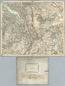
Meßtischblatt 2662 : Märk. Friedland, 1878
1 : 250000 Märk. Friedland. - Aufn. 1876. - 1:25000. - [Berlin]: Reichsamt für Landesaufnahme, 1878. - 1 Kt.
Meßtischblatt 2661 : Gr. Spiegel, 1940
1 : 250000 Gr. Spiegel. - Aufn. 1936. - 1:25000. - [Berlin]: Reichsamt für Landesaufnahme, 1940. - 1 Kt.
Meßtischblatt 2663 : Petznick, 1938
1 : 250000 Petznick. - Aufgen. 1936/37. - 1:25000. - [Berlin]: Reichsamt für Landesaufnahme, 1938. - 1 Kt.
Meßtischblatt 2562 : Virchow, 1937
1 : 250000 Virchow. - Aufgen. 1937. - 1:25000. - [Berlin]: Reichsamt für Landesaufnahme, 1937. - 1 Kt.
Meßtischblatt 2561 : Gr. Lübbesee, 1937
1 : 250000 Gr. Lübbesee. - Aufgen. 1937. - 1:25000. - [Berlin]: Reichsamt für Landesaufnahme, 1937. - 1 Kt.
Meßtischblatt 2563 : Gr. Linichen, 1937
1 : 250000 Gr. Linichen. - Aufgen. 1937. - 1:25000. - [Berlin]: Reichsamt für Landesaufnahme, 1937. - 1 Kt.
Meßtischblatt 2762 : Spechtsdorf, 1878
1 : 250000 Spechtsdorf. - Aufn. 1876. - 1:25000. - [Berlin]: Reichsamt für Landesaufnahme, 1878. - 1 Kt.
Meßtischblatt 2761 : Kallies, 1940
1 : 250000 Kallies. - Aufn. 1934/36, redakt. Änd. 1938. - 1:25000. - [Berlin]: Reichsamt für Landesaufnahme, 1940. - 1 Kt.
Meßtischblatt 2763 : Marzdorf, 1878
1 : 250000 Marzdorf. - Aufn. 1876. - 1:25000. - [Berlin]: Reichsamt für Landesaufnahme, 1878. - 1 Kt.
63. Arnswalde, uit: Topographische Uebersichtskarte des Deutschen Reiches / herausgegeben v. d. Kartogr. Abt. d. Königl. Preuß. Landesaufnahme
1 : 200000 titelvariant: Topogr. Übersichtskarte des Deutschen Reiches; Annotatie: Titel boven bladen ook: Topogr. Übersichtskarte des Deutschen Reiches; Annotatie geografische gegevens: Op elk blad twee maatstokken: 10 Kilometer = 5,5 cm; 1 geogr. Meile = 3,6 cm; Legenda onder op elk blad Königlich Preußische Landesaufnahme. Kartographische Abtheilung [S.l : Königlich Preußische Landesaufnahme, Kartographische Abtheilung]
Der Arenswaldische Creis
1 : 290000 Sotzmann, Daniel Friedrich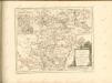

Tempelburg 37, uit: Special-Karte von Mittel-Europa / nach amtlichen Quellen bearbeitet von W. Liebenow
1 : 300000 titelvariant: W. Liebenow's Mittel-Europa; Annotatie: Titel boven de bladen: W. Liebenow's Mittel-Europa Johannes Wilhelm Liebenow 1822-1897 Frankfurt a. M. : Ludwig Ravenstein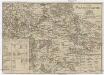
Der Dramburgsche Creis
1 : 296000 Drawsko Pomorskie (Polsko) Sotzmann, Daniel Friedrich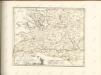

Sect. 9: Stettin, uit: Geologische Karte des Deutschen Reichs in 27 Blaettern / [von] Richard Lepsius ; Red. von C. Vogel
1 : 500000 Annotatie: Blad 18 ontbreekt; Een aantal bladen op linnen; Een aantal bladen gereviseerd 1913-1914; Annotatie geografische gegevens: Met schaalstokken o.a. in kilometers; Legenda Carl Vogel 1828-1897 Gotha : Justus Perthes
Mapa Wojewodztwa Szczecinskiego

Bromberg
1 : 600000 Opitz, Carl Solbrig
Marchia Nova; Vulgò New Marck in March. Brandenburg. [Karte], in: Novus atlas absolutissimus, Bd. 2, S. 63.
1 Karte aus Atlas Janssonius Offizin
Provinz Posen
1 : 1200000 Provinz Posen
Posen.
1 : 810000 Radefeld, Carl Christian Franz, 1788-1874
Palatinatus Posnaniensis. In Majori Polonia Primarii Nova Delinatio [Karte], in: Novus atlas absolutissimus, Bd. 1, S. 96.
1 Karte aus Atlas Janssonius Offizin
Die polnische Curve in Westpreußen
Polen Westpreußen Polen Bevölkerung
Provinz Westpreussen
1 : 1250000 Westpreußen
Kreise der Provinz Posen 1864
Preußen, Provinz Posen, Verwaltungsgliederung Kunz, Andreas ; Moeschl, Joachim Robert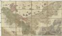
Ducatus Pomeraniae citerioris et ulterioris principatibus, comitatibus urbibus suis definitae nova et ampla descriptio
1 : 257000 Pomořansko (Německo a Polsko) Lotter, Tobias Conrad T. C. Lotter
Provinz Westpreussen
1 : 472000 Gdaňsk (Polsko) Handtke, Friedrich Carl Flemming
Danzig, Colberg, Thorn
1 : 750000 Gdaňsk (Polsko : oblast) Konrad, A. K. u. k. Militärgeographisches Institut