Maps of gmina Karsin

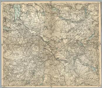
Composite: 129. Czersk. (Germany)
1 : 100000 Reichsamt fur Landesaufnahme
129. Czersk. (Germany)
1 : 100000 Reichsamt fur Landesaufnahme
Meßtischblatt 2174 : Long, 1940
1 : 250000 Long. - Aufn. 1929/30. - 1:25000. - [Berlin]: Reichsamt für Landesaufnahme, 1940. - 1 Kt.
Meßtischblatt 2173 : Malachin, 1940
1 : 250000 Malachin. - Aufn. 1874, letzte Nachtr. 1929/30, Ausg. 1940. - 1:25000. - [Berlin]: Reichsamt für Landesaufnahme, 1940. - 1 Kt.
Meßtischblatt 2175 : Occippel, 1940
1 : 250000 Occippel. - Aufn. 1931. - 1:25000. - [Berlin]: Reichsamt für Landesaufnahme, 1940. - 1 Kt.
Meßtischblatt 2074 : Wigonin, 1940
1 : 250000 Wigonin. - Aufn. 1895, hrsg. 1874, letzte Nachtr. 1934. - 1:25000. - [Berlin]: Reichsamt für Landesaufnahme, 1940. - 1 Kt.
Meßtischblatt 2073 : Wielle, 1934
1 : 250000 Wielle. - Aufn. 1895, letzte Nachtr. 1934. - 1:25000. - [Berlin]: Reichsamt für Landesaufnahme, 1934. - 1 Kt.
Meßtischblatt 2075 : Hoch- Stüblau, 1940
1 : 250000 Hoch- Stüblau. - Aufn. 1930/31. - 1:25000. - [Berlin]: Reichsamt für Landesaufnahme, 1940. - 1 Kt.
Meßtischblatt 2275 : Gr. Schliewitz, 1935
1 : 250000 Gr. Schliewitz. - Aufn. 1886, letzte Nachtr. 1935. - 1:25000. - [Berlin]: Reichsamt für Landesaufnahme, 1935. - 1 Kt.
Meßtischblatt 2274 : Schlachta, 1935
1 : 250000 Schlachta. - Aufn. 1887, letzte Nachtr. 1934/35. - 1:25000. - [Berlin]: Reichsamt für Landesaufnahme, 1935. - 1 Kt.
Meßtischblatt 2273 : Czersk, 1934
1 : 250000 Czersk. - Aufn. 1887, letzte Nachtr. 1934. - 1:25000. - [Berlin]: Reichsamt für Landesaufnahme, 1934. - 1 Kt.
Danzig 26, uit: Special-Karte von Mittel-Europa / nach amtlichen Quellen bearbeitet von W. Liebenow
1 : 300000 titelvariant: W. Liebenow's Mittel-Europa; Annotatie: Titel boven de bladen: W. Liebenow's Mittel-Europa Johannes Wilhelm Liebenow 1822-1897 Frankfurt a. M. : Ludwig Ravenstein
162. Tuchel. (Germany)
1 : 100000 Reichsamt fur Landesaufnahme
Composite: 162. Tuchel. (Germany)
1 : 100000 Reichsamt fur Landesaufnahme
Meßtischblatt 2172 : Bruß, 1940
1 : 250000 Bruß. - Aufn. 1874, letzte Nachtr. 1938. - 1:25000. - [Berlin]: Reichsamt für Landesaufnahme, 1940. - 1 Kt.
Meßtischblatt 2072 : Lesno, 1938
1 : 250000 Lesno. - Aufn. 1874, letzte Nachtr. 1938. - 1:25000. - [Berlin]: Reichsamt für Landesaufnahme, 1938. - 1 Kt.
Meßtischblatt 2076 : Pinschin, 1940
1 : 250000 Pinschin. - Aufn. 1908, letzte Nachtr. 1932. - 1:25000. - [Berlin]: Reichsamt für Landesaufnahme, 1940. - 1 Kt.
Meßtischblatt 2176 : Lubichow, 1940
1 : 250000 Lubichow. - Aufn. 1908, letzte Nachtr. 1932. - 1:25000. - [Berlin]: Reichsamt für Landesaufnahme, 1940. - 1 Kt.
Meßtischblatt 1973 : Funkelkau, 1941
1 : 250000 Funkelkau. - Aufn. 1931/34. - 1:25000. - [Berlin]: Reichsamt für Landesaufnahme, 1941. - 1 Kt.
Meßtischblatt 1974 : Neu- Paleschken, 1941
1 : 250000 Neu- Paleschken. - Aufn. 1931/32. - 1:25000. - [Berlin]: Reichsamt für Landesaufnahme, 1941. - 1 Kt.
Meßtischblatt 1975 : Liniewo, 1941
1 : 250000 Liniewo. - Aufn. 1932. - 1:25000. - [Berlin]: Reichsamt für Landesaufnahme, 1941. - 1 Kt.
Meßtischblatt 2272 : Rittel, 1936
1 : 250000 Rittel. - Aufn. 1874, letzte Nachtr. 1936. - 1:25000. - [Berlin]: Reichsamt für Landesaufnahme, 1936. - 1 Kt.
Svobodné město Gdansk (Danzig)
1 : 300000 Gdaňsk-oblast (Polsko) Jordán, V. O. Girgal

Sect. 10: Bromberg, uit: Geologische Karte des Deutschen Reichs in 27 Blaettern / [von] Richard Lepsius ; Red. von C. Vogel
1 : 500000 Annotatie: Blad 18 ontbreekt; Een aantal bladen op linnen; Een aantal bladen gereviseerd 1913-1914; Annotatie geografische gegevens: Met schaalstokken o.a. in kilometers; Legenda Carl Vogel 1828-1897 Gotha : Justus Perthes
Bromberg
1 : 600000 Opitz, Carl Solbrig
Languages in Prussian Poland
1 : 600000 First World War map of Languages in Prussian Poland. War Office
Die polnische Curve in Westpreußen
Polen Westpreußen Polen Bevölkerung
Provinz Westpreussen
1 : 1250000 Westpreußen