Maps of Langeoog

Composite: 108. Spiekeroog. (Germany)
1 : 100000 Reichsamt fur Landesaufnahme
108. Spiekeroog. (Germany)
1 : 100000 Reichsamt fur Landesaufnahme
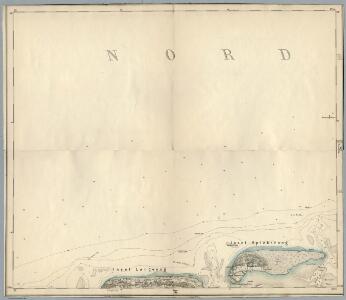
Meßtischblatt 824 : Spiekeroog, 1918
1 : 250000 Spiekeroog. - Aufn. 1891, hrsg. 1892, Auflagendr. 1918. - 1:25000. - [Berlin]: Reichsamt für Landesaufnahme, 1918. - 1 Kt.
Meßtischblatt 823 : Langeoog, 1918
1 : 250000 Langeoog. - Aufn. 1891, hrsg. 1892, Auflagendr. 1918. - 1:25000. - [Berlin]: Reichsamt für Landesaufnahme, 1918. - 1 Kt.
Meßtischblatt 822 : Baltrum, 1930
1 : 250000 Baltrum. - Hrsg. 1892, bericht. 1930. - 1:25000. - [Berlin]: Reichsamt für Landesaufnahme, 1930. - 1 Kt.
38. Wilhelmshaven, uit: Topographische Uebersichtskarte des Deutschen Reiches / herausgegeben v. d. Kartogr. Abt. d. Königl. Preuß. Landesaufnahme
1 : 200000 titelvariant: Topogr. Übersichtskarte des Deutschen Reiches; Annotatie: Titel boven bladen ook: Topogr. Übersichtskarte des Deutschen Reiches; Annotatie geografische gegevens: Op elk blad twee maatstokken: 10 Kilometer = 5,5 cm; 1 geogr. Meile = 3,6 cm; Legenda onder op elk blad Königlich Preußische Landesaufnahme. Kartographische Abtheilung [S.l : Königlich Preußische Landesaufnahme, Kartographische Abtheilung]
Wilhelmshaven 32, uit: [W. Liebenow's Special-Karte von Mittel-Europa]
1 : 300000 titelvariant: W. Liebenow's Mittel-Europa; Annotatie: Titel boven de bladen: W. Liebenow's Mittel-Europa Johannes Wilhelm Liebenow 1822-1897 Hannover : Hermann Oppermann
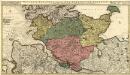
Oldenburg Grossherzogthum.
1 : 490000 Gotthard, A.
141. Esens. (Germany)
1 : 100000 Reichsamt fur Landesaufnahme
Composite: 141. Esens. (Germany)
1 : 100000 Reichsamt fur Landesaufnahme
Wilhelmshaven 32, uit: Special-Karte von Mittel-Europa / nach amtlichen Quellen bearbeitet von W. Liebenow
1 : 300000 titelvariant: W. Liebenow's Mittel-Europa; Annotatie: Titel boven de bladen: W. Liebenow's Mittel-Europa Johannes Wilhelm Liebenow 1822-1897 Frankfurt a. M. : Ludwig Ravenstein
[4], uit: Hydro-Oro und Chorographische General Karte des Koenigreichs der Niederlande und der angrenzenden Länder bis Paris : mit der Angabe der Kunst und Heer-Strassen und der Entfernung der Poststationen / ... zusammengetragen und reducirt von ... Wilhelm Müller
1 : 400000 titelvariant: Generalkarte des Koenigreichs Hannover; Annotatie: 1e supplement bij: Generalkarte des Koenigreichs Hannover (1818) Müller, Wilhelm (fl. 1818) [Hannover : Wilhelm Müller]
Emden & Olden Borch Comit. [Karte], in: Gerardi Mercatoris Atlas, sive, Cosmographicae meditationes de fabrica mundi et fabricati figura, S. 337.
1 Karte aus Atlas Mercator, Gerhard Montanus, Petrus
Tabula Frisiae orientalis
1 : 210000 Aurich (Německo) Coldewey, Ehrenreich Gerhard Allard, Abraham ex officina Ioh. Christoph. Homanni
Tabula Frisiae orientalis
1 : 210000 Aurich (Německo) Coldewey, Ehrenreich Gerhard Allard, Abraham ex officina Ioh. Christoph. Homanni
Ducatus Bremae & Ferdae maximaeque partis fluminis Visurgis
1 : 326500 Brémy (Německo : spolková země) Wit, Frederick de R. & J. Ottens
DUCATUS BREMAE & FERDAE Maximaeque partis FLUMINIS VISURGIS
1 : 340000 Brémy (Německo : spolková země) Wit, Frederick de Frederic de Wit
Ducatus Bremae & Ferdae maximaeque partis fluminis Visurgis
1 : 326500 Brémy (Německo : spolková země) Wit, Frederick de I. Covens et C. Mortier
Tabula Frisiae, Groninghae, et territory Embdensis nec non circumjacentium regionum puta Transisalaniae, Benthemiae, Westphaliae, et Oldenburgi
1 : 300000 noviter summa cura et studio edita, a Nicolao Johannide Piscatore. [Amsterdam] : [Claes Jansz. Visscher]
Tabula Frisiae, Groningae, et territorii Emdensis nec non circumjacentium regionum, puta Transisalaniae, Benthemiae, Westphaliae, et Oldenburgi.
1 : 450000 [Amsterdam] : ex officina N. Visscher
Oldenburg
1 : 600000 Opitz, Carl Solbrig
[Pas-Caarte van't Schager-Rack, De Sondt en de Belt. [Karte] Paskaartie van de Rievier de Elve. [...] [Nebenkarte], in: De Nieuwe Groote Vermeerderde Zee-Atlas ofte Water-Werelt, S. 19.
1 Karte aus Atlas Doncker, Hendrick
Sect. 6: Emden, uit: Geologische Karte des Deutschen Reichs in 27 Blaettern / [von] Richard Lepsius ; Red. von C. Vogel
1 : 500000 Annotatie: Blad 18 ontbreekt; Een aantal bladen op linnen; Een aantal bladen gereviseerd 1913-1914; Annotatie geografische gegevens: Met schaalstokken o.a. in kilometers; Legenda Carl Vogel 1828-1897 Gotha : Justus Perthes
Tabula Frisiae, Groningae, et Territorii Emdensis
1 : 460000 Mollova mapová sbírka Visscher, Nicolaes Schenk, Peter II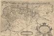
Oost ende West Vrieslandte beschryvinghe. Utriusque Frisiorum Regionis Noviss: Descriptio. 1568. [Karte], in: Theatrum orbis terrarum, S. 195.
1 Karte aus Atlas Ortelius, Abraham Vrients, Jan Baptista
Tabula Frisiae, Groningae, et Territorii Emdensis nec non circumiacentium Regionum [...] [Karte], in: Novus atlas absolutissimus, Bd. 3, S. 223.
1 Karte aus Atlas Janssonius Offizin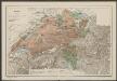
Nieuwe Caerte waerinne vertoont wordt de gantsche Vaert van Amsterdam over de Watten tot de stadt Hamborch toe. [Karte, Teil 2], in: Gerardi Mercatoris et I. Hondii Newer Atlas, oder, Grosses Weltbuch, Bd. 1, S. 152.
1 Karte aus Atlas Mercator, Gerhard und Hondius, Jodocus Jansson, Jan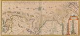
Nieuwe Caerte waerinne vertoont wordt de gantsche Vaert van Amsterdam over de Watten tot de stadt Hamborch toe. [Karte, Teil 2], in: Novus atlas absolutissimus, Bd. 2, S. 95.
1 Karte aus Atlas Janssonius Offizin