Maps of gmina Orneta

102. Wormditt. (Germany)
1 : 100000 Reichsamt fur Landesaufnahme
Composite: 102. Wormditt. (Germany)
1 : 100000 Reichsamt fur Landesaufnahme
Meßtischblatt 1986 : Liebstadt, 1937
1 : 250000 Liebstadt. - Hrsg. 1913, einzelne Nachtr. 1937. - 1:25000. - [Berlin]: Reichsamt für Landesaufnahme, 1937. - 1 Kt.
Meßtischblatt 1987 : Arnsdorf, 1913
1 : 250000 Arnsdorf. - Aufn. 1911. - 1:25000. - [Berlin]: Reichsamt für Landesaufnahme, 1913. - 1 Kt.
Meßtischblatt 1886 : Wormditt, 1938
1 : 250000 Wormditt. - Hrsg. 1913, bericht. 1932, einz. Nachtr. 1937, r. - 1:25000. - [Berlin]: Reichsamt für Landesaufnahme, 1938. - 1 Kt.
Meßtischblatt 1887 : Migehnen, 1936
1 : 250000 Migehnen. - Hrsg. 1913, bericht. 1932. - 1:25000. - [Berlin]: Reichsamt für Landesaufnahme, 1936. - 1 Kt.
Meßtischblatt 1985 : Sommerfeld / i. Ostpr., 1930
1 : 250000 Sommerfeld / i. Ostpr. - Hrsg. 1913, einzelne Nachtr. 1930. - 1:25000. - [Berlin]: Reichsamt für Landesaufnahme, 1930. - 1 Kt.
Meßtischblatt 1885 : Wusen, 1938
1 : 250000 Wusen. - Hrsg. 1913, einz. Nachtr. 1937, redakt. Änd. 193. - 1:25000. - [Berlin]: Reichsamt für Landesaufnahme, 1938. - 1 Kt.
Meßtischblatt 1786 : Mehlsack, 1937
1 : 250000 Mehlsack. - Hrsg. 1913, bericht. 1932, einz. Nachtr. 1937. - 1:25000. - [Berlin]: Reichsamt für Landesaufnahme, 1937. - 1 Kt.
Meßtischblatt 1787 : Lichtenau, 1936
1 : 250000 Lichtenau. - Hrsg. 1913, bericht. 1932. - 1:25000. - [Berlin]: Reichsamt für Landesaufnahme, 1936. - 1 Kt.
Meßtischblatt 1785 : Plaßwich, 1937
1 : 250000 Plaßwich. - Hrsg. 1913, einz. Nachtr. 1937. - 1:25000. - [Berlin]: Reichsamt für Landesaufnahme, 1937. - 1 Kt.
Meßtischblatt 1888 : Raunau, 1936
1 : 250000 Raunau. - Hrsg. 1913, bericht. 1932. - 1:25000. - [Berlin]: Reichsamt für Landesaufnahme, 1936. - 1 Kt.
Meßtischblatt 1988 : Schmolainen, 1937
1 : 250000 Schmolainen. - Hrsg. 1913, einzelne Nachtr. 1937. - 1:25000. - [Berlin]: Reichsamt für Landesaufnahme, 1937. - 1 Kt.
73. Heiligenbeil. (Germany)
1 : 100000 Reichsamt fur Landesaufnahme
Composite: 73. Heiligenbeil. (Germany)
1 : 100000 Reichsamt fur Landesaufnahme
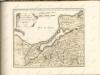
Karte von Ermeland oder zweites Blat von Westpreussen
1 : 225000 Prusko Západní Endersch, Johann Friedrich Amon, Anton F.A. Schraembl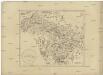
Karte von Ermeland oder zweites Blat von Westpreussen
1 : 225000 Prusko Západní Endersch, Johann Friedrich Amon, Anton F.A. Schraembl
Karte von Ermeland oder zweites Blat von Westpreussen
1 : 225000 Prusko Západní Endersch, Johann Friedrich Amon, Anton F.A. Schraembl
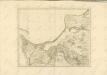
Elbing 27, uit: Special-Karte von Mittel-Europa / nach amtlichen Quellen bearbeitet von W. Liebenow
1 : 300000 titelvariant: W. Liebenow's Mittel-Europa; Annotatie: Titel boven de bladen: W. Liebenow's Mittel-Europa Johannes Wilhelm Liebenow 1822-1897 Frankfurt a. M. : Ludwig Ravenstein
Tabvla geographica episcopatvm Warmiensem in Prvssia exhibens, Heilsberg, solita habitatio episcopalis, longitudinem 38. graduum, et 16. minutorum ab insula Ferro numerat
1 : 220000 Lidzbark Warmiński-oblast (Polsko) Endersch, Johann Friedrich Grabowski, Adam Stanisław Ioannes Fridericus Endersch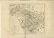

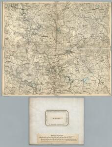
Composite: 133. Mohrungen. (Germany)
1 : 100000 Reichsamt fur Landesaufnahme
Meßtischblatt 2087 : Heiligenthal, 1929
1 : 250000 Heiligenthal. - Hrsg. 1913, einz. Nachtr. 1926. - 1:25000. - [Berlin]: Reichsamt für Landesaufnahme, 1929. - 1 Kt.
Meßtischblatt 2086 : Reichau, 1936
1 : 250000 Reichau. - Hrsg. 1913, Nachtr. 1926, gedr. [19]36. - 1:25000. - [Berlin]: Reichsamt für Landesaufnahme, 1936. - 1 Kt.
Meßtischblatt 2085 : Mohrungen, 1930
1 : 250000 Mohrungen. - Hrsg. 1913, bericht. 1930. - 1:25000. - [Berlin]: Reichsamt für Landesaufnahme, 1930. - 1 Kt.
Meßtischblatt 1788 : Landsberg (Ostpr.), 1936
1 : 250000 Landsberg (Ostpr.). - Hrsg. 1913, bericht. 1932. - 1:25000. - [Berlin]: Reichsamt für Landesaufnahme, 1936. - 1 Kt.
Meßtischblatt 2088 : Guttstadt, 1938
1 : 250000 Guttstadt. - Hrsg. 1914, red. Änd. 1938. - 1:25000. - [Berlin]: Reichsamt für Landesaufnahme, 1938. - 1 Kt.
Operationskarte
1 : 300000 Annotatie: Uit Bd. 4 van: Der Krieg von 1806 und 1807 / O. von Lettow-Vorbeck. - Berlin : Mittler, 1896; Fotogr. reprod. van origineel uit: Der Krieg von 1806 und 1807 ... / E. von Höpfner. - Berlin : Schropp, 1850 Berlin : Mittler