Maps of gmina Kobylnica

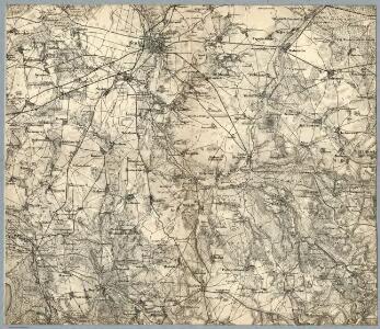
Composite: 67. Stolp. (Germany)
1 : 100000 Reichsamt fur Landesaufnahme
67. Stolp. (Germany)
1 : 100000 Reichsamt fur Landesaufnahme
[Stargard]
Stargard Szczeciński
Meßtischblatt 382 : Rathsdamnitz, 1932
1 : 250000 Rathsdamnitz. - Hrsg. 1891, einz. Nachtr. 1929. - 1:25000. - [Berlin]: Reichsamt für Landesaufnahme, 1932. - 1 Kt.
Meßtischblatt 1667 : Kulsow, 1934
1 : 250000 Kulsow. - Hrsg. 1891, bericht. 1934. - 1:25000. - [Berlin]: Reichsamt für Landesaufnahme, 1934. - 1 Kt.
Meßtischblatt 1669 : Gr. Dübsow, 1938
1 : 250000 Gr. Dübsow. - Hrsg. 1891, bericht. 1935, red. Änd. 1938. - 1:25000. - [Berlin]: Reichsamt für Landesaufnahme, 1938. - 1 Kt.
Meßtischblatt 1568 : Stolp, 1938
1 : 250000 Stolp. - Hrsg. 1890, bericht. 1935, redakt. Änd. 1938. - 1:25000. - [Berlin]: Reichsamt für Landesaufnahme, 1938. - 1 Kt.
Meßtischblatt 1567 : Zitzewitz, 1935
1 : 250000 Zitzewitz. - Hrsg. 1890, bericht. 1935. - 1:25000. - [Berlin]: Reichsamt für Landesaufnahme, 1935. - 1 Kt.
Meßtischblatt 1569 : Sageritz, 1938
1 : 250000 Sageritz. - Hrsg. 1891, bericht. 1935, redakt. Änd. 1938. - 1:25000. - [Berlin]: Reichsamt für Landesaufnahme, 1938. - 1 Kt.
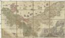
30. Stolp, uit: Topographische Uebersichtskarte des Deutschen Reiches / herausgegeben v. d. Kartogr. Abt. d. Königl. Preuß. Landesaufnahme
1 : 200000 titelvariant: Topogr. Übersichtskarte des Deutschen Reiches; Annotatie: Titel boven bladen ook: Topogr. Übersichtskarte des Deutschen Reiches; Annotatie geografische gegevens: Op elk blad twee maatstokken: 10 Kilometer = 5,5 cm; 1 geogr. Meile = 3,6 cm; Legenda onder op elk blad Königlich Preußische Landesaufnahme. Kartographische Abtheilung [S.l : Königlich Preußische Landesaufnahme, Kartographische Abtheilung]
Meßtischblatt 454 : Alt- Kolziglow, 1891
1 : 250000 Alt- Kolziglow. - Aufn. 1889. - 1:25000. - [Berlin]: Reichsamt für Landesaufnahme, 1891. - 1 Kt.
Meßtischblatt 453 : Zuckers, 1891
1 : 250000 Zuckers. - Aufn. 1889. - 1:25000. - [Berlin]: Reichsamt für Landesaufnahme, 1891. - 1 Kt.
Meßtischblatt 1767 : Varzin, 1934
1 : 250000 Varzin. - Hrsg. 1890, bericht. 1934. - 1:25000. - [Berlin]: Reichsamt für Landesaufnahme, 1934. - 1 Kt.
Meßtischblatt 1467 : Stolpmünde, 1937
1 : 250000 Stolpmünde. - Hrsg. 1891, einz. Nachtr. 1929. - 1:25000. - [Berlin]: Reichsamt für Landesaufnahme, 1937. - 1 Kt.
Meßtischblatt 1468 : Freist, 1939
1 : 250000 Freist. - Aufn. 1889, hrsg. 1891, bericht. 1939. - 1:25000. - [Berlin]: Reichsamt für Landesaufnahme, 1939. - 1 Kt.
Meßtischblatt 1469 : Dammen, 1938
1 : 250000 Dammen. - Hrsg. 1891, Nachtr. 1924, redakt. Änd. 1938. - 1:25000. - [Berlin]: Reichsamt für Landesaufnahme, 1938. - 1 Kt.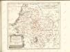


Composite: 44. Stolpmunde. (Germany)
1 : 100000 Reichsamt fur Landesaufnahme
44. Stolpmunde. (Germany)
1 : 100000 Reichsamt fur Landesaufnahme
Meßtischblatt 1570 : Lupow, 1938
1 : 250000 Lupow. - Hrsg. 1877, kleine Nachtr. 1912, redakt. Änd. 19. - 1:25000. - [Berlin]: Reichsamt für Landesaufnahme, 1938. - 1 Kt.
Meßtischblatt 1670 : Budow, 1938
1 : 250000 Budow. - Hrsg. 1877, Nachtr. 1919, red. Änd. 1938. - 1:25000. - [Berlin]: Reichsamt für Landesaufnahme, 1938. - 1 Kt.
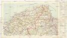
Mapa samochodowa Rzeczypospolitej Polskiej
1 : 300000 Gdaňsk-oblast (Polsko) wydanie Wojskowego instytutu geograficznego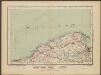
Danzig
1 : 600000 Opitz, Carl Solbrig
Sect. 4: Danzig, uit: Geologische Karte des Deutschen Reichs in 27 Blaettern / [von] Richard Lepsius ; Red. von C. Vogel
1 : 500000 Annotatie: Blad 18 ontbreekt; Een aantal bladen op linnen; Een aantal bladen gereviseerd 1913-1914; Annotatie geografische gegevens: Met schaalstokken o.a. in kilometers; Legenda Carl Vogel 1828-1897 Gotha : Justus Perthes
Languages in Prussian Poland
1 : 600000 First World War map of Languages in Prussian Poland. War Office
Die polnische Curve in Westpreußen
Polen Westpreußen Polen Bevölkerung
Provinz Westpreussen
1 : 1250000 Westpreußen