Maps of Mönchgut-Granitz

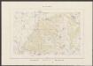
64. Bergen a. Rugen. (Germany)
1 : 100000 Reichsamt fur Landesaufnahme
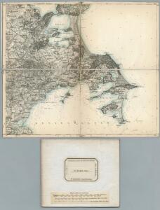
Composite: 64. Bergen a. Rugen. (Germany)
1 : 100000 Reichsamt fur Landesaufnahme
Meßtischblatt 375 : Vilmnitz, 1898
1 : 250000 Vilmnitz. - Aufn. 1885, hrsg. 1887, einz. Nachtr. 1898. - 1:25000. - [Berlin]: Reichsamt für Landesaufnahme, 1898. - 1 Kt.
Meßtischblatt 374 : Putbus, 1886
1 : 250000 Putbus. - Aufn. 1885, hrsg. 1887. - 1:25000. - [Berlin]: Reichsamt für Landesaufnahme, 1886. - 1 Kt.
Meßtischblatt 316 : Lubkow, 1925
1 : 250000 Lubkow. - Aufn. 1885, bericht. 1925. - 1:25000. - [Berlin]: Reichsamt für Landesaufnahme, 1925. - 1 Kt.
Meßtischblatt 1546 : Bergen (auf Rügen), 1936
1 : 250000 Bergen (auf Rügen). - Hrsg. 1887, bericht. 1925. - 1:25000. - [Berlin]: Reichsamt für Landesaufnahme, 1936. - 1 Kt.
Meßtischblatt 376, 316 a : Middelhagen, 1909
1 : 250000 Middelhagen. - Aufn. 1885, hrsg. 1887, einz. Nachtr. 1909. - 1:25000. - [Berlin]: Reichsamt für Landesaufnahme, 1909. - 1 Kt.
Plan Binz
Löwe, Cornelius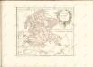

Reise Karte von der Insel Rügen
Rujana (Německo) Hagenow, Friedrich von Janssonius, Johannes
Rvgia insvla ac dvcatvs
1 : 270000 Rujana (Německo) Lubin, Eilhard Janssonius, Johannes Ioannis Ianßonius
Rugia Insula Ac Ducatus
1 : 240000 Mollova mapová sbírka Lubin, Eilhard Covens, Johannes I
Rugia Insula Ac Ducatus
1 : 265000 Mollova mapová sbírka Lubin, Eilhard Schenk, Peter I
Rugia Insula Ac Ducatus
1 : 240000 Mollova mapová sbírka Lubin, Eilhard Blaeu, Joan I.
Rugia Insula Ac Ducatus
1 : 525000 Mollova mapová sbírka Merian, Matthäus Merian, Matthäus
Rugia Insula Ac Ducatus
1 : 265000 Mollova mapová sbírka Lubin, Eilhard Janssonius, Johannes I
Meßtischblatt 442, neue Nr. 1747 : Zickersches Höft, 1937
1 : 250000 Zickersches Höft. - Hrsg. 1886, bericht. 1925. - 1:25000. - [Berlin]: Reichsamt für Landesaufnahme, 1937. - 1 Kt.
Meßtischblatt 1746 : Zudar, 1937
1 : 250000 Zudar. - Hrsg. 1886, bericht. 1925. - 1:25000. - [Berlin]: Reichsamt für Landesaufnahme, 1937. - 1 Kt.
Meßtischblatt 443 : Gr. Zicker, 1925
1 : 250000 Gr. Zicker. - Aufn. 1885, bericht. 1925. - 1:25000. - [Berlin]: Reichsamt für Landesaufnahme, 1925. - 1 Kt.
27. Greifswald, uit: Topographische Uebersichtskarte des Deutschen Reiches / herausgegeben v. d. Kartogr. Abt. d. Königl. Preuß. Landesaufnahme
1 : 200000 titelvariant: Topogr. Übersichtskarte des Deutschen Reiches; Annotatie: Titel boven bladen ook: Topogr. Übersichtskarte des Deutschen Reiches; Annotatie geografische gegevens: Op elk blad twee maatstokken: 10 Kilometer = 5,5 cm; 1 geogr. Meile = 3,6 cm; Legenda onder op elk blad Königlich Preußische Landesaufnahme. Kartographische Abtheilung [S.l : Königlich Preußische Landesaufnahme, Kartographische Abtheilung]
Rügen


RVGIA | INSVLA AC DVCATVS
accuratissimè descripta ab E. Lubino. | Adjecta sunt ad utrumque latus Baronum et Nobilium | antiquissimarum familiarum in Insula Rugia habi- | tantium, juxta alphabeti ordinem, Insignia. Amsterdami | Apud Guiljelmum Blaeuw.
Insulae et principatus Rugiae cum vicinis Pomeraniae littoribus nova tabula
1 : 215000 Pomořansko (Německo a Polsko) Homann, Johann Baptist J. B. Homann
Insulae et principatus Rugiae cum vicinis Pomeraniae littoribus nova tabula
1 : 215000 Pomořansko (Německo a Polsko) Homann, Johann Baptist â Ioh. Baptista Homanno

Rugia Insula Ac Ducatus accuratissimè descripta [Karte], in: Novus Atlas, das ist, Weltbeschreibung, Bd. 1, S. 93.
1 Karte aus Atlas Blaeu, Joan Blaeu, Willem Janszoon
Rugia Insula Ac Ducatus accuratissimè descripta ab E. Lubino. [Karte], in: Le théâtre du monde, ou, Nouvel atlas contenant les chartes et descriptions de tous les païs de la terre, Bd. 1, S. 122.
1 Karte aus Atlas Blaeu, Willem Janszoon und Blaeu, Joan Blaeu, Willem Janszoon