Maps of Polessky District

30. Labiau. (Germany)
1 : 100000 Reichsamt fur Landesaufnahme
Sect. 7. Labiau (Ost-Samland), uit: Geologische Karte der Provinz Preussen
1 : 100000 Annotatie: Incompleet; Voor aanwezige bladen zie bladoverzicht; Met inzetkaarten; Annotatie geografische gegevens: Coördinaten gebaseerd op nulmeridiaan van Ferro (Hierro) Berlin : Neumann
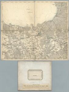
Composite: 30. Labiau. (Germany)
1 : 100000 Reichsamt fur Landesaufnahme
Composite: 29. Cranz. (Germany)
1 : 100000 Reichsamt fur Landesaufnahme
29. Cranz. (Germany)
1 : 100000 Reichsamt fur Landesaufnahme
Meßtischblatt 1192 : Labiau, 1938
1 : 250000 Labiau. - Hrsg. 1913, bericht. 1922, einz. Nachtr. 1937, r. - 1:25000. - [Berlin]: Reichsamt für Landesaufnahme, 1938. - 1 Kt.
Meßtischblatt 1191 : Lablacken, 1938
1 : 250000 Lablacken. - Hrsg. 1913, bericht. 1922, redakt. Änd. 1938. - 1:25000. - [Berlin]: Reichsamt für Landesaufnahme, 1938. - 1 Kt.
Meßtischblatt 1193 : Laukischken, 1928
1 : 250000 Laukischken. - Hrsg. 1913, bericht. 1922, einz. Nachtr. 1928. - 1:25000. - [Berlin]: Reichsamt für Landesaufnahme, 1928. - 1 Kt.
Meßtischblatt 1190 : Schaaken, 1938
1 : 250000 Schaaken. - Hrsg. 1908, bericht. 1922, redakt. Änd. 1938. - 1:25000. - [Berlin]: Reichsamt für Landesaufnahme, 1938. - 1 Kt.
Messtischblatt 1092 : Rinderort, 1938 Rinderort
1 : 250000 Rinderort. - Hrsg. 1912, bericht. 1922, redakt. Änd.1938.. - 1:25000. - [Berlin]: Reichsamt für Landesaufnahme, 1938. - 1 Kt.
Messtischblatt 1091 : Postnicken, 1922 Postnicken (Ost)
1 : 250000 Postnicken (Ost). - Hrsg. 1912, bericht. 1922. - 1:25000. - [Berlin]: Reichsamt für Landesaufnahme, 1922. - 1 Kt.
Messtischblatt 111 : Nemonien, 1925 Nemonien
1 : 250000 Nemonien. - Hrsg. 1911, bericht. 1922. - 1:25000. - [Berlin]: Reichsamt für Landesaufnahme, 1922. - 1 Kt.
Messtischblatt 1090 : Postnicken, 1937 Postnicken (West.)
1 : 250000 Postnicken (West.). - Hrsg. 1908, bericht. 1922, einz. Nachtr. 1937. - 1:25000. - [Berlin]: Reichsamt für Landesaufnahme, 1937. - 1 Kt.
Meßtischblatt 0990 : Mövenhaken, 1935
1 : 250000 Mövenhaken. - Hrsg. 1912. - 1:25000. - [Berlin]: Reichsamt für Landesaufnahme, 1935. - 1 Kt.
Meßtischblatt 0993 : Gilge, 1937
1 : 250000 Gilge. - Hrsg. 1913, einzl. Nachtr. 1937. - 1:25000. - [Berlin]: Reichsamt für Landesaufnahme, 1937. - 1 Kt.
Meßtischblatt 1293 : Alt Gertlauken, 1938
1 : 250000 Alt Gertlauken. - Hrsg. 1913, bericht. 1922, einz. Nachtr. 1928, r. - 1:25000. - [Berlin]: Reichsamt für Landesaufnahme, 1938. - 1 Kt.
Meßtischblatt 1292 : Goldbach, 1938
1 : 250000 Goldbach. - Hrsg. 1914, bericht. 1922, einz. Nachtr. 1928, r. - 1:25000. - [Berlin]: Reichsamt für Landesaufnahme, 1938. - 1 Kt.
Meßtischblatt 1291 : Kaimen, 1942
1 : 250000 Kaimen. - Aufn. 1911, Hrsg. 1914, bericht. 1922, letzte Na. - 1:25000. - [Berlin]: Reichsamt für Landesaufnahme, 1942. - 1 Kt.
Meßtischblatt 1290 : Schönwalde (Ostpr.), 1938
1 : 250000 Schönwalde (Ostpr.). - Hrsg. 1908, bericht. 1922, einz. Nachtr. 1937, r. - 1:25000. - [Berlin]: Reichsamt für Landesaufnahme, 1938. - 1 Kt.
Meßtischblatt 1189 : Powunden, 1942
1 : 250000 Powunden. - Aufn. 1906, hrsg. 1908, bericht. 1922, letzt. Na. - 1:25000. - [Berlin]: Reichsamt für Landesaufnahme, 1942. - 1 Kt.
Messtischblatt 1089 : Bledau, 1936 Bledau
1 : 250000 Bledau. - Bericht. 1922. - 1:25000. - [Berlin]: Reichsamt für Landesaufnahme, 1922. - 1 Kt.
Meßtischblatt 0989 : Sarkau, 1938
1 : 250000 Sarkau. - Hrsg. 1912, redakt. Änd. 1938. - 1:25000. - [Berlin]: Reichsamt für Landesaufnahme, 1938. - 1 Kt.
Meßtischblatt 1289 : Königsberg (Pr.) (West), 1937
1 : 250000 Königsberg (Pr.) (West). - Hrsg. 1908, bericht. 1922, einz. Nachtr. 1937. - 1:25000. - [Berlin]: Reichsamt für Landesaufnahme, 1937. - 1 Kt.
Meßtischblatt 184 : Königsberg i.Pr., 1933
1 : 250000 Königsberg i.Pr. - Hrsg. 1908, bericht. 1922, einz. Nachtr. 1930. - 1:25000. - [Berlin]: Reichsamt für Landesaufnahme, 1933. - 1 Kt.
16. Rossitten. (Germany)
1 : 100000 Reichsamt fur Landesaufnahme
Composite: 16. Rossitten. (Germany)
1 : 100000 Reichsamt fur Landesaufnahme
Sect. 3. Rossitten (Das Curische Haff südl. Theil), uit: Geologische Karte der Provinz Preussen
1 : 100000 Annotatie: Incompleet; Voor aanwezige bladen zie bladoverzicht; Met inzetkaarten; Annotatie geografische gegevens: Coördinaten gebaseerd op nulmeridiaan van Ferro (Hierro) Berlin : Neumann
15. Sarkau. (Germany)
1 : 100000 Reichsamt fur Landesaufnahme
Composite: 15. Sarkau. (Germany)
1 : 100000 Reichsamt fur Landesaufnahme