Maps of Central Lowland

America Septentrionalis. A Map of the British Empire in America.
1 : 11000000 Popple, Henry
Carte générale de l'Amérique séptentrionale: avec les posséssions Angloises dans cette partie du nouveau monde / dressée sur la carte de Pople [sic], publiée à Londres en 20 feuilles, pour servir à l'intelligence de la guerre présente.
from Whole Henry Popple,
A map of the British Empire in America: with the French, Spanish and Hollandish settlements adjacent thereto / by Henry Popple; I. Condet s.
from John H. Levine Collection Henry Popple; I. Condet s.,
Amerique septentrionale: suivant la carte de Pople faite à Londres en 20 feuilles.
from Charts and maps Par et chez le Sr. le Rouge ...: Paris; Lawson, Oscar A.; Le Rouge, Georges-Louis,
America Septentrionalis A Map of the British Empire in America.
1 : 11000000 Popple, Henry
Composite: British Empire in America.
1 : 2000000 Popple, Henry
Amerikanisch-spanischer Kriegsschauplatz
1 : 7500000 Habenicht, Hermann Justus Perthes
Composite: North America.
1 : 5400000 Robert Laurie & James Whittle
A new map of North America with the West India Islands: divided according to the preliminary articles of peace, signed at Versailles, 20, Jan. 1783; wherein are particularly distinguished the United States and the several provinces, governments & ca. which compose the British dominions / laid down according to the latest surveys and corrected from the original materials of Goverr. Pownall, Membr. of Parliamt., 1783.
from Charts and maps Governor Pownall,
Composite: Amerique Septentrionale.
1 : 6300000 Anville, Jean Baptiste Bourguignon d, 1697-1782
Composite: North America.
1 : 5400000 Jefferys, Thomas
Composite: A Map of the British Empire in America.
1 : 2000000 Popple, Henry
Composite: North America, West India Islands.
1 : 5300000 Pownall, Thomas
United States, Mexico, Central America, Caribbean.
1 : 1584000 Smith, J. Calvin
Amerikanisch-Spanischer kriegsschauplatz
1 : 7500000
A new map of the north parts of America claimed by France under ye names of Louisiana, Mississipi, Canada and New France, with ye adjoyning territories of England and Spain ... / ... laid down according to the newest and most exact observations by H. Mol
from The world described, or, A new and correct sett of maps : shewing the kingdoms and states in all the known parts of the earth, with the principal cities, and most considerable towns in the world ... / ... by Herman Moll, geographer ...
North America / performed under the patronage of Louis Duke of Orleans, First Prince of the Blood by the Sieur d'Anville ; greatly improved by Mr. Bolton ; engrav,d by R. W. Seale ; Gravelot, delin. ; Walker, sculp.
from Whole
Map of the United States of America, the British provinces, Mexico, the West Indies and Central America, with part of New Granada and Venezuela / map drawn by Geo. W. Colton ; engraved by John M. Atwood ; border desig'd. & eng'd. by W. S. Barnard.
From Parts
Map Of The United States The British Provinces Mexico &c.
1 : 14000000 Colton, J. H.
Regni Mexicani seu Novae Hispaniae, Ludovicianae, N. Angliae, Carolinae, Virginiae, Pensylvaniae, ... in America Septentrionali
from John H. Levine Collection

A Correct Map of the United States.
1 : 4850000 Lewis, Samuel
A map of Florida and ye Great Lakes of Canada / by Robt. Morden.
from Atlas terrestris / by Robt. Morden.
Central America.
1 : 16600000 Sharpe, J.
[Vereinigte Staaten von Nord-Amerika]
Hypsometrischer Atlas Ziegler, Jakob Melchior Topogr. Anstalt v. J. Wurster u. Comp.
Map of the United States of North America / compiled from the latest and most authentic information by David H. Vance ; engraved by J.H. Young.
from Whole
Continental Map Of North America.
1 : 3041280 Monk, Jacob
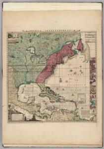
America septentrionalis
1 Karte : Kupferdruck ; 45 x 53 cm Janssonius excudit Ioannes Janssonius
America septentrionalis
1 Karte : Kupferdruck ; 45 x 53 cm Valck; Schenk penes Gerardum Valk et Petrum Schenk