Maps of New York City

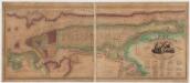
New York med Trakten Daromkring.
1 : 370000 Klinckowstrom, Axel Leonhard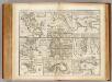
Towns, harbours, America, W.I.
Bowen, Emanuel
Bay and harbor of New York.
from U.S. Coast and Geodetic Survey. Nautical chart ; no. 369.
Coast Chart No. 20 New York Bay And Harbor, New York.
1 : 80000 United States Coast Survey
New York Bay and Harbor, New York.
1 : 126720 United States Coast Survey
Chart of the entrance of Hudson's River, from Sandy Hook to New York : with the banks, depths of water, sailing-marks, & ca
1 : 70000 Printed for Robt. Sayer & John Bennett, sea chart & map-sellers ...
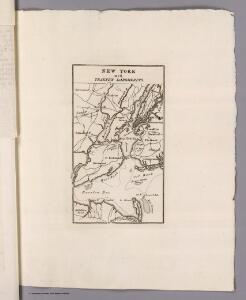
New York and its Environs.
1 : 253440 Rogers, Henry Darwin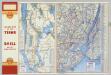
Various Regions and Cities in New Jersey, New York.
Shell Oil Company
A plan of New York Island, with part of Long Island, Staten Island & east New Jersey : with a particular description of the engagement on the woody heights of Long Island, between Flatbush and Brooklyn, on the 27th of August 1776 between His Majesty's fo
from Whole
Educational Extension Work of the Ameriocan Museum of Natrural History. Public Schools supplied by the Museum with Nature Study Collections or Lectures in 1919.
From Manhattan
Map of Staten Island , Richmond County, Staten Island,New York.
from Atlas of Staten Island, Richmond County, New York, from official records and surveys; compiled and drawn by F. W. Beers.
Map of New-York Bay and Harbor and the environs
1 : 30000 United States Coast Survey Survey of the Coast of the United States
Map of New-York Bay And Harbor And The Environs.
1 : 30600 United States Coast Survey
Map of the Hudson ... from New York Harbor the Fort Washington.
from Map of the Hudson between Sandy Hook & Sandy Hill : with the post road between New York and Albany / Bridges delt. ; Rollinson sct.
Industrial map of New York City : showing manufacturing industries, concentration, distribution, character / prepared by the Industrial Bureau of the Merchants' Association of New York.
from Whole
Map of the Hudson ... from Sandy Hook to New York Harbor
from Map of the Hudson between Sandy Hook & Sandy Hill : with the post road between New York and Albany / Bridges delt. ; Rollinson sct.
Brooklyn, from Rand McNally Metropolitan Map of New York City.
From Brooklyn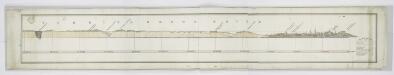
Tibbits Brook route.
from Croton Water System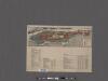
Map of the Borough of Manhattan and part of the Bronx showing location and extent of racial colonies.
From Manhattan
Staten Island, N.Y., ed. of Feb. 1900, repr. 1932
from New York, 15 minute series (topographic) / mapped, edited, and published by the Geological Survey.
TheHome Life Publishing Co.' s map of the City of New York.
From Manhattan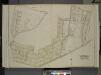
Queens, Vol. 2, Double Page Plate No. 20; Part of Ward Two Maspeth; [Map bounded by Maurice Ave., Jay Ave., Nielson St., Buerman PL., Hull Ave., Prospect Ave., Linden St., Elm St., Fulton St.; Including Franklin St., Fisk Ave., Calamus Ro
from First and second wards: Long Island City and Newtown.
Map of part of New York City, showing underground mains of the Edison Electric Illuminating Co. of New York.
From Manhattan
Authentic street plan of greater New York.
From Manhattan
Staten Island (cont.)
From The Borough
Map of New York City : showing passenger and freight lines, ticket and freight offices, subway, elevated, and street car lines.
From Manhattan
Map of the borough of Brooklyn.
From Brooklyn
Correctly indexed vest pocket map of Brooklyn, Kings County, New York [cover title: c. 1906].
From Brooklyn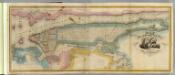
New York City & County.
1 : 20000 Burr, David H., 1803-1875