Maps of Edinburgh

Fife W.
1 : 75000 Martin, Alexander
Fifæ pars occidentalis
1 Karte : Kupferdruck ; 40 x 52 cm Blaeu Joan Blaeu
FIFÆ PARS | OCCIDENTALIS, | THE WEST PART OF FIFE.
[Amsterdam : Joan Blaeu]
Fifae pars occidentalis, [vulgo], The West Part of Fife.
Blaeu, Joan, 1596-1673
Kinross - OS One-Inch map
1 : 63360 Topographic maps Ordnance Survey Ordnance Survey
Kinross - OS One-Inch map
1 : 63360 Topographic maps Ordnance Survey Ordnance Survey
[Kinross] - OS One-Inch map
1 : 63360 Topographic maps Ordnance Survey Ordnance Survey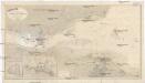
Nordsee
1 : 25000 Severní moře Reichs-Marine-Amt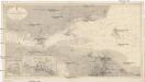
Nordsee
1 : 25000 Severní moře Reichs-Marine-Amt
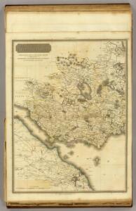
A new description of the shyres Lothian and Linlitquo
1 : 171000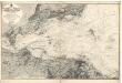
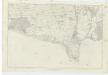
Firth of Forth: Fisherrow to Edgar
Great Britain. Hydrographic Office
County of Kinross.
Bell, John, fl. 1792-1833
NO10 - OS 1:25,000 Provisional Series Map
1 : 25000 Topographic maps Ordnance Survey Ordnance Survey
NT19 - OS 1:25,000 Provisional Series Map
1 : 25000 Topographic maps Ordnance Survey Ordnance Survey
NT18 - OS 1:25,000 Provisional Series Map
1 : 25000 Topographic maps Ordnance Survey Ordnance Survey
NT17 - OS 1:25,000 Provisional Series Map
1 : 25000 Topographic maps Ordnance Survey Ordnance Survey
NT29 - OS 1:25,000 Provisional Series Map
1 : 25000 Topographic maps Ordnance Survey Ordnance Survey
NT28 - OS 1:25,000 Provisional Series Map
1 : 25000 Topographic maps Ordnance Survey Ordnance Survey
NO20 - OS 1:25,000 Provisional Series Map
1 : 25000 Topographic maps Ordnance Survey Ordnance Survey
NT27 - OS 1:25,000 Provisional Series Map
1 : 25000 Topographic maps Ordnance Survey Ordnance Survey
NT07 - OS 1:25,000 Provisional Series Map
1 : 25000 Topographic maps Ordnance Survey Ordnance Survey
NT08 - OS 1:25,000 Provisional Series Map
1 : 25000 Topographic maps Ordnance Survey Ordnance Survey
NT09 - OS 1:25,000 Provisional Series Map
1 : 25000 Topographic maps Ordnance Survey Ordnance Survey
Plan of Edinburgh and Leith - Bartholomew's 'Survey Atlas of Scotland'
1 : 18000 Topographic maps John Bartholomew & Son, Ltd John Bartholomew & Son, Ltd
NO00 - OS 1:25,000 Provisional Series Map
1 : 25000 Topographic maps Ordnance Survey Ordnance Survey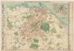
Bartholomew's pocket plan of Edinburgh
1 : 18500 John Bartholomew and Son J. Bartholomew & Son, Ltd.
Edinburgh and Leith
Great Britain. Parliament. House of Commons.
Linlithgowshire, Sheet 2 - OS 6 Inch map
1 : 10560 Topographic maps Ordnance Survey Ordnance Survey
Linlithgowshire, Sheet 3 - OS 6 Inch map
1 : 10560 Topographic maps Ordnance Survey Ordnance Survey