Maps of Dumfries
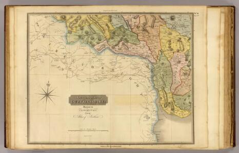
Dumfriesshire 3 S.
1 : 64000 Crawford & Son
Dumfries (88) - OS One-Inch map
1 : 63360 Topographic maps Ordnance Survey Ordnance Survey
Dumfries (88) - OS One-Inch map
1 : 63360 Topographic maps Ordnance Survey Ordnance Survey
NX77 - OS 1:25,000 Provisional Series Map
1 : 25000 Topographic maps Ordnance Survey Ordnance Survey
NX76 - OS 1:25,000 Provisional Series Map
1 : 25000 Topographic maps Ordnance Survey Ordnance Survey
NX87 - OS 1:25,000 Provisional Series Map
1 : 25000 Topographic maps Ordnance Survey Ordnance Survey
NX86 - OS 1:25,000 Provisional Series Map
1 : 25000 Topographic maps Ordnance Survey Ordnance Survey
NX97 - OS 1:25,000 Provisional Series Map
1 : 25000 Topographic maps Ordnance Survey Ordnance Survey
NX96 - OS 1:25,000 Provisional Series Map
1 : 25000 Topographic maps Ordnance Survey Ordnance Survey
NX78 - OS 1:25,000 Provisional Series Map
1 : 25000 Topographic maps Ordnance Survey Ordnance Survey
Kirkcudbrightshire, Sheet 19 - OS 6 Inch map
1 : 10560 Topographic maps Ordnance Survey Ordnance Survey
Dumfriesshire, Sheet XLVII - OS 6 Inch map
1 : 10560 Topographic maps Ordnance Survey Ordnance Survey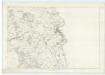
Kirkcudbrightshire, Sheet 27 - OS 6 Inch map
1 : 10560 Topographic maps Ordnance Survey Ordnance Survey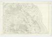
Kirkcudbrightshire, Sheet 34 - OS 6 Inch map
1 : 10560 Topographic maps Ordnance Survey Ordnance Survey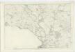
Dumfriesshire, Sheet XLIX - OS 6 Inch map
1 : 10560 Topographic maps Ordnance Survey Ordnance Survey
Kirkcudbrightshire, Sheet 41 - OS 6 Inch map
1 : 10560 Topographic maps Ordnance Survey Ordnance Survey
Dumfriesshire, Sheet LV - OS 6 Inch map
1 : 10560 Topographic maps Ordnance Survey Ordnance Survey
Kirkcudbrightshire, Sheet 33 - OS 6 Inch map
1 : 10560 Topographic maps Ordnance Survey Ordnance Survey
Kirkcudbrightshire, Sheet 18 - OS 6 Inch map
1 : 10560 Topographic maps Ordnance Survey Ordnance Survey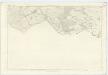
Dumfriesshire, Sheet XLVIII - OS 6 Inch map
1 : 10560 Topographic maps Ordnance Survey Ordnance Survey
Dumfriesshire, Sheet LX - OS 6 Inch map
1 : 10560 Topographic maps Ordnance Survey Ordnance Survey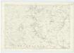
Kirkcudbrightshire, Sheet 32 - OS 6 Inch map
1 : 10560 Topographic maps Ordnance Survey Ordnance Survey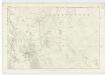
Kirkcudbrightshire, Sheet 40 - OS 6 Inch map
1 : 10560 Topographic maps Ordnance Survey Ordnance Survey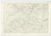
Kirkcudbrightshire, Sheet 26 - OS 6 Inch map
1 : 10560 Topographic maps Ordnance Survey Ordnance Survey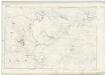
Kirkcudbrightshire, Sheet XVII (& parts of Dumfriesshire XXXIX & XLVI* - OS 6 Inch map
1 : 10560 Topographic maps Ordnance Survey Ordnance Survey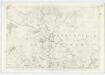
Kirkcudbrightshire, Sheet 25 - OS 6 Inch map
1 : 10560 Topographic maps Ordnance Survey Ordnance Survey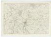
Kirkcudbrightshire, Sheet 39 - OS 6 Inch map
1 : 10560 Topographic maps Ordnance Survey Ordnance Survey
Dumfriesshire, Sheet LXV - OS 6 Inch map
1 : 10560 Topographic maps Ordnance Survey Ordnance Survey
Dumfries
Great Britain. Parliament. House of Commons.