Maps of Germany

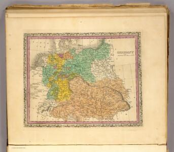
Germany.
1 : 6400000 Tanner, Henry S.
Germania magna, Rhaetia, Noricum
1 : 3800000 Evropa střední Spruner, Karl von Behrens, W. Justus Perthes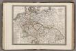
Allemagne.
1 : 5000000 Monin, C.V.
Tabula Geographica Imperii Germanici
1 : 2100000 Mollova mapová sbírka Rhode, Johann Christoph Berger, Friedrich Gottlieb
Germany.
1 : 6000000 Finley, Anthony
Deutschland
Plastischer Schul-Atlas über alle Theile der Erde : in 24 Karten Woldermann, G Verlag von P. Eckerlein
Composite: Germany.
1 : 1250000 Robert Laurie & James Whittle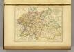
l'Allemagne par Cercles in 1789.
1 : 6300000 Malte-Brun, Conrad, 1775-1826
A new map of the German Empire...

Autriche, Prusse, Confed. Germanique, Pologne 1788 a 1841.
1 : 6300000 Houze, Antoine Philippe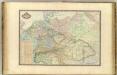
Europe Centrale.
1 : 3000000 Garnier, F. A., 1803-1863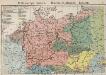
Mitteleuropa. Völker
1 : 9000000 Mitteleuropa Ethnische Gruppe
Karte des Deutschen Reichs
Schmidt, Johann Marius Friedrich; Jäck Schropp
Regenkarte, Mittlere Jahrestemperatur v. Deutschland.
1 : 7000000 Andree, Richard
Sprachenkarte, Religionskarte v. Deutschland.
1 : 7000000 Andree, Richard
Hohenschichtenkarte, Bevolkerungsdichtigkeit.
1 : 7000000 Andree, Richard
Map of the Empire of Germany.
1 : 1250000 Delarochette, Louis Stanislas d'Arcy
Post Karte von Deutschland und den angraenzenden Laendern vorzüglich der preussischen Staaten
1 : 1700000 Evropa střední Mollo, Tranquillo T. Mollo
Post- & Reise-Karte von Deutschland und den nachbar Staaten
Evropa střední Handtke, Friedrich Flemming, C. C. Flemming
Post- & Reise-Karte von Deutschland und den nachbar Staaten
Evropa střední Handtke, Friedrich Weber, H. C. Fleming
Composite Map: Map of the Central States of Europe Situate between France and Russia
1 : 1200000 Faden, William (1749-1836)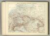
Carte Politique de L'Europe Centrale.
1 : 3600000 Jouvet et Cie.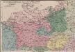
Das Sprachgebiet der Deutschen in Mitteleuropa
1 : 7500000 Mitteleuropa Deutsche, Sprachkartografie
Tabula Moderna Germanie [Karte], in: Claudii Ptolemei viri Alexandrini mathematice discipline philosophi doctissimi geographie opus [...], S. 245.
1 Karte aus Atlas Waldseemüller, Martin [und Ptolemaeus, Claudius] Übelin, Georg
L'Allemagne 843 a 911.
1 : 6300000 Houze, Antoine Philippe
Telegrafenlinien, Eisenbahnen und Dampfbootfahrten in Deutschland und den Nachbarstaaten
Evropa střední Raffelsperger, Franz Franz Raffelsperger
Deutschland 1555
Deutschland Kunz, Andreas ; Moeschl, Joachim Robert
[Mitteleuropa]
1 : 2500000 [S.l. : s.n.]
Deutschland 1648
Deutschland Kunz, Andreas ; Moeschl, Joachim Robert