Maps of New York
United States 4.
1 : 1750000 Arrowsmith, Aaron
Sheet 2: United States of Nth. America.
1 : 1584000 Tardieu, P.F.
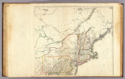
States Of Maine, N. Hampshire, Vermont, Massachusetts, Rhode Island, Connecticut, New York, Pennsylvania, And New Jersey.
1 : 3453120 Rogers, Henry Darwin
Map of the Troy & Greenfield Rail Road and its connections
Edwards, A. F B.W. Thayer & Co.'s Lith.
Soil Map of the United States, Section 1. Atlas of American Agriculture.
1 : 2500000 Marbut, Curtis F.
Map of the Canadas.
1 : 1267200 Taylor, David
United States ... North Eastern States.
1 : 2851200 Fullarton, A. & Co.
Northern provinces of the United States

Canada.
1 : 4100000 Hughes, William
United States.
1 : 3380000 Sharpe, J.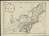
Nieuwe en nauwkeurige kaart van een gedeelte van Noord America, behelzende Nieuw England, New York, Pensylvania, New Jersey, Connecticut, Rhode Island, een stuck van Virginia, Kanda en Halifax, ter opheldering der reizen van den Heer P. Kalm
1 : 2000000 C.J. de Huyser direx. P. Mol geletterdt Te Utrecht : by de boekverkopers J. v. Schoonhoven & Comp. en G. v. d. Brink jz.
Sheet 2: United States of Nth. America.
1 : 1584000 Tardieu, P.F.
New England and New York.
1 : 3000000 Lloyd, H.H.
New England and New York.
1 : 3000000 Walling, H. F.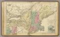
N.E. United States.
1 : 2150000 Cornell, S. S. (Sarah S.)
197-198. United States of America, North East. The World Atlas.
1 : 2500000 USSR (Union of Soviet Socialist Republics).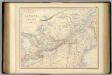
British North America. Sheet II, West.
1 : 2407680 Fullarton, A. & Co.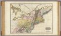
United States of America, northern part.
1 : 2100000 Pinkerton, John, 1758-1826
Belgii novi, angliae novae, et partis Virginiae : novissima delineatio
1 : 2450000 Jansson, Jan, 1588-1664 Prostant ... apud Petrum Schenk, et Gerardum Valk
Carte pour servir à l'itinéraire pittoresque du fleuve Hudson et des parties latérales de l'Amerique du Nord
1 : 4200000 Milbert, Jacques Gérard Gaugain, Henri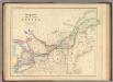
Upper Or Western And Lower Or Eastern Canada.
1 : 3453120 Rogers, Henry Darwin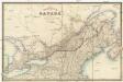
The province of Canada
Kanada Wyld, James James Wyld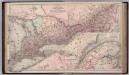
Canada. Provinces of Ontario and Quebec.
1 : 1550000 Colton, G.W.
Map of the Vermont Central Rail Road and its connections from Smith's map of the United States.
from Parts

Carte réduite du Nord des Etat-Unis avec l'intérieur du pays, pour servirà l'intelligence de cette histoire.
from Histoire de la derniere guerre, entre la Grande-Bretagne, et les États-Unis de l'Amérique, la France, l'Espagne et la Hollande, depuis son commencement en 1775, jusqu'a sa fin en 1783 ...
Map of the Provinces of Lower & Upper Canada.
1 : 887040 Wyld, James, 1812-1887
Railway map of routes to the White Mountains
Boardman, Harvey J.H. Bufford's Lith.
United States of America, northern part / drawn under the direction of Mr. Pinkerton by L. Hebert; Neele sculpt. 352 Strand.
from Whole L. Hebert Neele; Mr. Pinkerton,