Maps of Asia

Planisphere physique.
1 : 60000000 L'Isle, Guillaume de, 1675-1726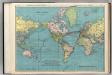
World on Mercator's Projection.
1 : 60000000 Rand McNally and Company
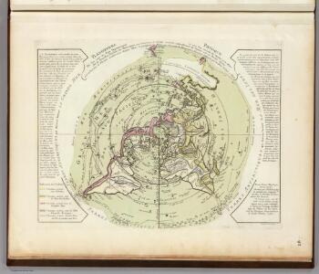
Planisphere physique où l'on voit du pole septentrional ce que l'on connoît de terres et de mers
1 Karte : Kupferdruck ; Durchmesser 34 cm Buache; Dezauche; Desbruslins chez Dezauche succ.r des Srs. De l'Isle et Buache ... rue des Noyers près celle des Anglois
Planisphere physique où l'on voit du pole septentrional ce que l'on connoît de terres et de mers
1 Karte : Kupferdruck ; Durchmesser 34 cm, Blattgrösse 46 x 60 cm Buache; Desbruslins Philippe Buache sur le quay de l'Horloge du Palais
(World)
1 : 130000000 Willard, Emma
Distribution primitive du genre humain.
1 : 95000000 Vincent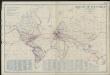
Airways of the world on Mercator's projection
1 : 40600000 Briesemeister, William A. Aeronautic Maps Association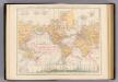
Weltverkehrs, Meeresstromungen.
1 : 90000000 Andree, Richard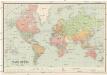
Mapa světa
1 : 40000000 země světa Machát, František V. Neubert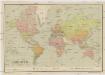
Mapa světa
1 : 40000000 země světa Machát, František V. Neubert
Planisphere representant toute l'etendue du monde
1 Karte : Kupferdruck ; Durchmesser 26 cm, Bildgrösse 43 x 26 cm Renard chez Louis Renard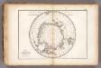
Carte des glaces australes.
1 : 42000000 Vincent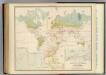
Health, disease.
1 : 67000000 Johnston, Alexander Keith, 1804-1871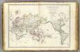
Mappe-monde.
1 : 55000000 Brue, Adrien Hubert, 1786-1832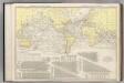
Steamship Routes of The World.
1 : 60000000 Rand McNally and Company
Geographische Verbreitung der Menschen-Rassen.
1 : 140000000 Berghaus, Heinrich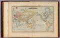
Mercator's Chart.
1 : 91000000 Lucas, Fielding Jr.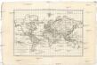
Carte générale de toutes les parties connues de la surface de la terre en carte réduite
země světa Bonne, Rigobert
Weltkarte zur Uebersicht der vorzügluchsten Varietaeten des Menschen, nach Blumenbach'schen Systeme
1 : 82300000 entworfen und gezeichnet von C.F. Weiland nach Bory de St. Vincent entworfen und gezeichnet von C.F. Weiland Weimar : Im Verlage des Geograph. Instituts
[Map of the world]
Tsurumine, Shigenobu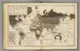
Moral, political World.
1 : 133000000 Woodbridge, William C.
Welt-Karte zur Ubersicht der Luft-Stromungen und der See-Wege.
1 : 115000000 Berghaus, Hermann
Welt-Karte zur Ubersicht der Meeres-Stromungen und des Schnellverkehrs.
1 : 115000000 Berghaus, Hermann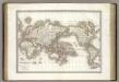
Mappe-monde.
1 : 75000000 Lapie, M. (Pierre), 1779-1850
DIE ERDE in Zwey Halbkugeln der östlichen und westlichen
země světa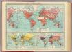
World - commerce.
1 : 92000000 John Bartholomew and Son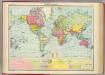
World - political.
1 : 82000000 John Bartholomew and Son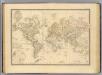
Terre, Mercator proj.
1 : 70000000 Andriveau-Goujon, J.
Planiglob zur Ubersicht der verschiedenen Bekleidung's Weise der Bewohner des ganzen Erdbodens.
1 : 140000000 Berghaus, Heinrich