Maps of Saint-Paul-sur-Ubaye

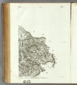
166 Queyras.
1 : 86400 Cassini family; Cassini, Cesar-Francois, 1714-1784
[Queyraz]
1 Blatt : 56 x 48 cm s.n.
[Larche]
1 Blatt : 56 x 29 cm s.n.
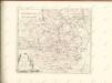
Bailliage d'Enbrun
1 : 250000 Mollova mapová sbírka Placide de Sainte-Hélène Berey, Charles Amadeus de
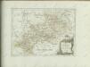
Source du Po, France-Piemont.
1 : 250000 Placide de Sainte Helene, Father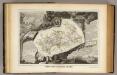
Dept. De Hautes Alpes.
1 : 570000 Levasseur, Victor.
Carte des départements des Hautes Alpes de l'Isere, et de la Drome, no. 4
1 Blatt : s.n.
Les Vallées du Piemont
1 : 590000 Mollova mapová sbírka Nolin, Jean-Baptiste Nolin, Jean Baptiste
Carte historique des vallées Vaudoises
1 : 100000 Rochas d'Aiglun, Albert de 1837-1914 Paris : Erhard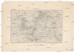
Briançon
1 : 80000 Service géographique de l'armee
Le Theatre de Bellone :
Mollova mapová sbírka Schenk, Pieter Braakman, Adriaan
Bez titulu:Itálie
Carta d'Italia speciale per automobilisti, ciclisti e touristi
1 : 250000 Cuneo (Itálie) Istituto Italiano d'arti grafiche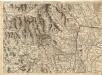
Environs de Suse, et de St. Jean de Morienne.
1 : 240000 Mollova mapová sbírka Dheulland, Guillaume Dheulland, Guillaume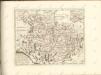

Partie du Briançonnois, du Graisivaudan, du Gapençois et l'Ambrunois dans le Daufiné
1 Karte : Kupferdruck ; 61 x 45 cm Jaillot chez le Sr. Iaillot geographe du roy joignant les grands Augustins aux deux globes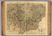
Piemont, Monferrat meridionale.
1 : 275000 L'Isle, Guillaume de, 1675-1726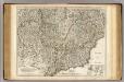
Piemont, Monferrat meridionale.
1 : 275000 L'Isle, Guillaume de, 1675-1726
36) XII.N.E. ''Turin'', uit: Carte géologique de France
1 : 500000 Annotatie: Voor aanwezige bladen zie bladoverzicht [S.l : s.n.]
Partie Meridionale du Piemont et du Monferrat
1 : 270000 Mollova mapová sbírka Delisle, Guillaume Desrosiers, F. L'Isle, Guillaume de
Stato Del Piemonte [Karte], in: Novus Atlas, das ist, Weltbeschreibung, Bd. 3, S. 44.
1 Karte aus Atlas Blaeu, Joan Blaeu, Willem Janszoon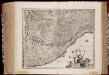
Riviera di Genova di Ponente
1 : 400000 Annotatie: In tegenstelling tot eerdere uitgaven van Johannes Janssonius bevat deze kaart een afwijkend cartouche in de vorm van een afbeelding van Neptunus geflankeerd door paarden en putti, waarbij 1 van de putti een banier vasthoudt met daarop de titel van de kaart; In tegenstelling tot latere uitgaven door Schenk & Valk ontbreekt de kompasroos en het impressum van Schenk en Valk; Origineel is Blad 156 in atlas factice; Annotatie geografische gegevens: Schaalstokken op de kaart: 10 milliaria Italica communia (= 4,1 cm) en: 2 mill. Ger. communia (= 3,6 cm) [S.l.] : [s.n.]
Riviera Di Genova Di Ponente [Karte], in: Novus atlas absolutissimus, Bd. 5, S. 99.
1 Karte aus Atlas Janssonius Offizin
Composite 13: Carte de France.
1 : 86400 Cassini family; Cassini, Cesar-Francois, 1714-1784
Riviera Di Genova Da Ponente [Karte], in: Novus Atlas, das ist, Weltbeschreibung, Bd. 3, S. 60.
1 Karte aus Atlas Blaeu, Joan Blaeu, Willem Janszoon
Dauphine.
1 : 400000 Robert de Vaugondy, Gilles, 1688-1766