Maps of Beaufort
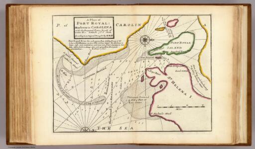
Plan of Port Royal Harbour in Carolina.
1 : 300000 Moll, Herman, d. 1732
Parris Island
1 : 24000
Parris Island
1 : 24000
Parris Island
1 : 24000
Parris Island
1 : 24000
Parris Island
1 : 24000
Beaufort
1 : 24000
Beaufort
1 : 24000
Beaufort
1 : 24000
Beaufort
1 : 24000
Beaufort
1 : 24000
Beaufort
1 : 24000
Hilton Head
1 : 24000
Hilton Head
1 : 24000
Hilton Head
1 : 24000
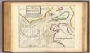
A large draught port royall harbour in CAROLINA
from The sea-atlas : containing an hydrographical description of most of the sea-coasts of the known parts of the world.
Fort Fremont
1 : 62500
Fort Fremont
1 : 62500
Dale
1 : 24000
Frank Leslie's war maps
Leslie, Frank
Beaufort
1 : 100000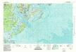
Beaufort
1 : 100000
A plan of the river and sound of D'Awfoskee in South Carolina
1 : 63360 Gascoigne, John
Hilton Head
1 : 62500
Hilton Head
1 : 62500
Green Pond
1 : 62500
Green Pond
1 : 62500
Green Pond
1 : 62500
Green Pond
1 : 62500