Maps of Allegheny Plat.

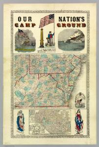
Our Nation's Camp Ground.
1 : 2181787 Ensign, Bridgman & Fanning
A New map of the province of Maryland in North America.
from Maryland
Eastern U.S.
1 : 2750000 Cornell, S. S. (Sarah S.)
Map of Virginia, Maryland and Delaware exhibiting the post offices, post roads, canals, rail roads &c. / by David H. Burr, (Late topographer to the Post Office,) Geographer to the House of Representatives of the U.S.
from Parts David H. Burr,
Virginia, Delaware, Maryland, and West Virginia.
1 : 1520000 Johnson, A.J.
Virginia, Delaware, Maryland, and West Virginia.
1 : 1520000 Johnson, A.J.
The tourist's pocket map of the state of Virginia : exhibiting its internal improvements, roads, distances, &c. / by J.H. Young ; engraved by E. Yeager & F. Dankworth.
from Virginia
County map of Pennsylvania, New Jersey, Maryland and Delaware ; City of Philadelphia [inset]; City of Baltimore [inset].
from Mitchell's new general atlas, containing maps of the various countries of the world, plans of cities, etc., embraced in fifty-three quarto maps., forming a series of eighty four maps and plans, together with valuable statistical tables.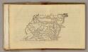
(Virginia, Maryland, Delaware)
1 : 4200000 Moore, M. B. (Marinda Branson), 1829-1864
Virginia and Maryland / By H. Moll, geographer.
from Parts
Virginia, Maryland, and Delaware / by H.S. Tanner.
from Parts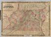
Virginia, Maryland, Delaware.
1 : 760320 Colton, J. H.
Map of Virginia and Maryland, constructed from the latest authorities / J.H. Young sc.
from Parts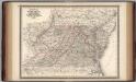
Virginia, Delaware, Maryland, and West Virginia.
1 : 1520000 Johnson, A.J.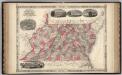
Virginia, Delaware, Maryland, and West Virginia.
1 : 1487000 Johnson, A.J.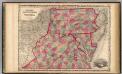
Pennsylvania And Virginia.
1 : 1520640 Johnson, A.J.
A map of Virginia: formed from actual surveys and the latest as well as the most accurate observations / by James Madison; drawn by Wm. Davis; with extensive additions and corrections to the year 1818.
from Charts and maps James Madison; William Davis,
A map of Virginia: formed from actual surveys and the latest as well as the most accurate observations / by James Madison; drawn by Wm. Davis; with extensive additions and corrections to the year 1818.
from Charts and maps James Madison; William Davis,
A map of Virginia: formed from actual surveys, and the latest as well as most accurate observations / by James Madison, D.D., president of Wm. & Mary College.; drawn by Wm. Davis; engraved by Fred. Bossler, Richmd.
from Charts and maps James Madison; William Davis; Fred. Bossler,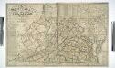
A map of the state of Virginia reduced from the nine sheet map of the state, in conformity to law / by Herman Böye ; engraved by H.S. Tanner and E.B. Dawson.
from Virginia
A new map of Virginia from the best authorities / by T. Kitchin, Geogr.
from London magazine, or, Gentleman's monthly intelligencer (1747)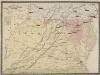
Pocket Map, showing the probable Theatre of the War. Compiled by G.A. Aschbach
Pocket Map, showing the probable Theatre of the War. Compiled by G.A. Aschbach. Published in Philadelphia, Pocket Map Showing the Probable Theatre of the War, complied by G.A. Aschbach, details the states of Virginia, Maryland and Pennsylvania. Published in 1860, before any major fighting had occurred, this map highlights areas that would see the bulk of fighting in the conflict. The map shows the balance on military power on either side by pointing out camps and forts. The Union held military bases are underlined in red, while Confederate holdings are in blue. The map also shows railway lines running across the states.
Delaware, Maryland, Virginia, West Virginia, District of Columbia
1 : 1280000 Asher & Adams
E. United States 7.
1 : 1774080 Letts, Son & Co.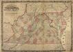
Colton's New Topographical Map of the States of Virginia, Maryland and Delaware
Colton's New Topographical Map of the States of Virginia, Maryland and Delaware, showing also Eastern Tennessee and parts of other adjoining States, all the Fortifications, Military-Stations, Rail-Roads, Common Roads and other internal improvements. Colton’s New Topographical Map of the States of Virginia, Maryland and Delaware, along with parts of Eastern Tennessee and ‘other adjoining states’ was published in 1862 by the New York-based J.H. Colton. The state is divided by county, with a breakdown of area per square mile on the right hand side. Colton was one of the foremost map publishers in American during the 19th century. The majority were coloured to divide the states and individual counties and covered numerous scales, from pocket maps to large atlases. The publishing company also reproduced maps by other publishers. Colton maps are highly valued for their accuracy and detailing and are held by numerous collections across America and the rest of the world. J.H. Colton
Map of Virginia and Maryland, constructed from the latest authorities / J.H. Young sc.
from Parts J. H. Young,
Virginia, Maryland and Delaware.
from Parts s.n.: [Philadelphia?],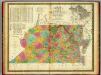
Map of Virginia and Maryland.
1 : 1450000 Mitchell, Samuel Augustus
Map of Virginia and Maryland, constructed from the latest authorities.
from Parts Published by Anthony Finley, at the corner of Chestnut and Fourth Streets?: [Philadelphia?],