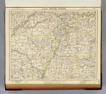
Maps of Ozark Plateau

E. United States 6.
1 : 1774080 Letts, Son & Co.
Missouri, Ill., Ky., Tenn., Ala., Miss., Ark.
1 : 1770000 Society for the Diffusion of Useful Knowledge (Great Britain)
Il Paese de' Cherachesi, con la Parte Occidentale della Carolina Settentrionale.
1 : 2100000 Zatta, Antonio
(Missouri, Arkansas) Railroad Map of the United States.
1 : 506880 Rand McNally and Company
(Missouri, Arkansas) Railroad Map of the United States.
1 : 506880 Rand McNally and Company
Missouri and Arkansas.
1 : 2100000 Rand McNally and Company
Map of the Tennessee Government.
1 : 3294720 Morse, Jedidiah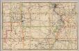
Shippers' Railroad Map.
1 : 506880 Rand McNally and Company
Prang's War Map. Missouri
Prang's War Map. Missouri. L. Prang & Co.
Prang's War Map. Missouri, Virginia & North Carolina Coast Line
Prang's War Map. Missouri, Virginia and North Carolina Coast Line. L. Prang & Co.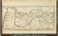
Map of the Tennassee (sic) Government.
1 : 1900800 Winterbotham, W.
Western Battle-Ground. Western Naval Expedition Map
Western Battle-Ground. Western Naval Expedition Map. Published by Prang, Western Naval Expansion Map, Showing Tennessee & Mississippi Rivers details the middle states of the Confederacy and the Border State of Kentucky and highlights forts, railroads and cities in the region. The portrait at the corner of the map is Commander Andrew Hull Foot who commanded navy gunboats in the region and aided General Ulysses S. Grant in Union victory at For Henry in February 1862. The fort is labelled on the top right of the map. L. Prang & Co.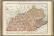
Kentucky, Tennessee.
1 : 1180000 Rand McNally and Company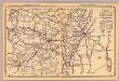
Arkansas.
1 : 1800000 Rand McNally and Company
Neueste Karte von Arkansas mit seinen Canaelen Strassen & Entfernungen der Hauptpunkte
Grosser Hand-Atlas über alle Theile der Erde in 170 Karten Meyer, J. Verlag des Bibliographischen Instituts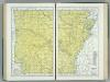
Arkansas.
1 : 947000 Hammond, C.S.
Schonberg's Map of Arkansas.
1 : 1900000 Schonberg & Co.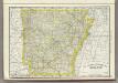
Arkansas.
1 : 1275000 Rand McNally and Company
Arkansas.
1 : 1450000 Colton, G.W.
Arkansas.
1 : 1500000 Colton, G.W.
Arkansas.
1 : 1500000 Colton, G.W.
Arkansas.
1 : 1500000 Colton, G.W.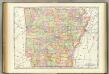
Arkansas.
1 : 860000 Rand McNally and Company
State of Arkansas.
1 : 760320 U.S. General Land Office
Arkansas.
1 : 1140480 U.S. General Land Office
Arkansas.
1 : 1450000 Colton, G.W.
Arkansas.
1 : 1700000 Greenleaf, Jeremiah
New Map Of Arkansas.
1 : 1680000 Mitchell, Samuel Augustus
Arkansas.
1 : 1450000 Morse, Sidney E. (Sidney Edwards), 1794-1871
Arkansas.
1 : 1700000 Meyer, Joseph, 1796-1856
New Map Of Arkansas.
1 : 1700000 Tanner, Henry S.
Arkansas.
1 : 1480000 Goodrich, S.G.
Arkansas.
1 : 3484800 Greenleaf, Jeremiah
Arkansas.
1 : 1480000 Bradford, Thomas G.
New Map Of Arkansas.
1 : 1700000 Tanner, Henry S.